Photography · Drives
Scenic Drives for Photographers
Some of Zion's best frames happen from the driver's seat and the pull-off. Here are the roads around the park, what each offers a camera, and what to check before you go.
Road Rules for Photographers
Never stop in a travel lane, and park only where parking is allowed. Road status, tunnel rules, and seasonal access change, so every road-condition note below is flagged and worth confirming with the park before you drive. Check golden-hour times for your date and plan to be at a pull-off when the light is right, not scrambling for one as it fades.
SR-9 Through Springdale
State Route 9 is the gateway road. Springdale hugs it for a couple of miles right up to Zion's south entrance, with cliff views from nearly everywhere. Most photographers do this stretch on foot; see the Springdale photography guide for the walkable spots along it.
The Zion Canyon Scenic Drive
This is the road that runs up the canyon floor, and the Observation Point guide describes it threading the valley floor more than 2,000 feet below the rim. In season, personal vehicles are not allowed on it and visitors ride the Zion Canyon shuttle instead [VERIFY: nps.gov]. Plan it as a walking-and-riding photo day rather than a drive; the canyon-floor stops are covered in the photo spots guide.
The Zion-Mt. Carmel Highway
This is the drive to the park's east side. The Canyon Overlook trailhead lot sits just east of the Zion-Mt. Carmel Tunnel and is not on the shuttle route, so you drive yourself there [VERIFY: nps.gov]. From the overlook at the end of the Canyon Overlook Trail you look straight down the switchbacks of the highway and out over the lower canyon, a good way to see the road you just drove.
Oversized vehicles need a paid escort and one-way traffic control through the tunnel, so check current tunnel rules before you go [VERIFY: nps.gov]. Highway shoulder parking is prohibited, and the trailhead lot is small, so arrive early or plan another stop if it is full [VERIFY: nps.gov].
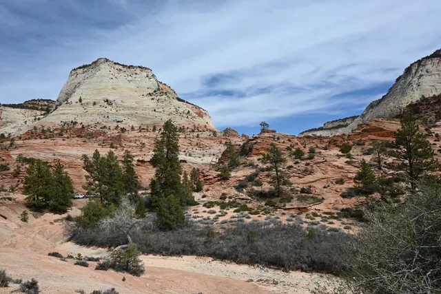
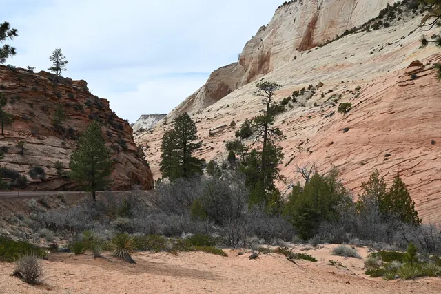
On the east side, pale sandstone domes rise above red slickrock and scattered pines, a quieter landscape than the canyon itself. The East Rim Trail trailhead is on the same highway corridor.
Kolob Terrace Road
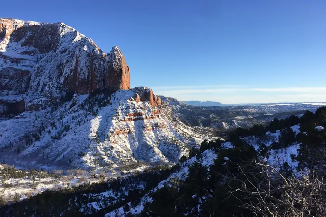
Kolob Terrace Road climbs out of the town of Virgin, west of Springdale, up onto the Kolob Terrace plateau. It is not on the shuttle route, and the trail guides describe far fewer visitors there than in Zion Canyon. Kolob Terrace sits at a higher elevation than Zion Canyon, so mornings and evenings can be noticeably cooler. The road typically closes with snow in winter [VERIFY: nps.gov], so check current status before you head up outside the warmer months. Cell coverage is limited; let someone know your plan. A relaxed stop is Northgate Peaks, a mostly level walk through ponderosa pine.
Kolob Canyons Road
Kolob Canyons is Zion's other entrance, in the northwest corner and reached from its own exit off I-15. The road ends at Timber Creek Overlook, a one-mile round-trip ridge walk to a panorama of Timber Creek, the Kolob Terrace plateau, and the Pine Valley Mountains. The guide calls it a good stretch-your-legs stop at the end of a scenic drive.