Historic Archive
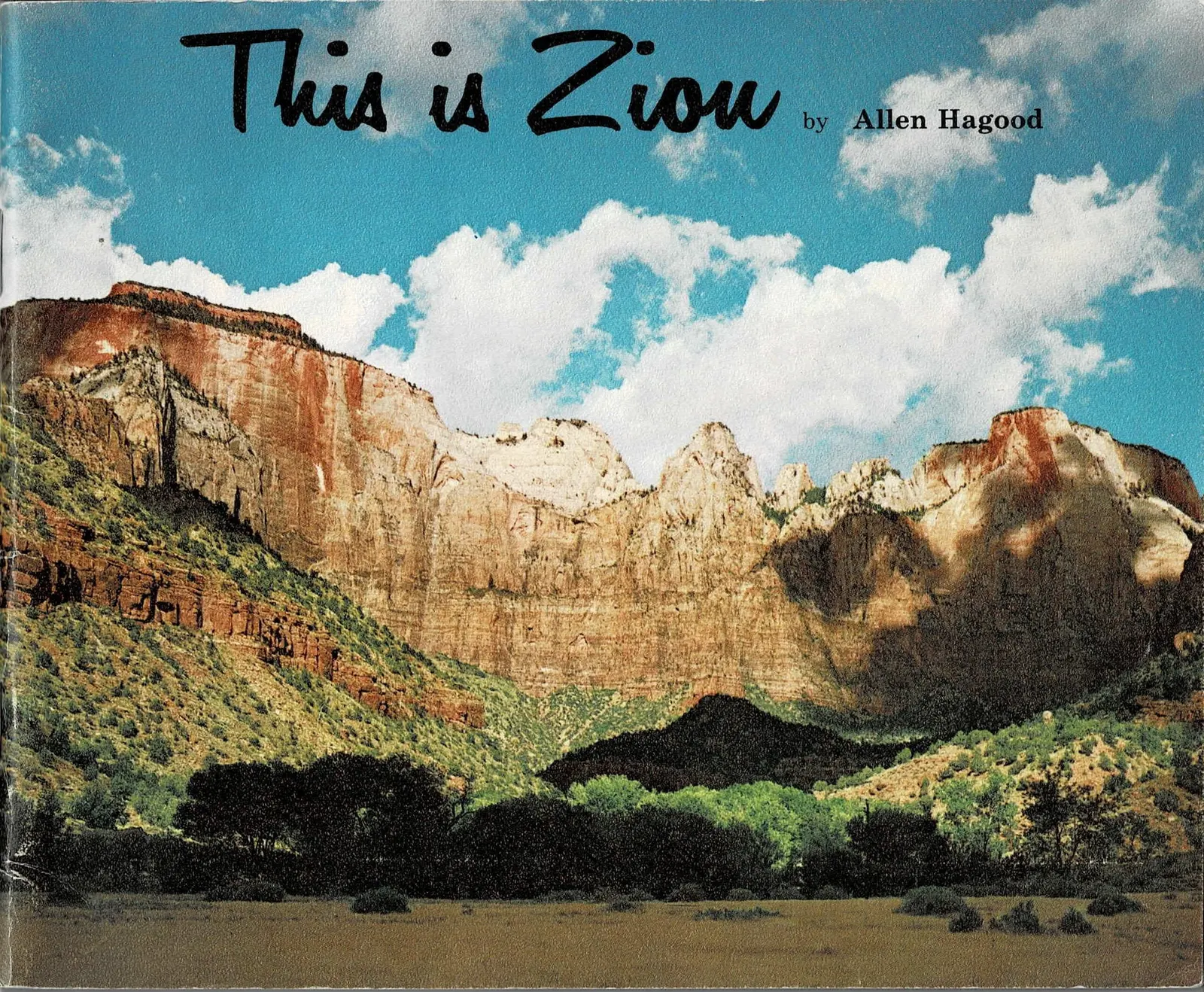
This is Zion
A hybrid digital edition of Allen Hagood's This is Zion, published by the Zion Natural History Association in 1974. Each two-page spread of the original book appears here as it was printed, with a short modern reading of what it shows and an expandable panel holding the original text word for word.
A Hybrid Reading Experience
This is Zion is not a promotional brochure. It is a working natural history of the park, written by a park naturalist for visitors who wanted to understand what they were looking at. It is built in two parts: Part One, "The Beauty of Zion," moves through the canyon as a photographic essay, and Part Two, "The Geological Story," explains in four chapters how that landscape came to be.
This page reproduces the book spread by spread, in the order it was printed. Above each spread you get a short modern reading of what the pages show and why they matter. Below it, a toggle opens the original printed wording for those same pages, preserved as closely as the web allows.
Page numbers shown throughout are the book's own printed page numbers, so this edition can be checked against a physical copy.
Zion Natural History Association, 2nd edition, 1974
This is Zion
by Allen Hagood
The cover sets the book's terms before a word is read: a wall of Navajo Sandstone catching full sun, the cliff base falling away into green, and nothing else competing for attention. No park entrance sign, no car, no visitor. The subject is the rock.
That restraint carries through the whole book. Hagood was writing for people standing in the canyon with the book in hand, and the photographs are chosen to be compared against what is actually in front of them.
Part One
The Beauty of Zion
Pages 6 through 35 of the book: a continuous photographic passage through Zion, from the first view of the canyon walls to the high country above them. Hagood declares no chapters here - the spreads simply follow one another, and this edition keeps that order.
Opening on Zion from Above
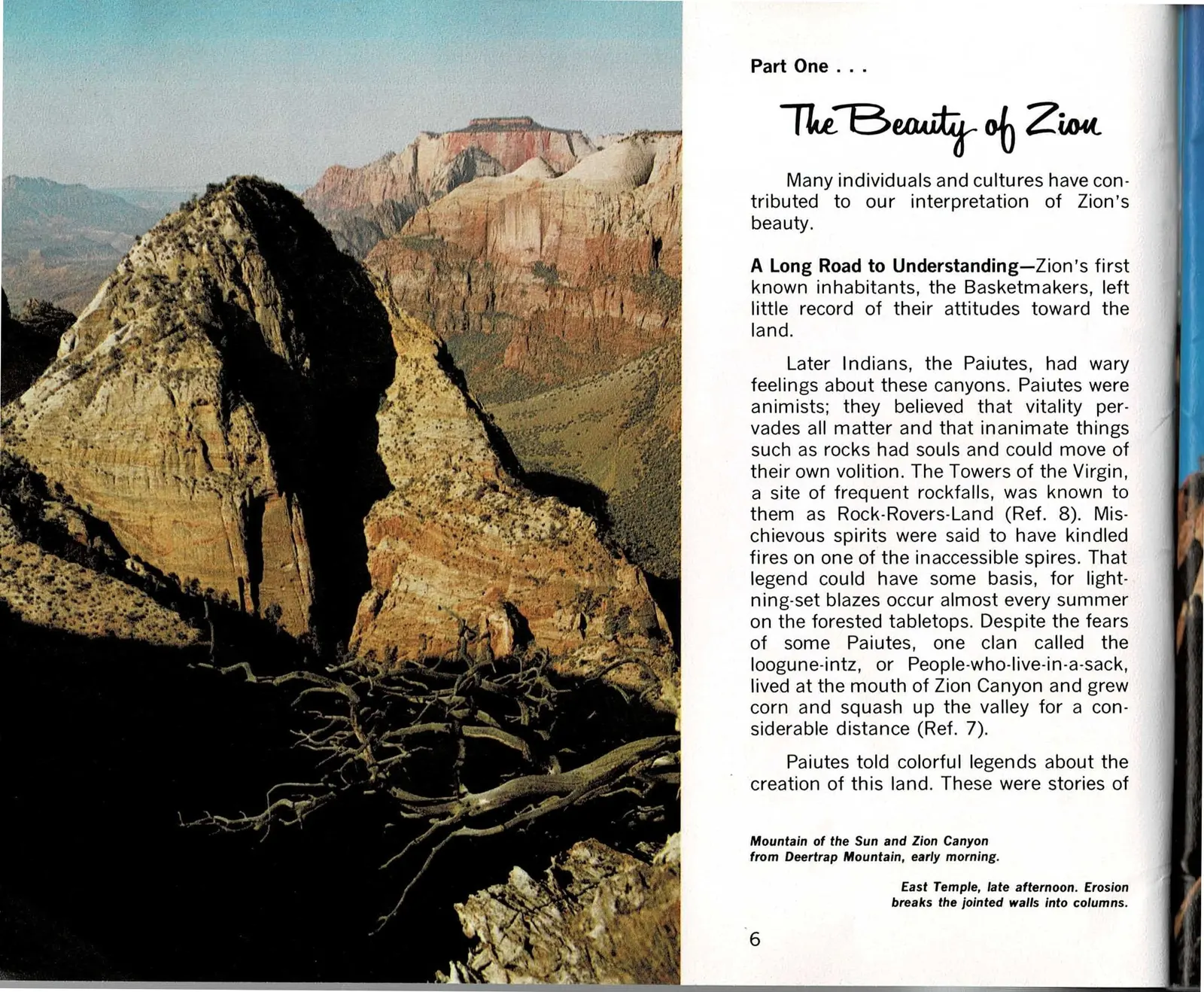
Hagood does not open Part One on the canyon floor. He opens above it, at Deertrap Mountain, looking down on the pyramid shape of the Mountain of the Sun with the layered walls of Zion Canyon fading into haze behind it. It is a deliberate choice: before the book asks anyone to feel anything about Zion, it wants them to see how the canyon is built, one ridge behind another, at a scale a person standing at the bottom could never take in at once.
The text that faces that photograph is not scenery writing either. It is a short history of who has found this place beautiful and why, starting with the Basketmakers and the Paiute, whose oral tradition treated these cliffs as animate rather than as a backdrop. To the Paiute, the Towers of the Virgin were a site of real danger, prone to rockfall, and their name for it, Rock-Rovers-Land, reads less like myth than like a working description of a place where the rock actually moves.
That framing sets up the rest of Part One. The book keeps circling back to the same question this spread raises first: whose eyes decide what counts as beautiful here, and how recently did European Americans start agreeing with them.
Read the original book text (pages 6 - 7)
Part One . . .
The Beauty of Zion
Many individuals and cultures have contributed to our interpretation of Zion's beauty.
A Long Road to Understanding—Zion's first known inhabitants, the Basketmakers, left little record of their attitudes toward the land.
Later Indians, the Paiutes, had wary feelings about these canyons. Paiutes were animists; they believed that vitality pervades all matter and that inanimate things such as rocks had souls and could move of their own volition. The Towers of the Virgin, a site of frequent rockfalls, was known to them as Rock-Rovers-Land (Ref. 8). Mischievous spirits were said to have kindled fires on one of the inaccessible spires. That legend could have some basis, for lightning-set blazes occur almost every summer on the forested tabletops. Despite the fears of some Paiutes, one clan called the loogune-intz, or People-who-live-in-a-sack, lived at the mouth of Zion Canyon and grew corn and squash up the valley for a considerable distance (Ref. 7).
Paiutes told colorful legends about the creation of this land. These were stories of
Mountain of the Sun and Zion Canyon from Deertrap Mountain, early morning.
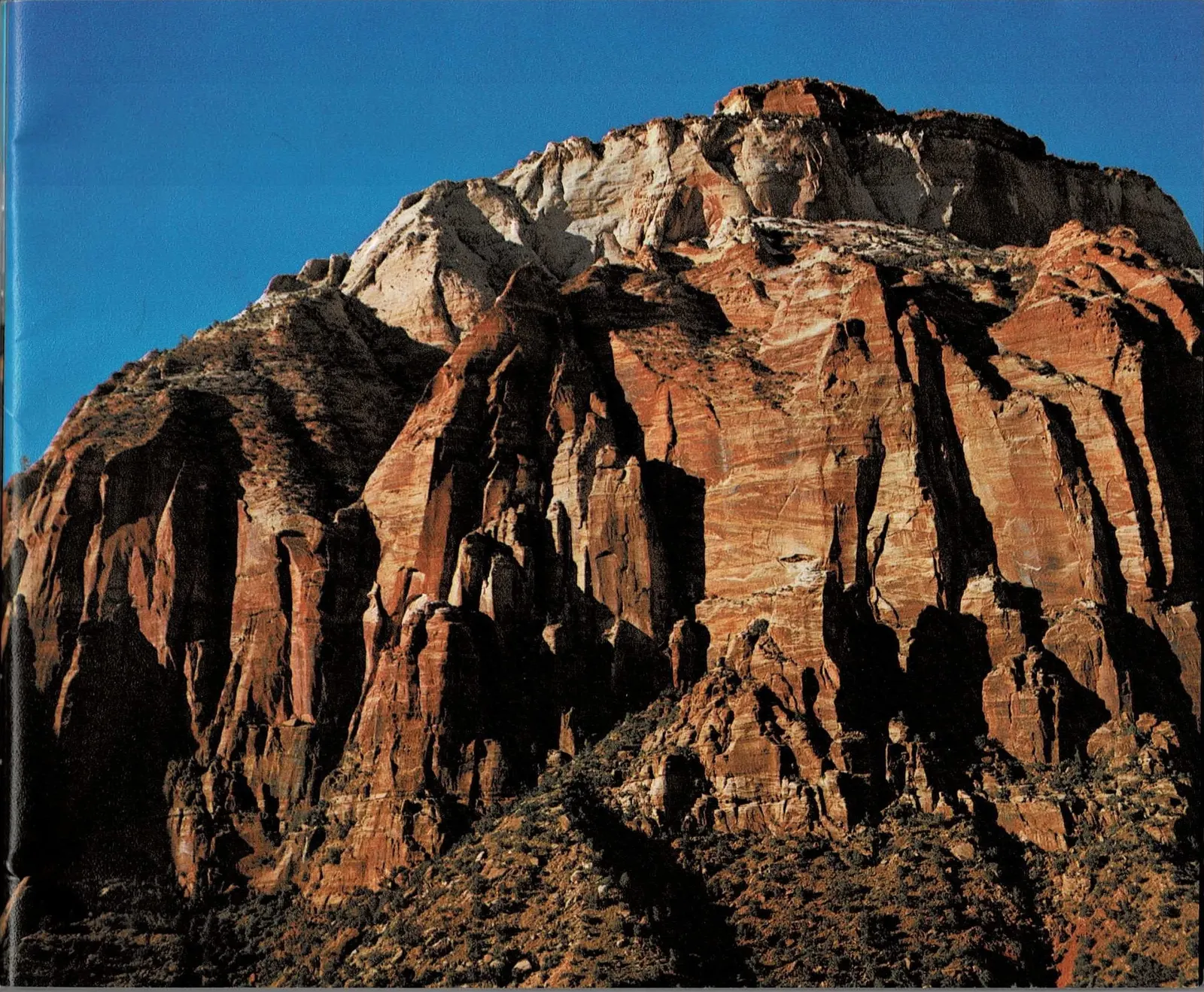
East Temple, late afternoon. Erosion breaks the jointed walls into columns.
A Landscape Nobody Wanted
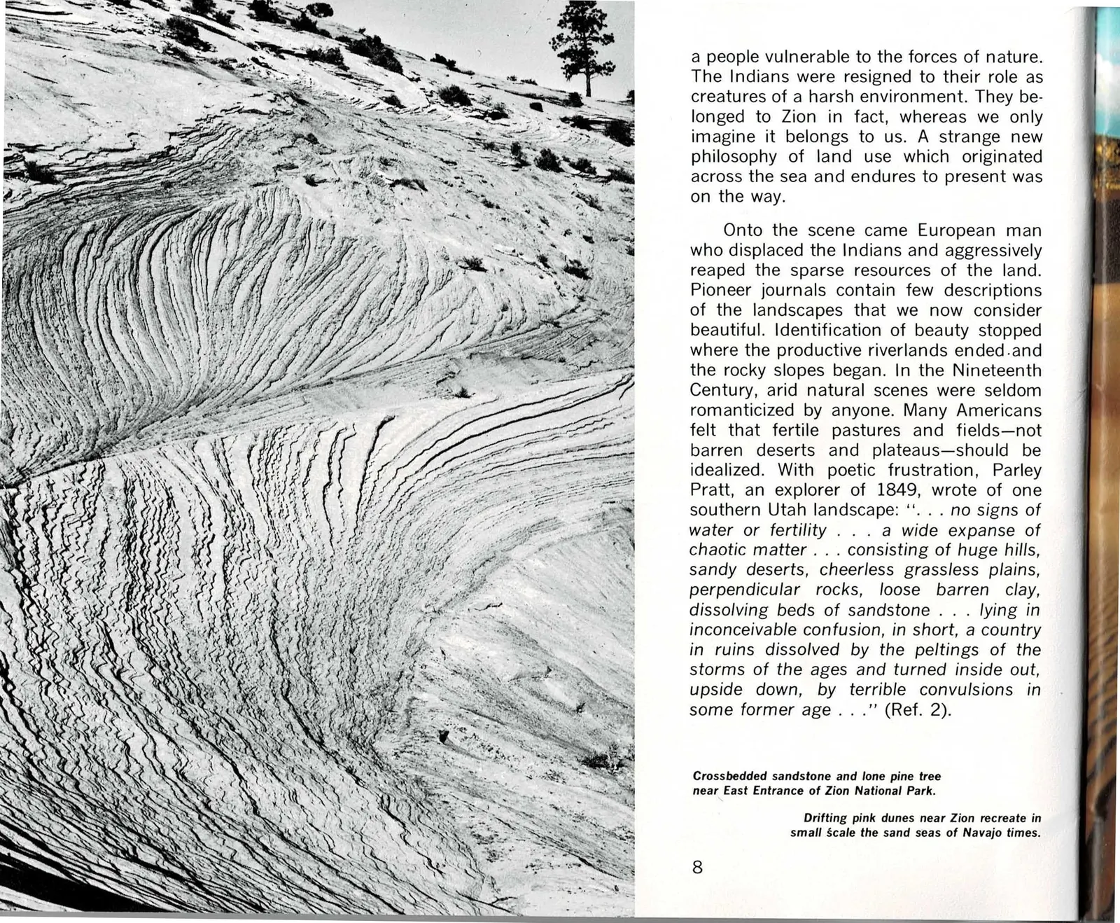
The pairing on this spread is almost sarcastic. On the left, a black and white photograph of crossbedded sandstone near the east entrance, a single lone pine somehow rooted in bare rock. On the right, a nineteenth-century explorer's verdict on country very much like it: chaotic matter, cheerless grassless plains, a country in ruins. Parley Pratt was not describing a bad campsite. He was describing the aesthetic standard almost every American of his generation carried into the desert Southwest.
Hagood's point is not that Pratt was foolish. It is that beauty is trained, not given. Nineteenth-century Americans measured land by whether it could be farmed, and by that measure the slickrock around Zion failed completely. The book uses Pratt's own words to show how thoroughly that standard has since flipped: the same crossbedded stone Pratt would have called ruined is now the reason people travel here.
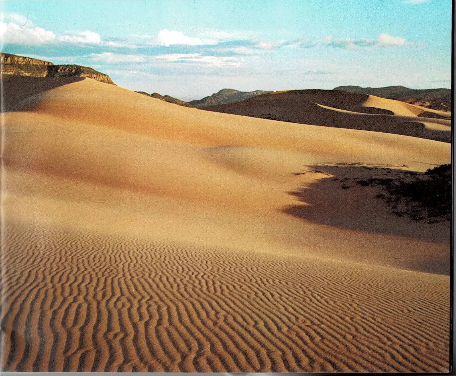
The photograph of drifting pink dunes on the facing page is doing quiet geological work. Those dunes are what the crossbedded sandstone once was, sand blowing and piling long before it became rock. Reading the two photographs together previews an idea Part Two develops at length: that Zion's cliffs are fossilized weather.
Read the original book text (pages 8 - 9)
a people vulnerable to the forces of nature. The Indians were resigned to their role as creatures of a harsh environment. They belonged to Zion in fact, whereas we only imagine it belongs to us. A strange new philosophy of land use which originated across the sea and endures to present was on the way.
Onto the scene came European man who displaced the Indians and aggressively reaped the sparse resources of the land. Pioneer journals contain few descriptions of the landscapes that we now consider beautiful. Identification of beauty stopped where the productive riverlands ended and the rocky slopes began. In the Nineteenth Century, arid natural scenes were seldom romanticized by anyone. Many Americans felt that fertile pastures and fields—not barren deserts and plateaus—should be idealized. With poetic frustration, Parley Pratt, an explorer of 1849, wrote of one southern Utah landscape: ". . . no signs of water or fertility . . . a wide expanse of chaotic matter . . . consisting of huge hills, sandy deserts, cheerless grassless plains, perpendicular rocks, loose barren clay, dissolving beds of sandstone . . . lying in inconceivable confusion, in short, a country in ruins dissolved by the peltings of the storms of the ages and turned inside out, upside down, by terrible convulsions in some former age . . ." (Ref. 2).
Crossbedded sandstone and lone pine tree near East Entrance of Zion National Park.
Drifting pink dunes near Zion recreate in small scale the sand seas of Navajo times.
The Scientists Arrive
Twenty-three years after Pratt wrote off the region, the tone changes completely. In 1872, surveyors from John Wesley Powell's expeditions arrived in Zion, and for the first time an official government report treated the canyon as a place of scenic grandeur rather than a problem to be crossed. Clarence Dutton, a geologist on that survey, wrote the passage this spread quotes, describing the Temples and Towers of the Virgin coming into view as a wonderful object that would in time rank among the world's finest spectacles.
Dutton's language matters because it gave later visitors, and later park advocates, a vocabulary for what they were seeing. The book credits Powell's team with building what it calls a rudimentary aesthetics for this kind of landscape, connecting the geology of the Colorado Plateau to the same sense of the sublime that painters like Turner had already established for mountains and coastlines in Europe.
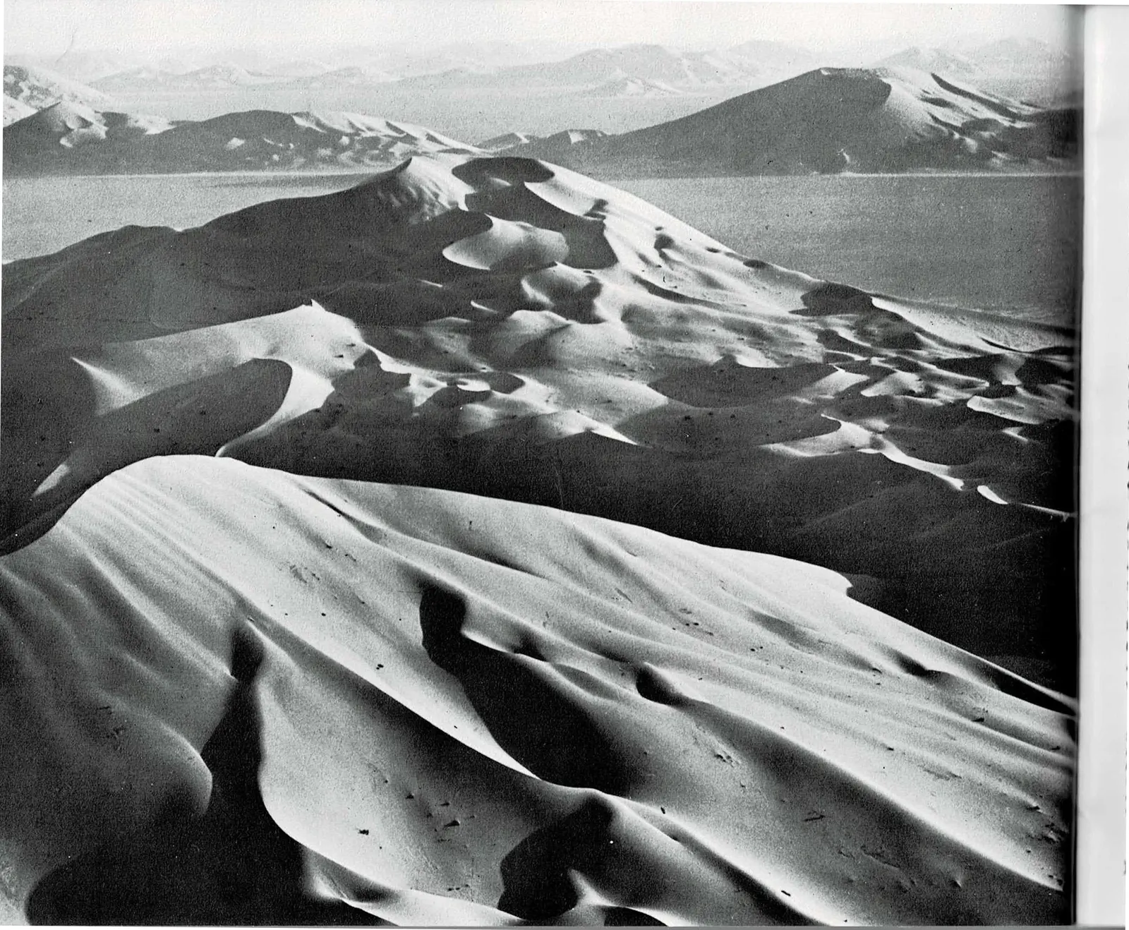
The facing photograph, an aerial view of dunes in Saudi Arabia's Empty Quarter, is not a random comparison. Geologists use modern dune fields exactly that large to explain how the crossbedded Navajo Sandstone at Zion first piled up, hundreds of feet of windblown sand later cemented into cliff.
Read the original book text (pages 10 - 11)
A few explorers were not seeking sites for immediate settlement. In 1872, U. S. Government scientists and surveyors of the Powell expeditions visited Zion. In their official publications, Zion first received attention as a place of scenic grandeur. Powell and his colleagues gave the Plateau Province, ". . . a rudimentary aesthetics, used it as a starting point for a curious and provocative inquiry into the sublime and beautiful, and strengthened the affinity that Turner and Ruskin had established between geology and art," (Ref. 9).
Clarence Dutton, a Powell geologist, wrote eloquently of Zion: ". . . As we rode along, there sailed slowly and majestically into view, a wonderful object . . . In coming time it will, I believe, take rank with a very small number of spectacles each of which will, in its own way, be regarded as the most exquisite of its kind which the world discloses. The scene before us was the Temples and Towers of the Virgin . . . There is an eloquence to their forms which stirs the imagination with a singular power, and kindles in the mind of the dullest observer a glowing response . . . Directly in front of us a complex group of white towers, springing from a central pile, mounts upwards to the clouds. Out of their midst, and high over all, rises a dome-like mass, which dominates the entire landscape . . .
Sand seas of the Empty Quarter, Saudi Arabia. Dunes about 500 feet high. The crossbedded layers of Navajo Sandstone at Zion may have formed under similar conditions. Arabian American Oil Company photo by T. F. Walters, courtesy of Donald Holm.
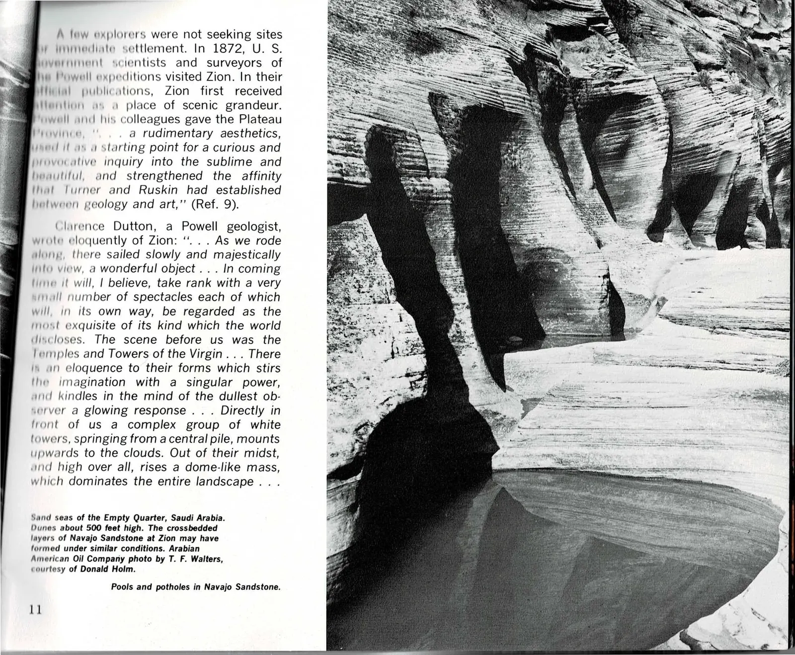
Pools and potholes in Navajo Sandstone.
Reading the Layers
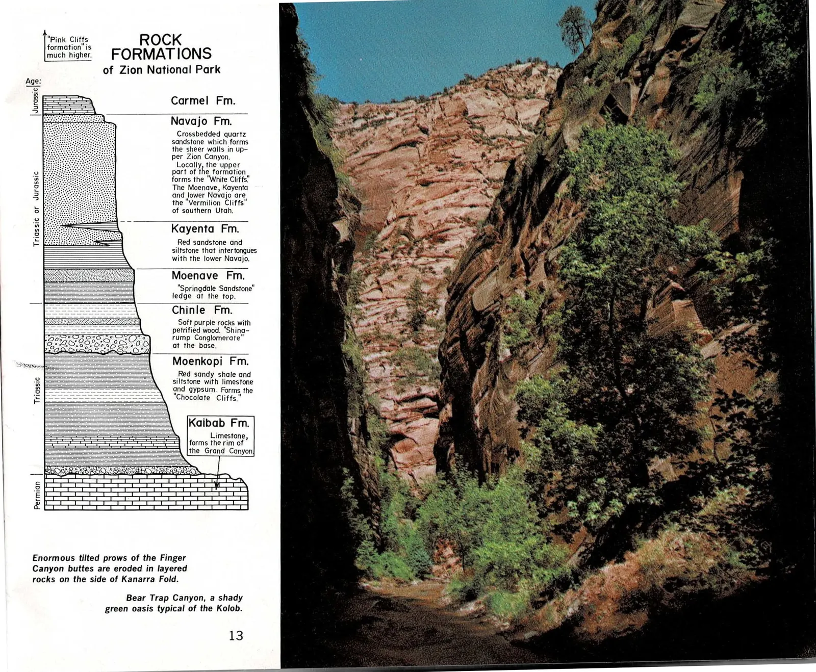
This spread is the book's reference page, the one diagram a reader is expected to return to. It stacks seven named rock formations, from the Kaibab limestone at the bottom to the Carmel formation at the top, and ties each one to the cliff colors and names visitors already associate with this country: the Chocolate Cliffs, the Vermilion Cliffs, the White Cliffs.
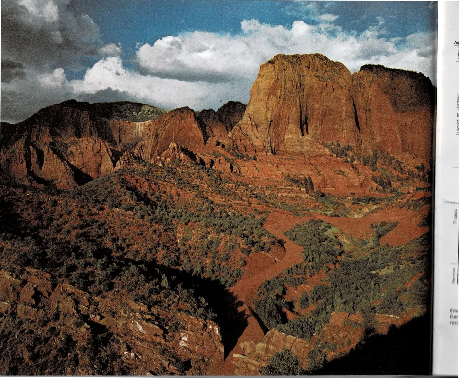
Paired with the diagram is a color photograph of the Kolob Finger Canyons, tall sandstone prows tilted along the Kanarra Fold, which gives the abstract column something physical to stand for. The Navajo Formation the diagram describes as forming sheer walls in upper Zion Canyon is the same rock making up those glowing red cliffs in the photograph.
Bear Trap Canyon, shown in the smaller photograph, is offered as a different kind of example: a narrow, shaded Kolob side canyon where the same rock layers create a cool, green pocket instead of an open cliff face. Hagood uses it to show that one formation can produce very different landscapes depending on how water and shade reach it.
Read the original book text (pages 12 - 13)
ROCK FORMATIONS of Zion National Park
"Pink Cliffs formation" is much higher.
Age column, top to bottom: Jurassic; Triassic or Jurassic; Triassic; Permian.
Carmel Fm.
Navajo Fm. Crossbedded quartz sandstone which forms the sheer walls in upper Zion Canyon. Locally, the upper part of the formation forms the "White Cliffs." The Moenave, Kayenta and lower Navajo are the "Vermilion Cliffs" of southern Utah.
Kayenta Fm. Red sandstone and siltstone that intertongues with the lower Navajo.
Moenave Fm. "Springdale Sandstone" ledge at the top.
Chinle Fm. Soft purple rocks with petrified wood. "Shinarump Conglomerate" at the base.
Moenkopi Fm. Red sandy shale and siltstone with limestone and gypsum. Forms the "Chocolate Cliffs."
Kaibab Fm. Limestone, forms the rim of the Grand Canyon.
Enormous tilted prows of the Finger Canyon buttes are eroded in layered rocks on the side of Kanarra Fold.
Bear Trap Canyon, a shady green oasis typical of the Kolob.
Tracks in Stone, and a Turn in the Argument
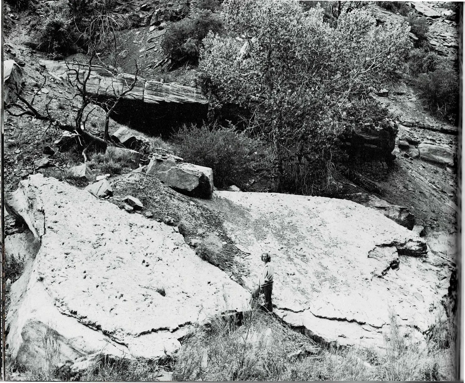
The full-bleed photograph opening this spread is easy to miss the strangeness of: a flat slab of pale Kayenta shale along North Creek, printed with three-toed dinosaur tracks, and a person standing beside them for scale. It is the same Kayenta Formation named two pages earlier in the rock diagram, here providing not color or cliff-forming strength but a literal fossil record of who walked across this ground roughly 200 million years ago.
The facing text closes out Dutton's long 1880 description of the Temples and Towers, the passage that compares Little Zion Valley favorably to Yosemite, then moves quickly through the history that followed: photographs by Jack Hillers, paintings by Frederick Dellenbaugh, lectures by Frederick Vining Fisher, and finally Stephen Mather's advocacy that helped make Zion a national park.
Then the book turns. Under the run-in subhead Man and Nature at Zion, Hagood stops describing scenery and starts describing a conflict: the same parks that are protected because people love them are also changed by how many people come to love them. It is the first place in Part One where the argument shifts from what Zion looks like to what visiting it does to it, and it sets up everything Part One still has to say about beauty and pressure.
Read the original book text (pages 14 - 15)
Nothing can exceed the wonderous beauty of Little Zion Valley, which separates the two temples and their respective groups of towers . . . In its proportions it is about equal to Yosemite, but in the nobility and beauty of the sculptures there is no comparison. It is Hyperion to a satyr. No wonder the fierce Mormon zealot, who named it, was reminded of the Great Zion, on which his fervid thoughts were bent—'of houses not built with hands, eternal in the heavens,'" (Ref. 3).
In the decades after Dutton's visit, Zion was publicized by the photographs of Jack Hillers, the paintings of Frederick Dellenbaugh, and the writings and lectures of Frederick Vining Fisher. Stephen T. Mather, the first director of the National Park Service, was impressed by Zion's little known beauty, and he felt it was truly of national significance. Congress agreed, and Zion became a national park.
Many visitors come to the parks to draw inspiration from the scenery. To say the national parks have become popular is understatement. As in the case of overloved children, we risk spoiling them.
Man and Nature at Zion—Man is a major force in shaping the course of nature on earth. But he is a force without definite direction to ensure his continued well being.
That man is in conflict with his environment is seen in his dual desire to use and to preserve the landscapes in national parks. It is not realistic to think that the parks are separate from the rest of the world. People who come here to "get away from it all," may be disturbed to find that "it all" is insidiously at work at Zion.
Man has gradually divided Zion into two parts. One part contains the visitors and their facilities, and the other
Fossil dinosaur tracks on slabs of Kayenta shale, North Creek. In rocks are records of ancient environments.
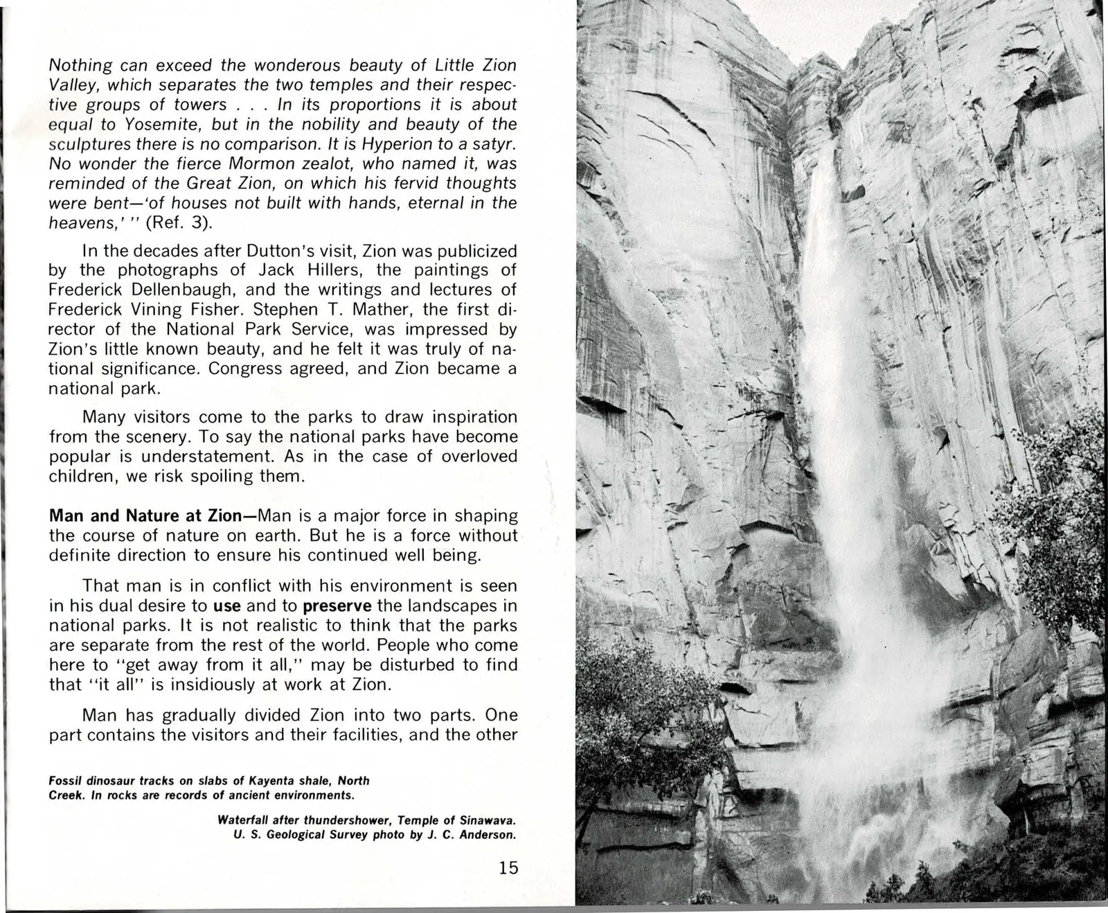
Waterfall after thundershower, Temple of Sinawava. U. S. Geological Survey photo by J. C. Anderson.
A Narrow Canyon Under Pressure
Page 16 completes the sentence that breaks off at the bottom of page 15, the strongest piece of continuity evidence anywhere in Part One: "the other part is the scenery and natural beauty." From there Hagood gets specific about the conflict he raised on the previous spread. Visitors on vacation get along fine in reasonable numbers, he argues, but push past that limit and the obvious question follows: why not spread the facilities beyond Zion Canyon's narrow floor?
His answer is that spreading out does not solve anything. He points to the Taylor Creek road, built to give visitors a look into the Kolob's Finger Canyons, and argues it back fires: the road itself becomes the intrusion, turning a wild gorge into something that looks tamed from the pavement. He compares it to a zoo in reverse, where caged animals might wonder if the world outside is the exhibit. National parks are finite, he writes, and every mile of new road narrows the wilderness it was built to reach.
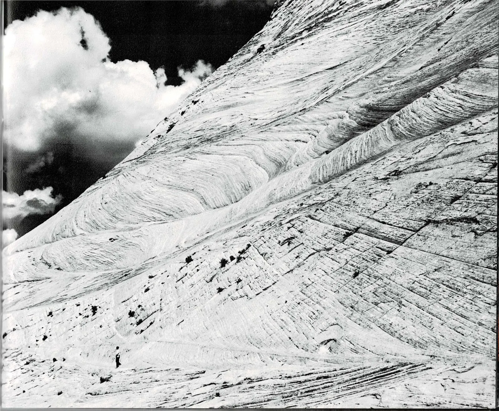
The photograph facing this argument does not illustrate a road at all. It is a close, steep view of crossbedded sandstone on a Kolob slope, a single hiker small against the rock. Paired with the trail photo on page 16 itself, captioned simply as a summer afternoon in LaVerkin Creek Canyon, the spread argues its case with pictures as much as text: this is what stays wild when a park resists paving it.
Read the original book text (pages 16 - 17)
part is the scenery and natural beauty. Fortunately for the Park Service, people on vacation in "reasonable" numbers seem to enjoy each other. There is a limit to tolerance, however, when people trying to escape crowds in the cities realize they are elbow to elbow in the country. A common reaction to this type of pressure is, "Why doesn't the Park Service spread the facilities beyond this narrow canyon?"
National parks, like all land areas, are finite. Only so much area can be developed before facilities begin to compete with nature's serenity. For example, from the new Taylor Creek road in the Kolob area of the park, visitors look into the Finger Canyons. They are thrilled to see the spectacular gorges, and they are interested in the wilderness lying before them. Yet the road as seen from the canyons is an intrusion on the landscape, and the wilderness seems less than wild, tamed perhaps. Here is an unintentional psychology in reverse, akin to a situation in zoos where caged wild animals might wonder if the world outside is on exhibit. In the positioning of the new road, perspective may have gone awry.
Meanwhile, in Zion Canyon, the density of modern human culture increases, and there is mounting pressure to pave more scenery with campgrounds and parking lots. We are party to a strange paradox.
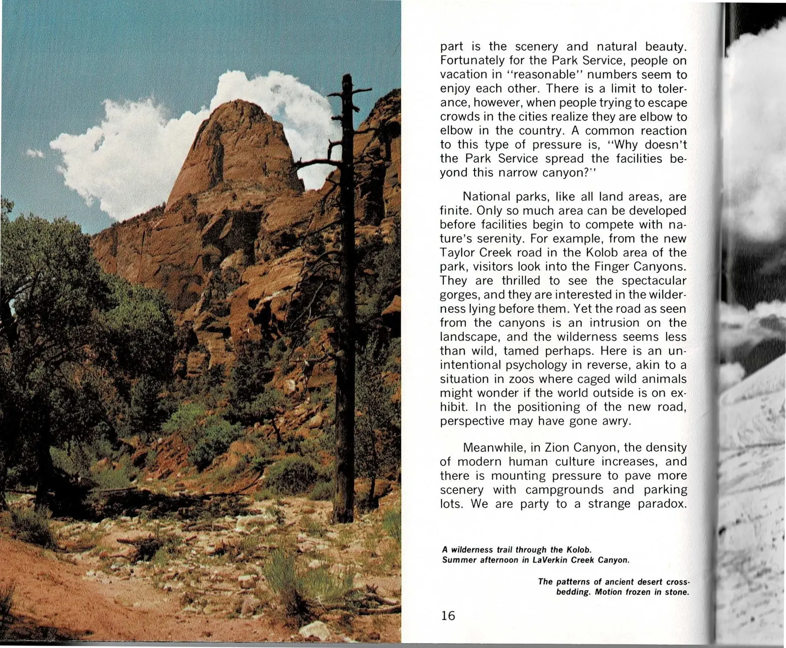
A wilderness trail through the Kolob. Summer afternoon in LaVerkin Creek Canyon.
The patterns of ancient desert crossbedding. Motion frozen in stone.
The Kolob, Zion's Hidden Showcase
Hagood turns the road argument into a definition. Wilderness, he writes, is as much concept as condition: without imagination it would have little meaning at all. Some visitors find it ten feet from the pavement; others need complete solitude, miles from any road. Zion Canyon can supply the first kind for almost anyone. For the second, he points northwest, to the Kolob, which he calls the showcase still little troubled by tourism.
He describes the Kolob's color in almost synesthetic terms, salmon-pink stone and green vegetation that reminds him of a shattered watermelon, forests breaking sharply at the edge of overhanging cliffs, black carbon stains descending hundreds of feet down north-facing walls where moisture lets plants take hold and decay. It is the most vivid language Part One has used yet for a single place.
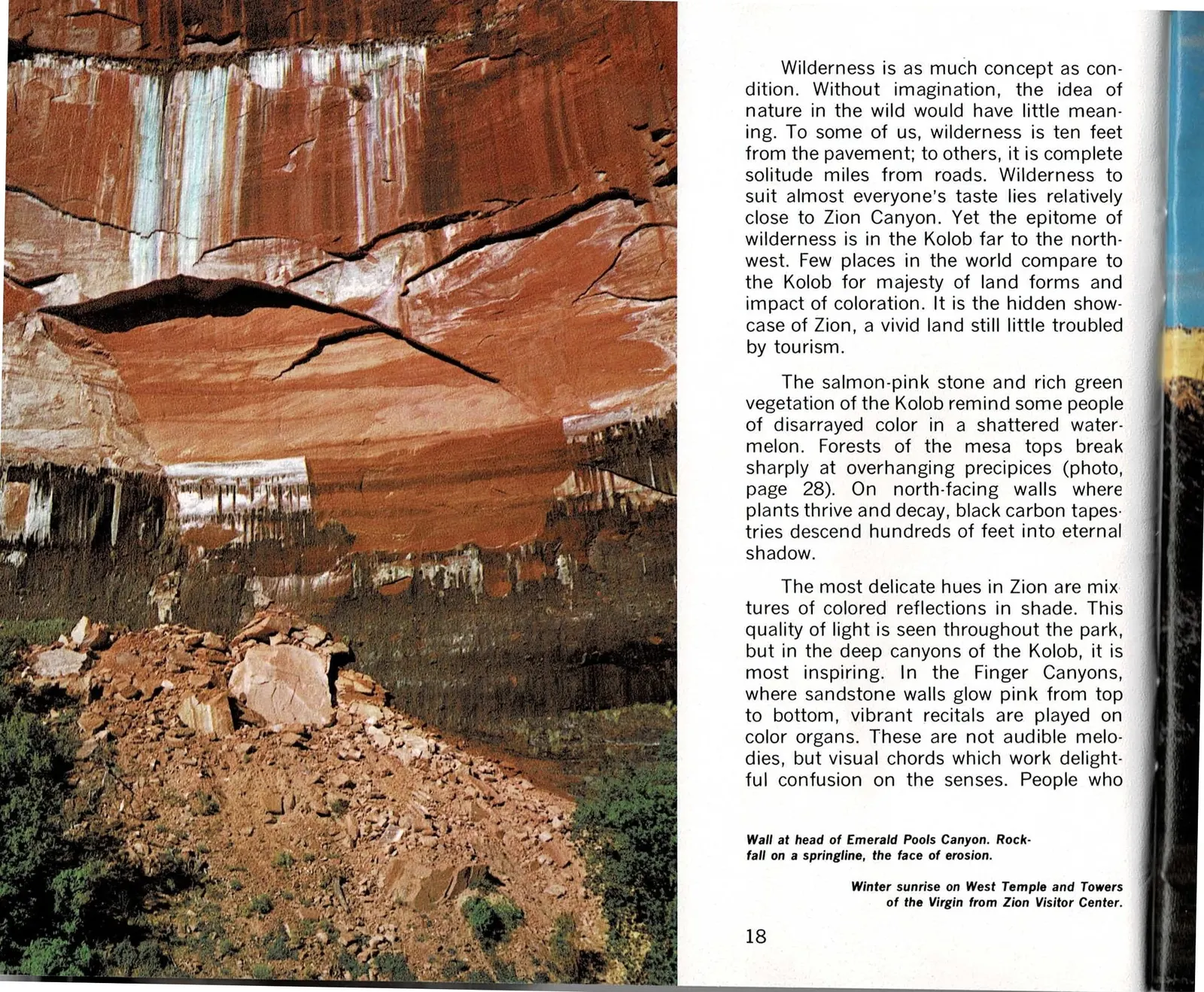
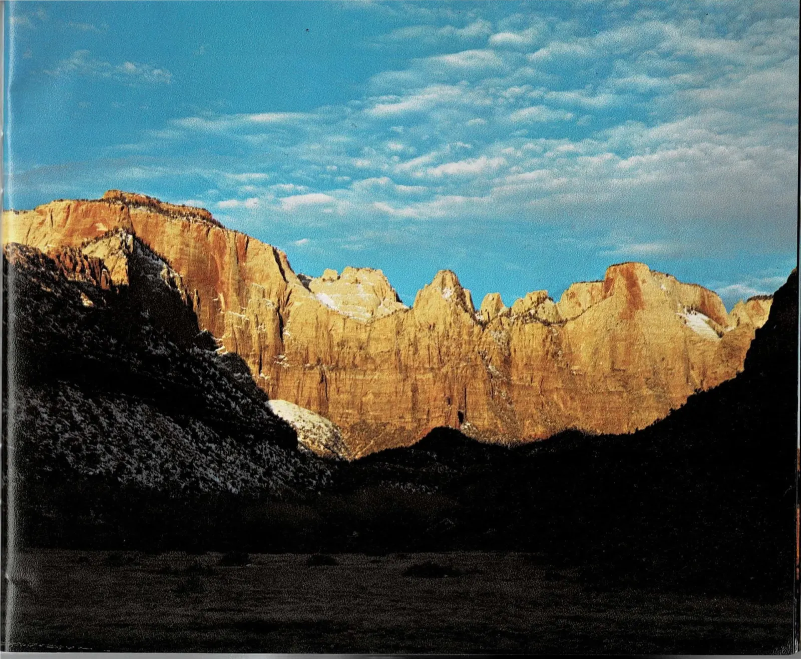
The two photographs on this spread hold both scales of wilderness at once. On the left, a quieter, closer view: mineral streaks and a rockfall at the head of Emerald Pools Canyon, an easy walk from the canyon floor. On the right, a full-bleed sunrise on the West Temple and the Towers of the Virgin, the same formation the book opened with back on page 6, now lit gold in winter light.
Read the original book text (pages 18 - 19)
Wilderness is as much concept as condition. Without imagination, the idea of nature in the wild would have little meaning. To some of us, wilderness is ten feet from the pavement; to others, it is complete solitude miles from roads. Wilderness to suit almost everyone's taste lies relatively close to Zion Canyon. Yet the epitome of wilderness is in the Kolob far to the northwest. Few places in the world compare to the Kolob for majesty of land forms and impact of coloration. It is the hidden showcase of Zion, a vivid land still little troubled by tourism.
The salmon-pink stone and rich green vegetation of the Kolob remind some people of disarrayed color in a shattered watermelon. Forests of the mesa tops break sharply at overhanging precipices (photo, page 28). On north-facing walls where plants thrive and decay, black carbon tapestries descend hundreds of feet into eternal shadow.
The most delicate hues in Zion are mixtures of colored reflections in shade. This quality of light is seen throughout the park, but in the deep canyons of the Kolob, it is most inspiring. In the Finger Canyons, where sandstone walls glow pink from top to bottom, vibrant recitals are played on color organs. These are not audible melodies, but visual chords which work delightful confusion on the senses. People who
Wall at head of Emerald Pools Canyon. Rockfall on a springline, the face of erosion.
Winter sunrise on West Temple and Towers of the Virgin from Zion Visitor Center.
Color as a Kind of Music
The sentence that trails off at the bottom of page 18 picks back up here, skipping past two consecutive full-bleed photographs with no text of their own. Hagood keeps pushing the color language of the Finger Canyons further: "vibrant recitals" and "color organs" become, on this page, a "vitality in all matter," a sense that even air and rock have life. He wonders aloud if he, like the Paiutes he described back on page 6, has become an animist.
That callback is deliberate. Part One opened with the Paiute belief that rocks had souls and could move on their own. Fourteen pages later, Hagood is describing the same country in almost the same terms, not as folklore this time but as a description of what standing in these canyons actually does to a modern visitor's sense of the world.
He contrasts that immediacy with modern life: technology reaching for the secrets of the universe while everyday wonder gets buried under freeway pavement and suburban sprawl. Then he returns to the canyons themselves, describing sunlight splashing off vivid walls, an understory that seems to glow, dust shimmering in canyon currents like a visible gas. The paragraph, and the thought, breaks off mid-sentence: "Here the material qualities of air remind us that we live on . . ." The book's next page of body text would be page 24, one of the four pages missing from this project's scanned source material. It is picked up again once new scans exist.
Read the original book text (pages 20 - 21)
come looking for effect may find they are listening to it instead. Suddenly, we sense a vitality in all matter around us as if there were life even in air and rock. With such synesthetic sensations, we begin to wonder if we, like the Paiutes, have become animists.
Indians saw the Creation wonderously in terms of their limited world. Today's world is different. We have an elaborate technology that grasps for possibly unreachable secrets of the Universe. Never have there been such horizons for inspiration and discovery. Where, then, is our sense of wonder? Perhaps trapped beneath the pavement of the freeways or enmeshed in the woven landscape of suburbia.
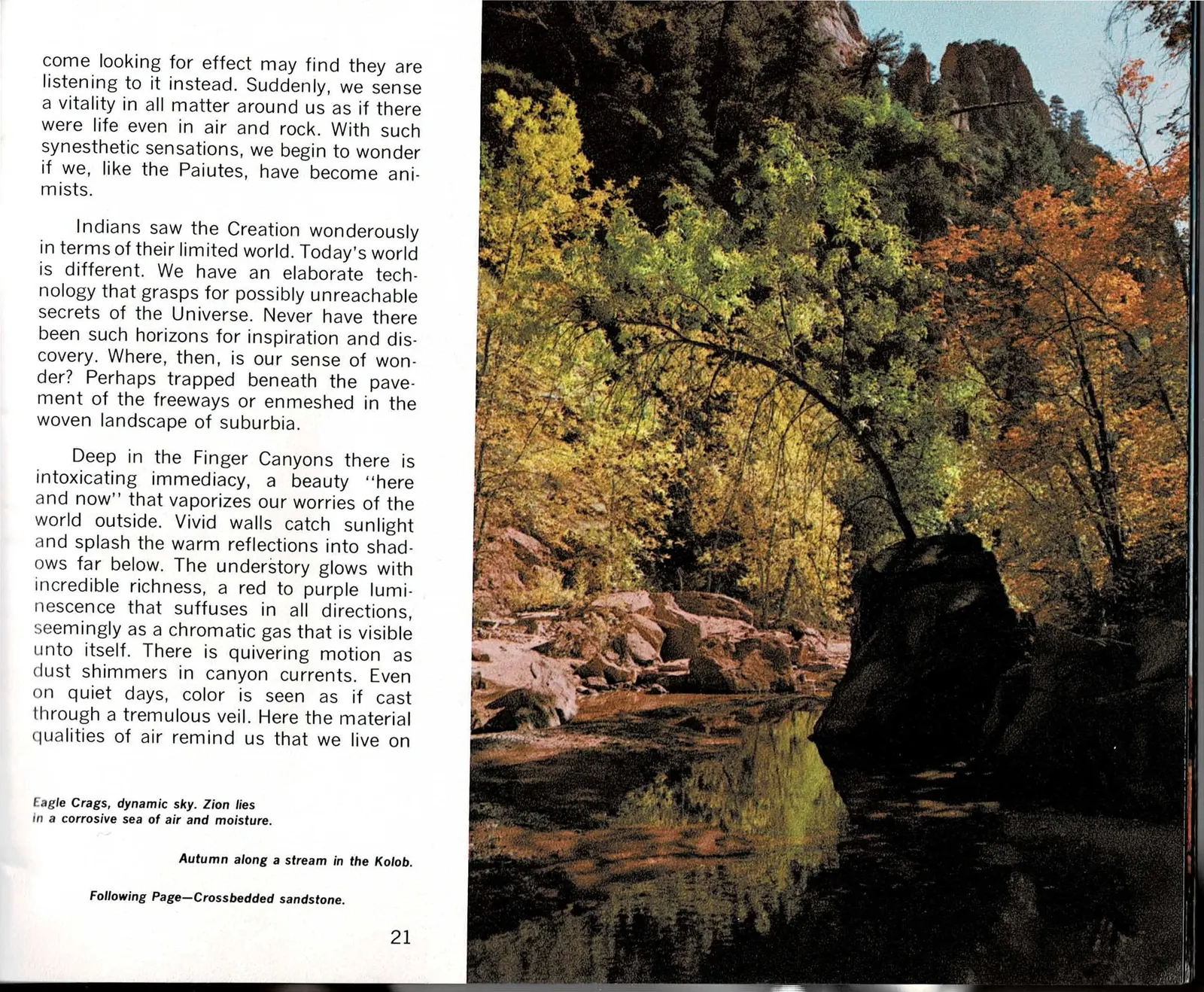
Deep in the Finger Canyons there is intoxicating immediacy, a beauty "here and now" that vaporizes our worries of the world outside. Vivid walls catch sunlight and splash the warm reflections into shadows far below. The understory glows with incredible richness, a red to purple luminescence that suffuses in all directions, seemingly as a chromatic gas that is visible unto itself. There is quivering motion as dust shimmers in canyon currents. Even on quiet days, color is seen as if cast through a tremulous veil. Here the material qualities of air remind us that we live on
Editorial note: The sentence breaks off here at the bottom of page 21. The book's next page of body text is page 24, one of the four printed pages (24 through 27) missing from the scans available for this project. See the note following the next spread.
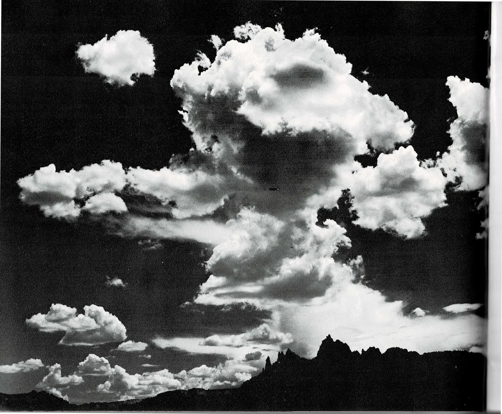
Eagle Crags, dynamic sky. Zion lies in a corrosive sea of air and moisture.
Autumn along a stream in the Kolob.
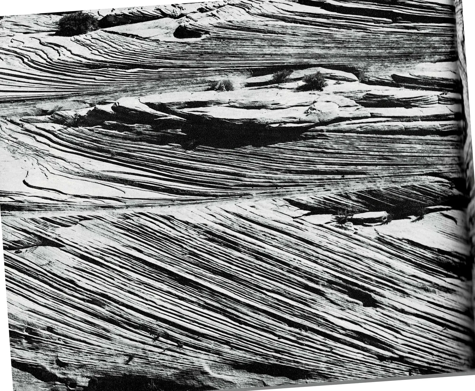
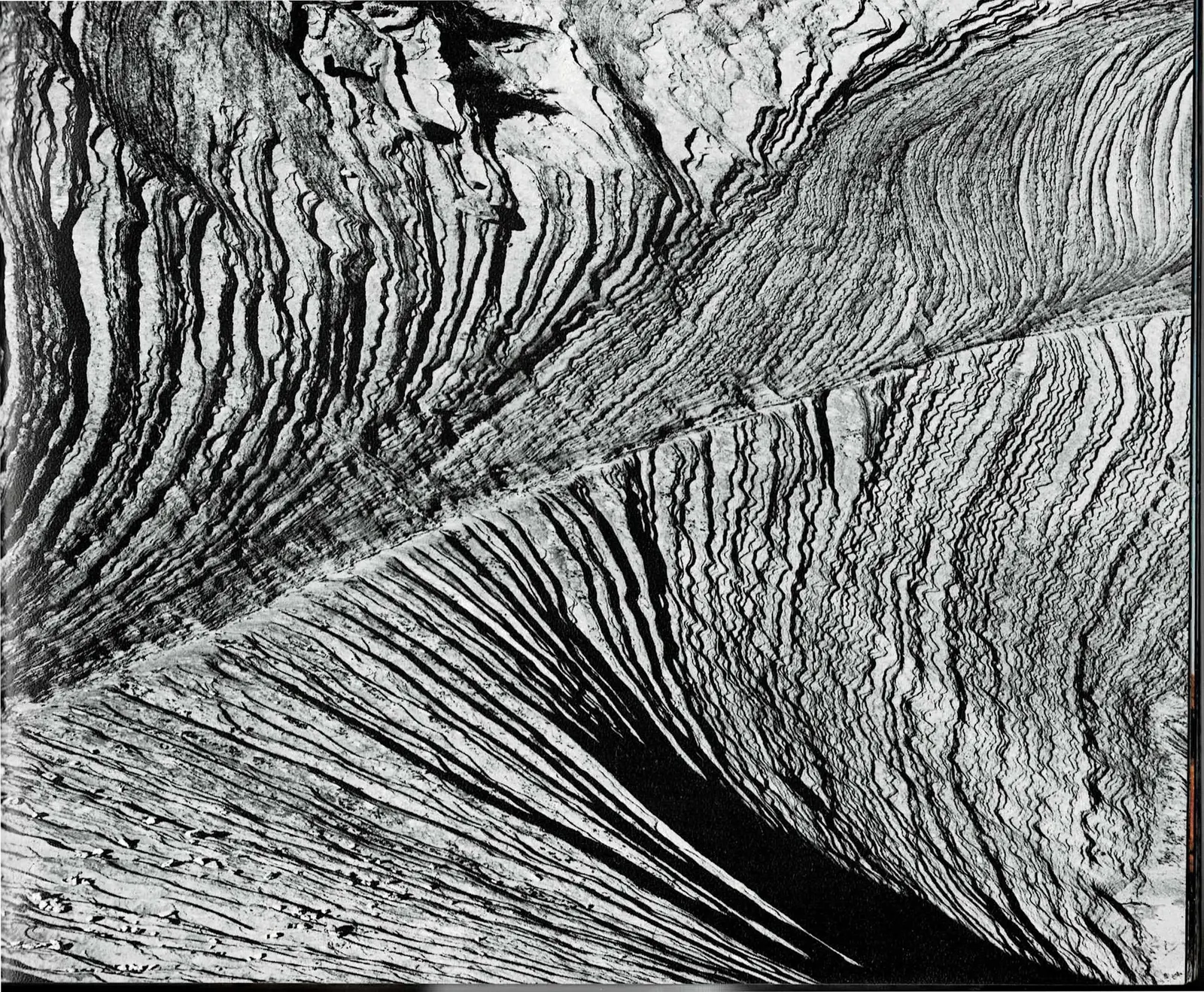
Following Page - Crossbedded sandstone.
A Page With Nothing But Stone
Page 21 closes with a caption promising "Following Page - Crossbedded sandstone," and the book delivers exactly that and nothing more. Pages 22 and 23 carry no headline, no body text, no photo credit, not even a printed page number. It is a single black-and-white photograph of Navajo Sandstone, cropped so close that the rock's diagonal laminations fill the frame edge to edge.
The photograph is also proof of how this two-page spread goes together. The laminations meet across the gutter at a matching angle, density, and exposure, evidence that the two printed pages were shot as one continuous scene rather than two separate photographs placed side by side. After eight spreads built from captions and forward references, this is the one place where the physical rock itself confirms the pairing.
It is also the last complete spread before a real gap in the record. The sentence that broke off on page 21 was headed for page 24, and page 24 is one of four printed pages (through page 27) that were never scanned for this project. A note explaining that gap follows immediately after this spread.
Read the original book text (pages 22 - 23)
Editorial note: These two pages carry no text and no photo captions in the original book. They form a single full-bleed photograph of crossbedded Navajo Sandstone, continuous across the gutter, previewed by the "Following Page" caption on page 21.
Pages 24 through 27 of the original book are missing from the scans available for this project. They'll be added here once new scans exist.
Seeing Zion From Outside Itself
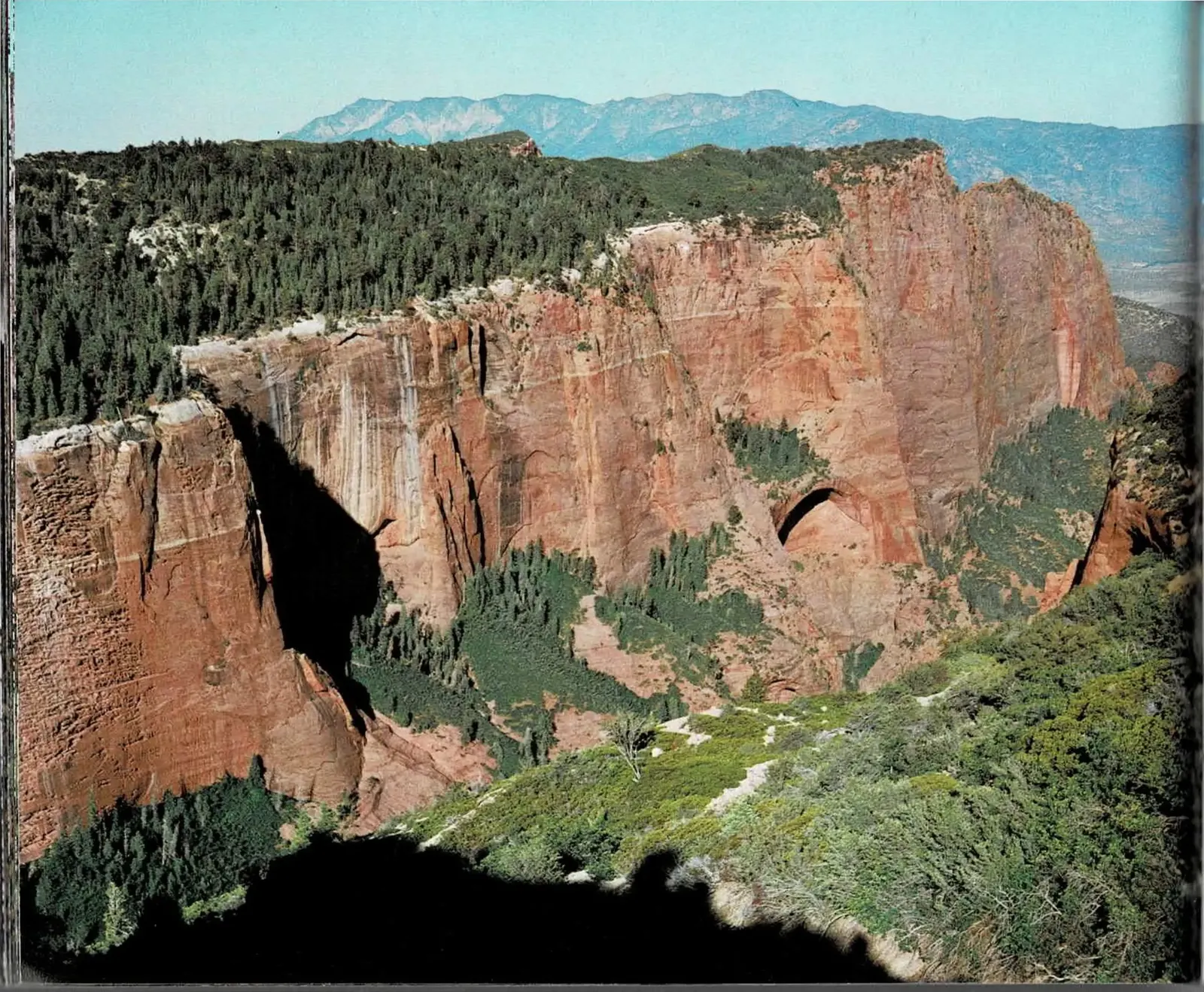
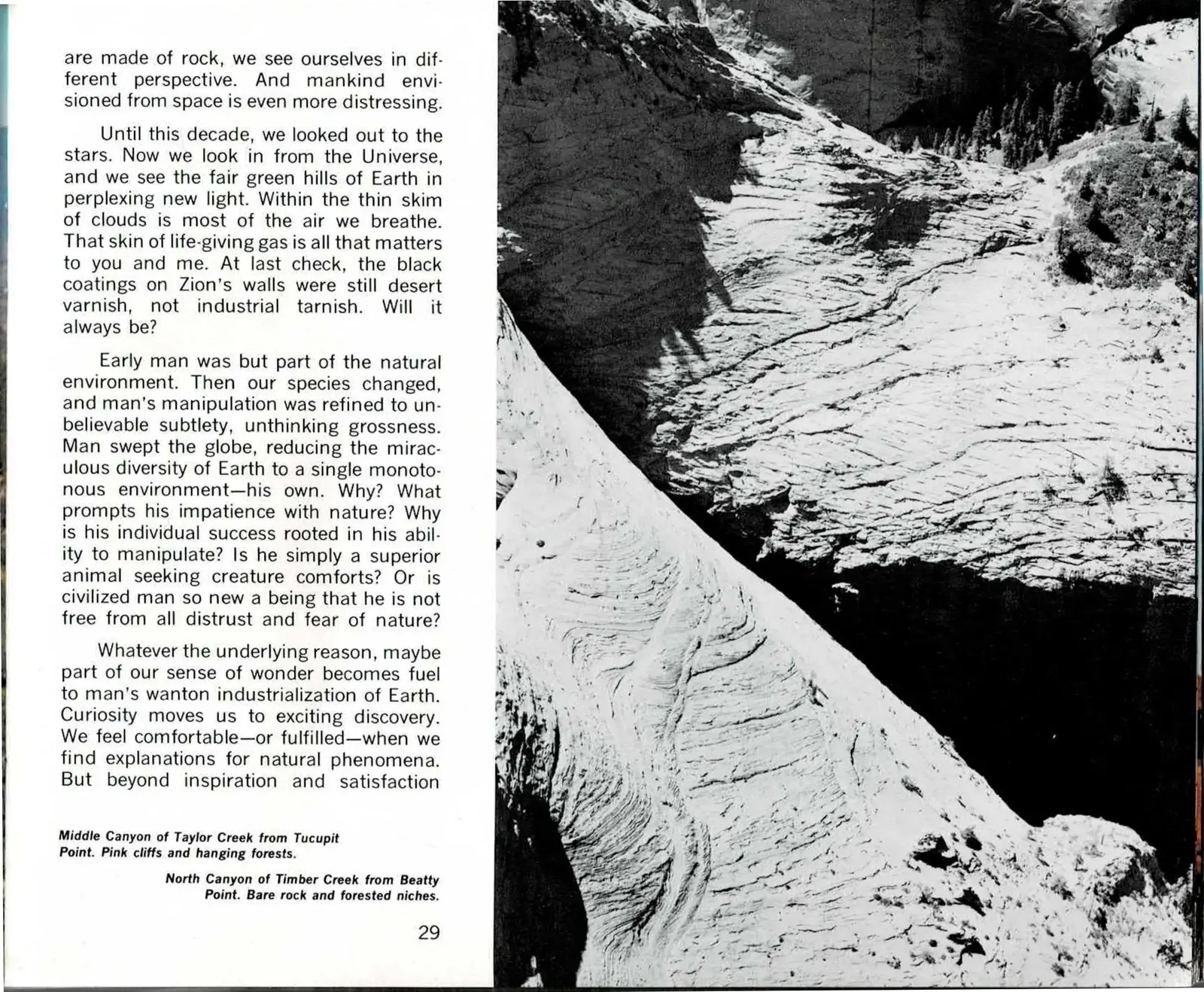
In 1974, Apollo photographs of the whole Earth were still new, and Hagood uses them here to push the "we are made of rock" idea past metaphor. Seeing the planet from orbit, he argues, changes how that fact lands: Earth's breathable atmosphere is a "thin skim of clouds," thinner and more finite than it looks from the ground, and that thinness is what actually matters to the people living under it.
He grounds that large claim in something specific to the canyon in front of him. The black streaks running down these walls, he notes, were still natural desert varnish as of his writing, not industrial soot - a plain, checkable fact standing in for a much bigger question about how long that will stay true.
The chapter's real argument is about why humans keep trying to "improve" on nature instead of living inside it. Hagood traces a line from early humans, who were simply part of the environment, to industrial humans, who manipulate that environment with more precision every year while losing the habit of seeing it whole. It is a pointed argument for a national park book, and it sets up the pages that follow.
Read the original book text (pages 28 - 29)
Editorial note: Page 29 picks up mid-sentence. The passage began on page 27, one of the four printed pages (24 through 27) missing from the scans available for this project; transcription resumes here exactly as printed.
are made of rock, we see ourselves in different perspective. And mankind envisioned from space is even more distressing.
Until this decade, we looked out to the stars. Now we look in from the Universe, and we see the fair green hills of Earth in perplexing new light. Within the thin skim of clouds is most of the air we breathe. That skin of life-giving gas is all that matters to you and me. At last check, the black coatings on Zion's walls were still desert varnish, not industrial tarnish. Will it always be?
Early man was but part of the natural environment. Then our species changed, and man's manipulation was refined to unbelievable subtlety, unthinking grossness. Man swept the globe, reducing the miraculous diversity of Earth to a single monotonous environment—his own. Why? What prompts his impatience with nature? Why is his individual success rooted in his ability to manipulate? Is he simply a superior animal seeking creature comforts? Or is civilized man so new a being that he is not free from all distrust and fear of nature?
Whatever the underlying reason, maybe part of our sense of wonder becomes fuel to man's wanton industrialization of Earth. Curiosity moves us to exciting discovery. We feel comfortable—or fulfilled—when we find explanations for natural phenomena. But beyond inspiration and satisfaction
Middle Canyon of Taylor Creek from Tucupit Point. Pink cliffs and hanging forests.
North Canyon of Timber Creek from Beatty Point. Bare rock and forested niches.
Move a Grain of Sand
The argument from the previous spread lands here in a single line: "There are no independent actions by man in nature. Move a grain of sand and you change the stars." Hagood draws a sharp distinction between industrial man, who treats environmental deterioration as an acceptable side effect of progress, and what he calls "man of the land," who takes only the dividends nature's systems produce and knows better than to draw down the capital.
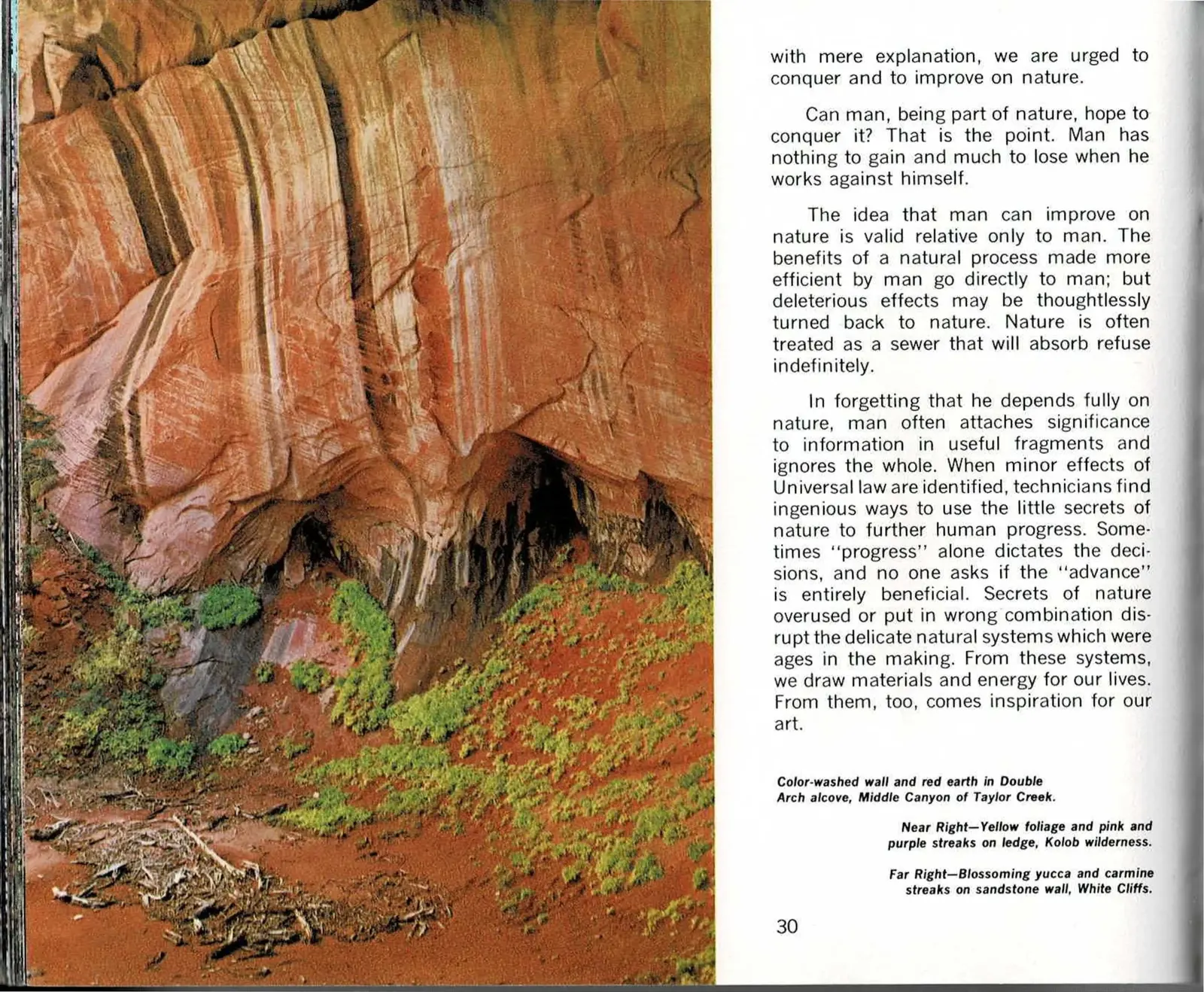
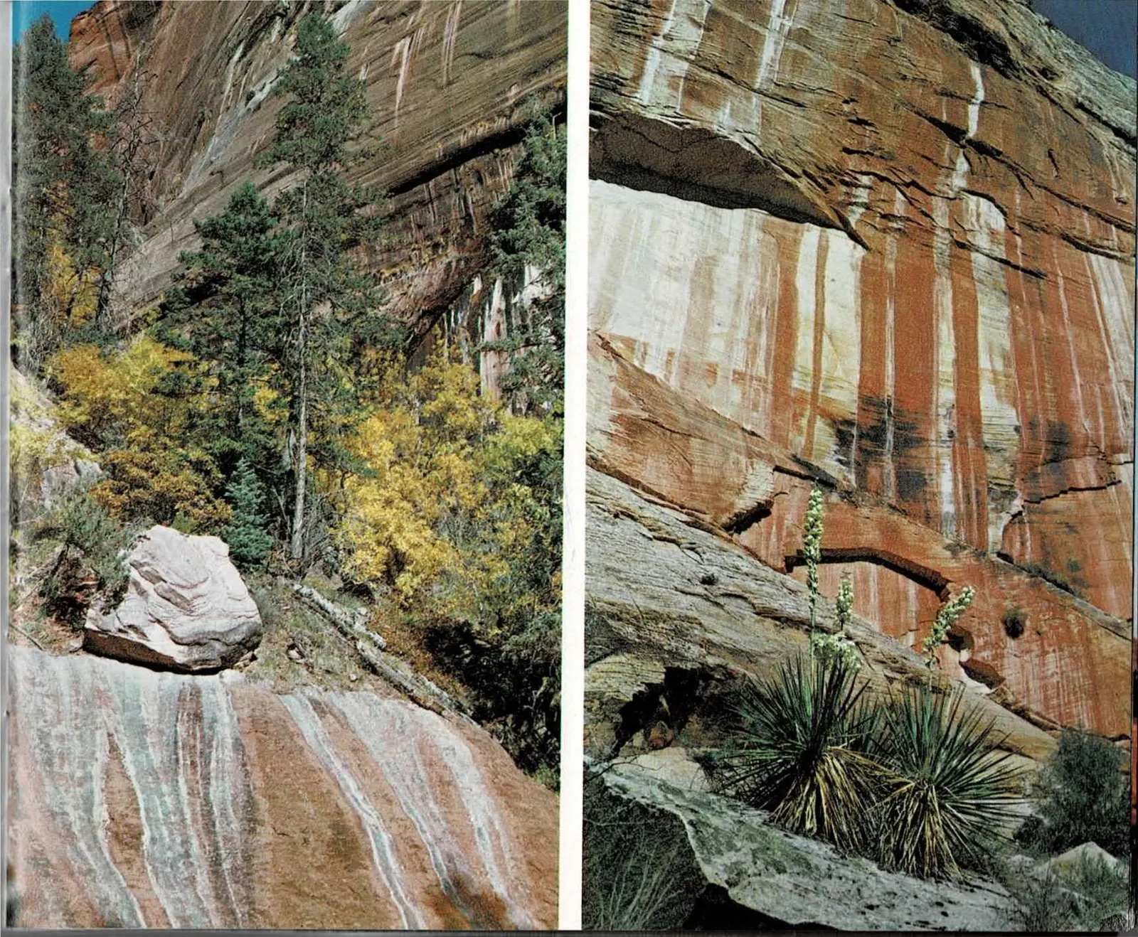
The two smaller photographs facing that argument are not scenery for its own sake. A sandstone ledge banded yellow, pink, and purple under autumn foliage, and a single blossoming yucca stalk against a carmine-streaked wall, are both exactly the kind of small, close-up detail the argument is built on: the grain of sand that turns out to matter.
The larger photograph on the facing page, looking up into the water-streaked alcove at Double Arch in Taylor Creek's Middle Canyon, shows the same slow process at a bigger scale - centuries of water finding the same path down the same rock face.
Read the original book text (pages 30 - 31)
with mere explanation, we are urged to conquer and to improve on nature.
Can man, being part of nature, hope to conquer it? That is the point. Man has nothing to gain and much to lose when he works against himself.
The idea that man can improve on nature is valid relative only to man. The benefits of a natural process made more efficient by man go directly to man; but deleterious effects may be thoughtlessly turned back to nature. Nature is often treated as a sewer that will absorb refuse indefinitely.
In forgetting that he depends fully on nature, man often attaches significance to information in useful fragments and ignores the whole. When minor effects of Universal law are identified, technicians find ingenious ways to use the little secrets of nature to further human progress. Sometimes "progress" alone dictates the decisions, and no one asks if the "advance" is entirely beneficial. Secrets of nature overused or put in wrong combination disrupt the delicate natural systems which were ages in the making. From these systems, we draw materials and energy for our lives. From them, too, comes inspiration for our art.
Color-washed wall and red earth in Double Arch alcove, Middle Canyon of Taylor Creek.
Near Right—Yellow foliage and pink and purple streaks on ledge, Kolob wilderness.
Far Right—Blossoming yucca and carmine streaks on sandstone wall, White Cliffs.
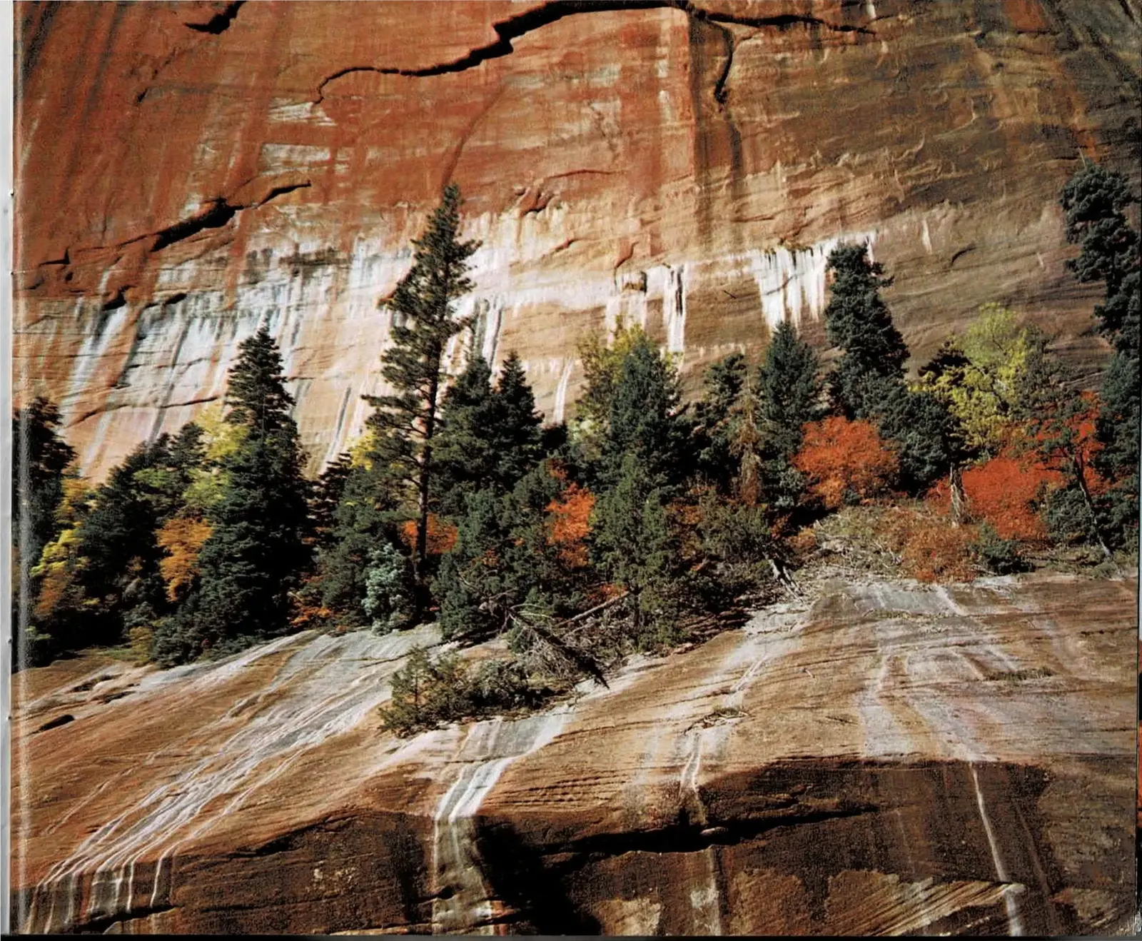
Chaos, Until You Tune Your Senses
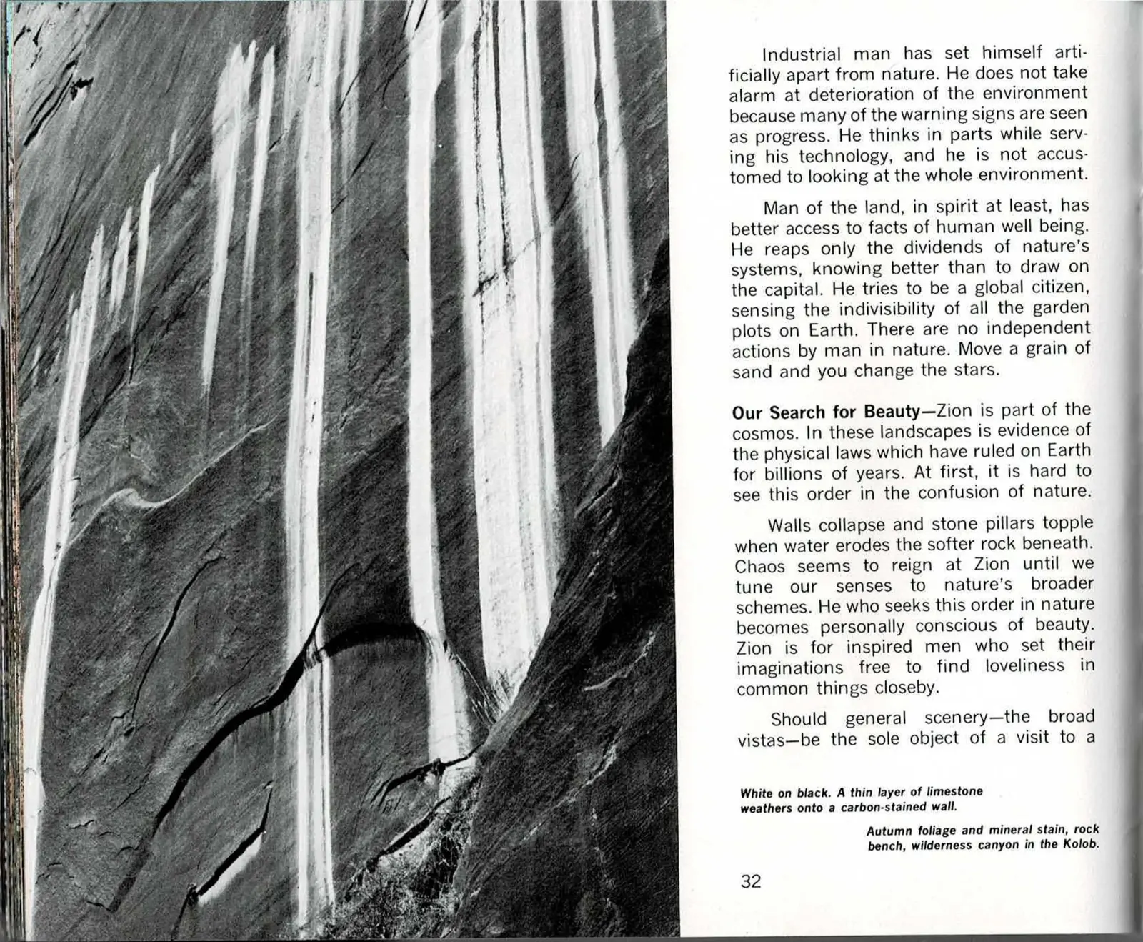
Page 32 finishes the industrial-man argument, then turns hard into a new one under a run-in subhead: "Our Search for Beauty." Hagood zooms all the way out first, calling Zion "part of the cosmos" and its rock layers evidence of physical laws that have governed Earth for billions of years, then zooms back down to what anyone standing in the canyon can actually see: walls collapsing, pillars toppling, water eating away at softer rock underneath. Up close, it reads as pure disorder.
His claim is that beauty is what happens when you stop looking for the postcard view and start reading that disorder as a pattern instead. He is explicit about who that is for: "Zion is for inspired men who set their imaginations free to find loveliness in common things closeby" - not just the named overlooks, but a streaked wall like the one pictured here, a thin layer of limestone weathering onto stone darkened by carbon.
The page runs out mid-question, wondering aloud whether the broad vistas most visitors come for should really be the whole point of a visit to a park like this one. The book picks the sentence back up on the next printed page.
Read the original book text (pages 32 - 33)
Industrial man has set himself artificially apart from nature. He does not take alarm at deterioration of the environment because many of the warning signs are seen as progress. He thinks in parts while serving his technology, and he is not accustomed to looking at the whole environment.
Man of the land, in spirit at least, has better access to facts of human well being. He reaps only the dividends of nature's systems, knowing better than to draw on the capital. He tries to be a global citizen, sensing the indivisibility of all the garden plots on Earth. There are no independent actions by man in nature. Move a grain of sand and you change the stars.
Our Search for Beauty—Zion is part of the cosmos. In these landscapes is evidence of the physical laws which have ruled on Earth for billions of years. At first, it is hard to see this order in the confusion of nature.
Walls collapse and stone pillars topple when water erodes the softer rock beneath. Chaos seems to reign at Zion until we tune our senses to nature's broader schemes. He who seeks this order in nature becomes personally conscious of beauty. Zion is for inspired men who set their imaginations free to find loveliness in common things closeby.
Should general scenery—the broad vistas—be the sole object of a visit to a
White on black. A thin layer of limestone weathers onto a carbon-stained wall.
Autumn foliage and mineral stain, rock bench, wilderness canyon in the Kolob.
A Museum Too Crowded to See
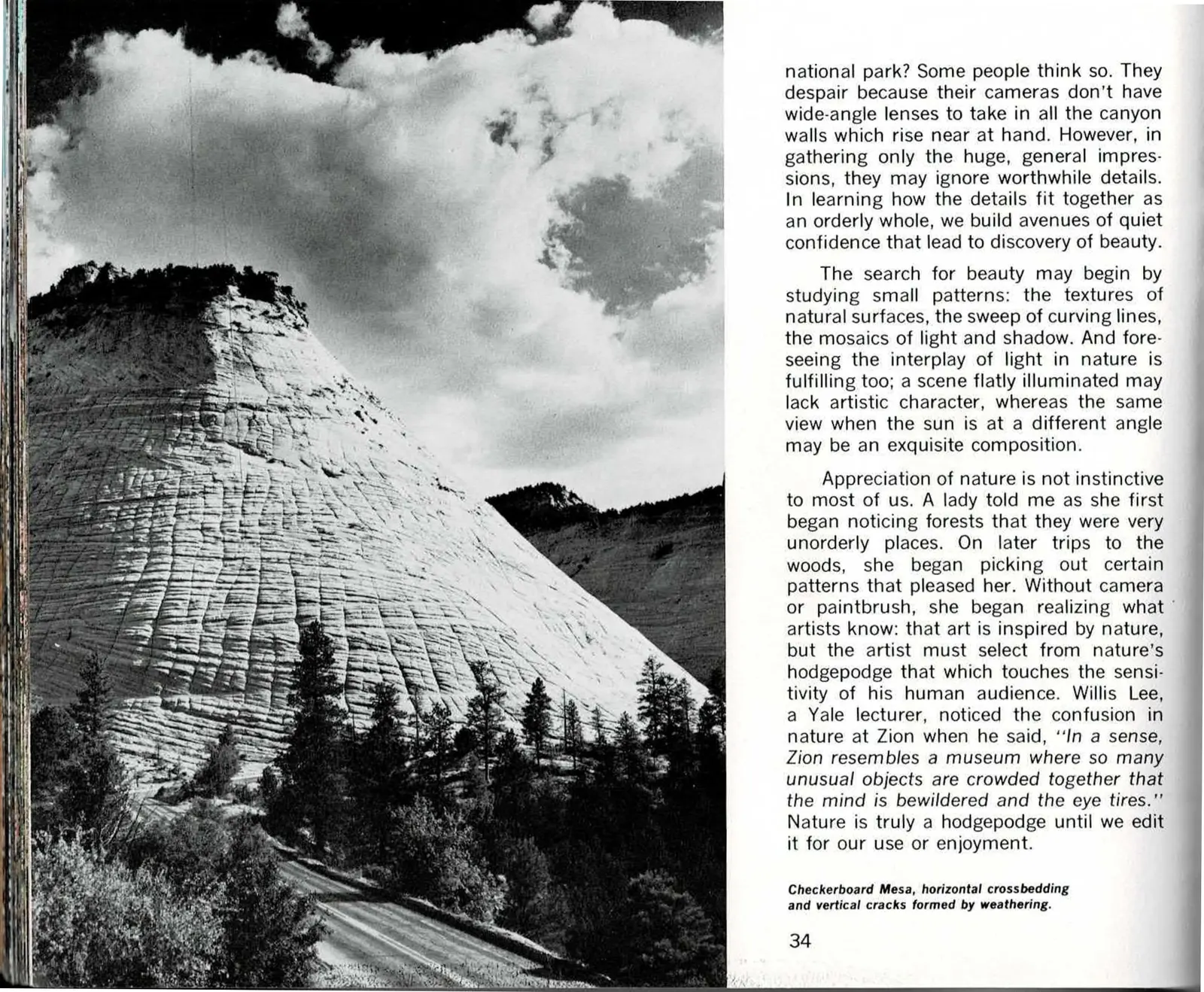
Page 34 finishes the idea the book has been building since the previous spread: most visitors leave Zion frustrated because no lens is wide enough to hold the canyon at once, so they gather only "huge, general impressions" and miss the worthwhile detail underneath. Hagood's fix is patient looking - texture, curving line, the mosaics of light and shadow, and how the same rock face reads differently as the sun moves across it. He backs the claim with a small anecdote about a woman who learned to see pattern in what had looked like unorderly forest, then reaches for an outside authority: Willis Lee, a Yale lecturer, who called Zion "a museum where so many unusual objects are crowded together that the mind is bewildered and the eye tires." His conclusion is blunt - nature is a hodgepodge until we edit it for our own use or enjoyment.
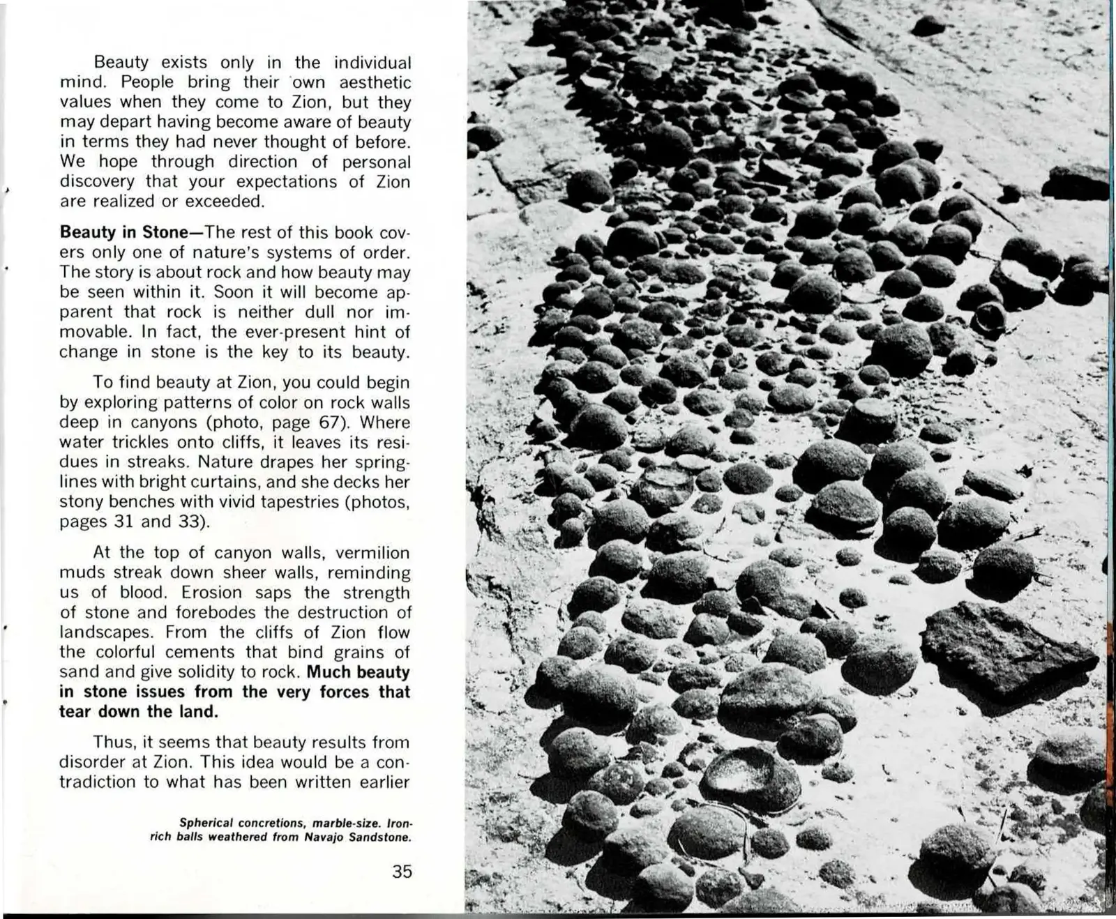
Page 35 turns that argument on the reader directly: beauty exists only in the individual mind, and the whole point of the book has been to help you find your own rather than hand you someone else's. A run-in subhead, "Beauty in Stone," then narrows Part One's closing pages to a single claim - that rock is neither dull nor fixed, and the hint of change in it is the real source of its beauty. Springlines drape canyon walls in mineral color, vermilion mud streaks read like old wounds, and the same erosion that destroys a landscape is also what cements sand into rock in the first place.
The page runs out mid-thought - "this idea would be a contradiction to what has been written earlier" - a sentence the book itself finishes on the next printed page, in Part Two. Part One closes without a tidy bow: beauty at Zion, Hagood argues, comes from disorder, and untangling that claim is where the book turns next, into the geological story of how the rock actually got this way.
Read the original book text (pages 34 - 35)
Some people think so. They despair because their cameras don't have wide-angle lenses to take in all the canyon walls which rise near at hand. However, in gathering only the huge, general impressions, they may ignore worthwhile details. In learning how the details fit together as an orderly whole, we build avenues of quiet confidence that lead to discovery of beauty.
The search for beauty may begin by studying small patterns: the textures of natural surfaces, the sweep of curving lines, the mosaics of light and shadow. And foreseeing the interplay of light in nature is fulfilling too; a scene flatly illuminated may lack artistic character, whereas the same view when the sun is at a different angle may be an exquisite composition.
Appreciation of nature is not instinctive to most of us. A lady told me as she first began noticing forests that they were very unorderly places. On later trips to the woods, she began picking out certain patterns that pleased her. Without camera or paintbrush, she began realizing what artists know: that art is inspired by nature, but the artist must select from nature's hodgepodge that which touches the sensitivity of his human audience. Willis Lee, a Yale lecturer, noticed the confusion in nature at Zion when he said, "In a sense, Zion resembles a museum where so many unusual objects are crowded together that the mind is bewildered and the eye tires." Nature is truly a hodgepodge until we edit it for our use or enjoyment.
Checkerboard Mesa, horizontal crossbedding and vertical cracks formed by weathering.
Beauty exists only in the individual mind. People bring their own aesthetic values when they come to Zion, but they may depart having become aware of beauty in terms they had never thought of before. We hope through direction of personal discovery that your expectations of Zion are realized or exceeded.
Beauty in Stone—The rest of this book covers only one of nature's systems of order. The story is about rock and how beauty may be seen within it. Soon it will become apparent that rock is neither dull nor immovable. In fact, the ever-present hint of change in stone is the key to its beauty.
To find beauty at Zion, you could begin by exploring patterns of color on rock walls deep in canyons (photo, page 67). Where water trickles onto cliffs, it leaves its residues in streaks. Nature drapes her springlines with bright curtains, and she decks her stony benches with vivid tapestries (photos, pages 31 and 33).
At the top of canyon walls, vermilion muds streak down sheer walls, reminding us of the strength of blood. Erosion saps the strength of stone and forebodes the destruction of landscapes. From the cliffs of Zion flow the colorful cements that bind grains of sand and give solidity to rock. Much beauty in stone issues from the very forces that tear down the land.
Thus, it seems that beauty results from disorder at Zion. This idea would be a contradiction to what has been written earlier
Spherical concretions, marble-size. Iron-rich balls weathered from Navajo Sandstone.
Part Two
The Geological Story
Where Part One shows the canyon, Part Two explains it. Hagood divides the argument into four chapters that run from the rock layers themselves through the forces that lift, break and finally remove them. This is the part of the book that carries citations, and those citations are preserved in the original-text panels below.
Part Two, Chapter One - Pages 36 to 47
The Layered Rocks of Zion
The chapter that names the stone. Hagood works down through the layers exposed in and around the park, starting from the Navajo Sandstone that dominates the main canyon and arguing that a visitor who never looks past those cliffs misses most of the story.
Markers in the form (Ref. 5) inside the original-text panels are Hagood's own citations to a numbered reference list. That list is not reproduced anywhere in this scanned edition, so the marker is preserved here for fidelity rather than as a working reference.
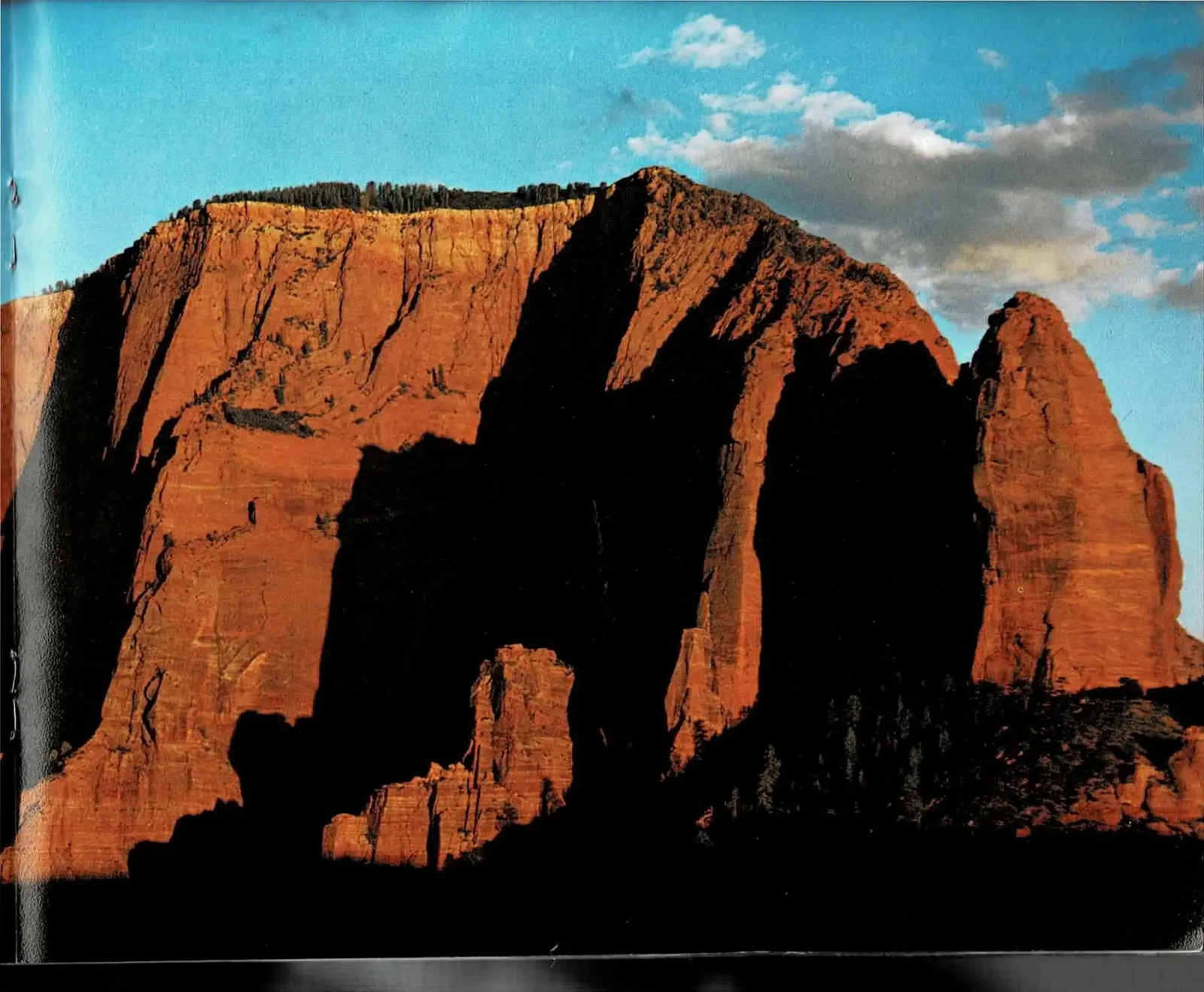
Where the Book Turns
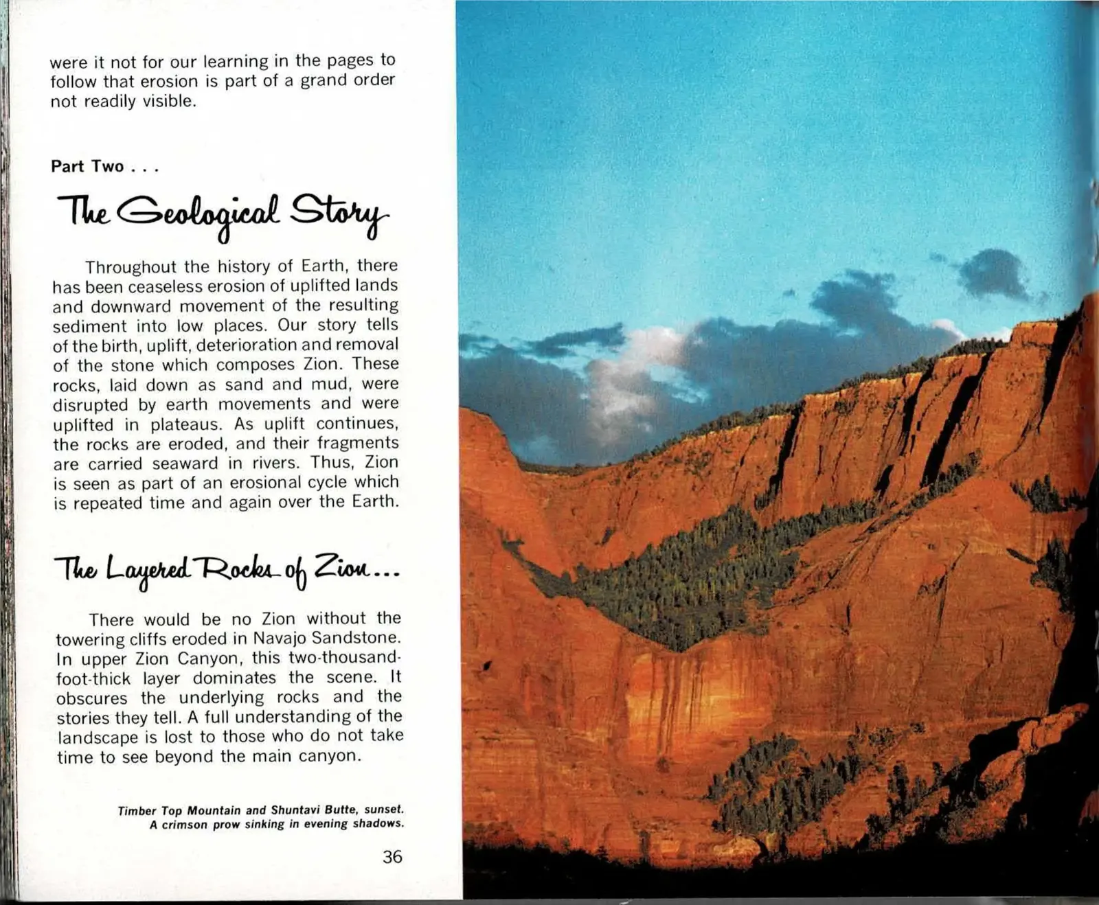
Page 36 is where the argument shifts. Everything before it made its case by showing the canyon - sunset light, a view, a shadow line. On this page Hagood closes that case with a single line about erosion belonging to an order the eye does not readily see, then opens the second half of the book: the geological argument. From here the photographs stop simply being scenery and start being evidence.
The claim he sets up carries the whole chapter that follows. Zion's stone was laid down as ordinary sand and mud long before it was stone at all, then lifted into plateaus and immediately set upon by the same forces that will eventually carry it away. The canyon a visitor drives through today is not a finished object. It is a cross-section of a process still running.
The spread also introduces the single formation most visitors actually see: the Navajo Sandstone, roughly two thousand feet of it stacked above the floor of upper Zion Canyon. Hagood's point, made right at the opening of Chapter One, is that this one layer is so dominant it hides everything underneath it, and that a reader who stops at admiring the sandstone misses most of the book's real subject.
Read the original book text (pages 36 - 37)
were it not for our learning in the pages to follow that erosion is part of a grand order not readily visible.
Part Two . . . The Geological Story
Throughout the history of Earth, there has been ceaseless erosion of uplifted lands and downward movement of the resulting sediment into low places. Our story tells of the birth, uplift, deterioration and removal of the stone which composes Zion. These rocks, laid down as sand and mud, were disrupted by earth movements and were uplifted in plateaus. As uplift continues, the rocks are eroded, and their fragments are carried seaward in rivers. Thus, Zion is seen as part of an erosional cycle which is repeated time and again over the Earth.
The Layered Rocks of Zion . . .
There would be no Zion without the towering cliffs eroded in Navajo Sandstone. In upper Zion Canyon, this two-thousand-foot-thick layer dominates the scene. It obscures the underlying rocks and the stories they tell. A full understanding of the landscape is lost to those who do not take time to see beyond the main canyon.
Timber Top Mountain and Shuntavi Butte, sunset. A crimson prow sinking in evening shadows.
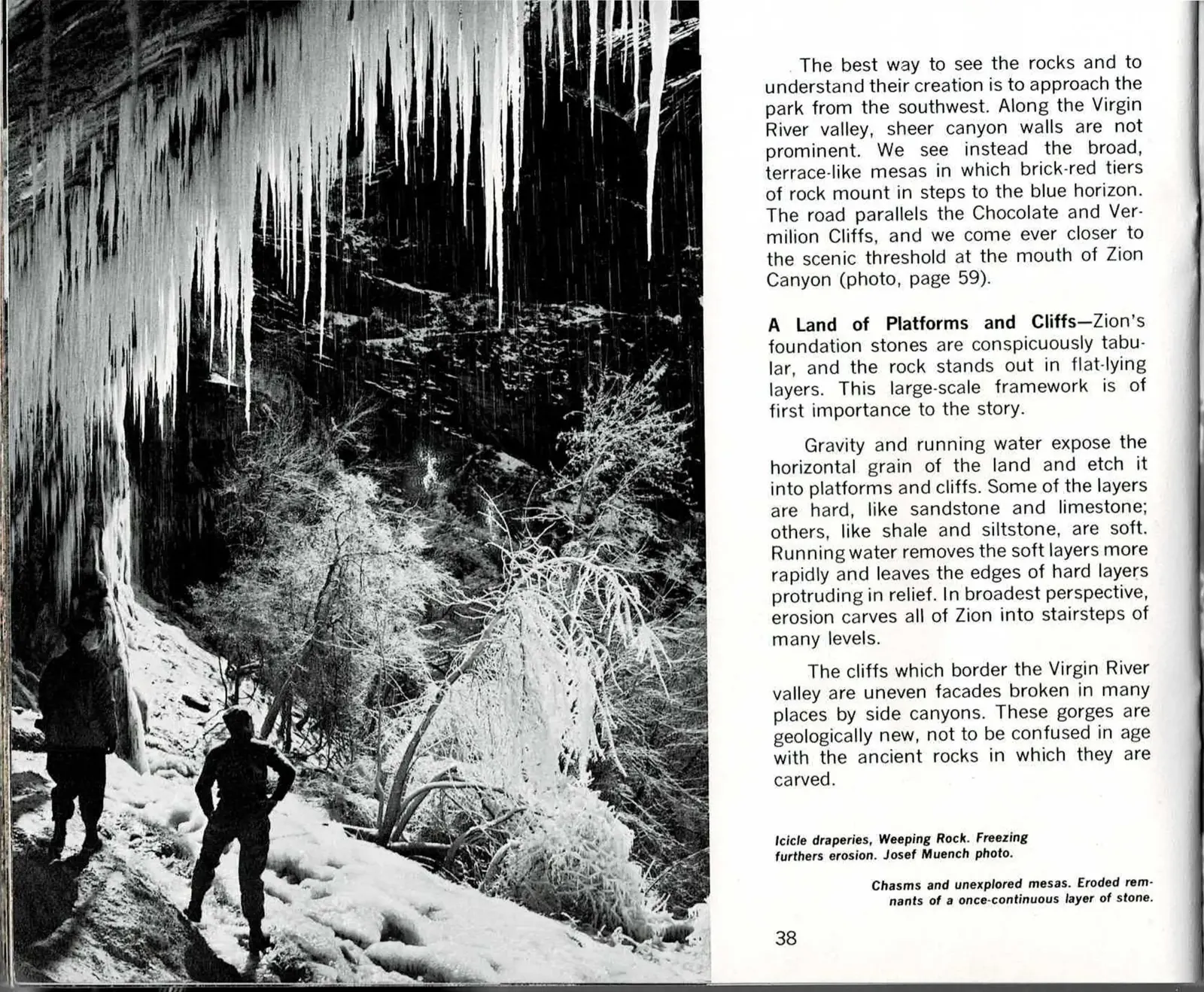
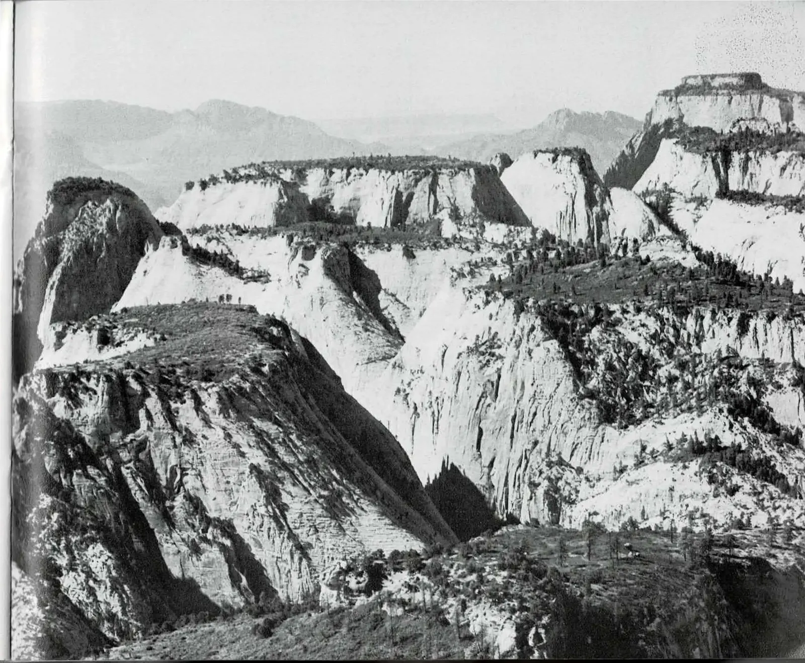
Stairsteps, Not Walls
Most visitors arrive through the main canyon and never see what this spread describes: the approach from the southwest, where the land doesn't rise as a single wall but climbs in broad terraces, brick-red tier stacked on brick-red tier toward the horizon.
That stairstep shape is the chapter's real subject. Rock doesn't erode evenly. Hard stone like sandstone and limestone stands proud while softer shale and siltstone wears away faster underneath it, so the land steps down in a series of platforms and cliffs rather than a smooth slope, the same logic that carves a staircase out of anything layered.
The spread also draws a distinction easy to miss on a single visit. The side canyons cutting into the Virgin River valley are young compared to the rock they're cut from. The stone itself may be hundreds of millions of years old; the specific gorge a hiker walks through is a far newer, ongoing cut into that older material.
Read the original book text (pages 38 - 39)
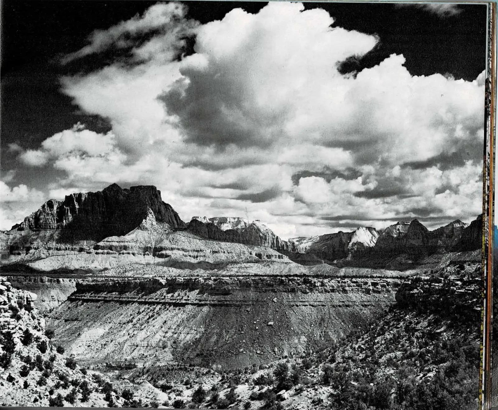
The best way to see the rocks and to understand their creation is to approach the park from the southwest. Along the Virgin River valley, sheer canyon walls are not prominent. We see instead the broad, terrace-like mesas in which brick-red tiers of rock mount in steps to the blue horizon. The road parallels the Chocolate and Vermilion Cliffs, and we come ever closer to the scenic threshold at the mouth of Zion Canyon (photo, page 59).
A Land of Platforms and Cliffs - Zion's foundation stones are conspicuously tabular, and the rock stands out in flat-lying layers. This large-scale framework is of first importance to the story.
Gravity and running water expose the horizontal grain of the land and etch it into platforms and cliffs. Some of the layers are hard, like sandstone and limestone; others, like shale and siltstone, are soft. Running water removes the soft layers more rapidly and leaves the edges of hard layers protruding in relief. In broadest perspective, erosion carves all of Zion into stairsteps of many levels.
The cliffs which border the Virgin River valley are uneven facades broken in many places by side canyons. These gorges are geologically new, not to be confused in age with the ancient rocks in which they are carved.
Icicle draperies, Weeping Rock. Freezing furthers erosion. Josef Muench photo.
Chasms and unexplored mesas. Eroded remnants of a once-continuous layer of stone.
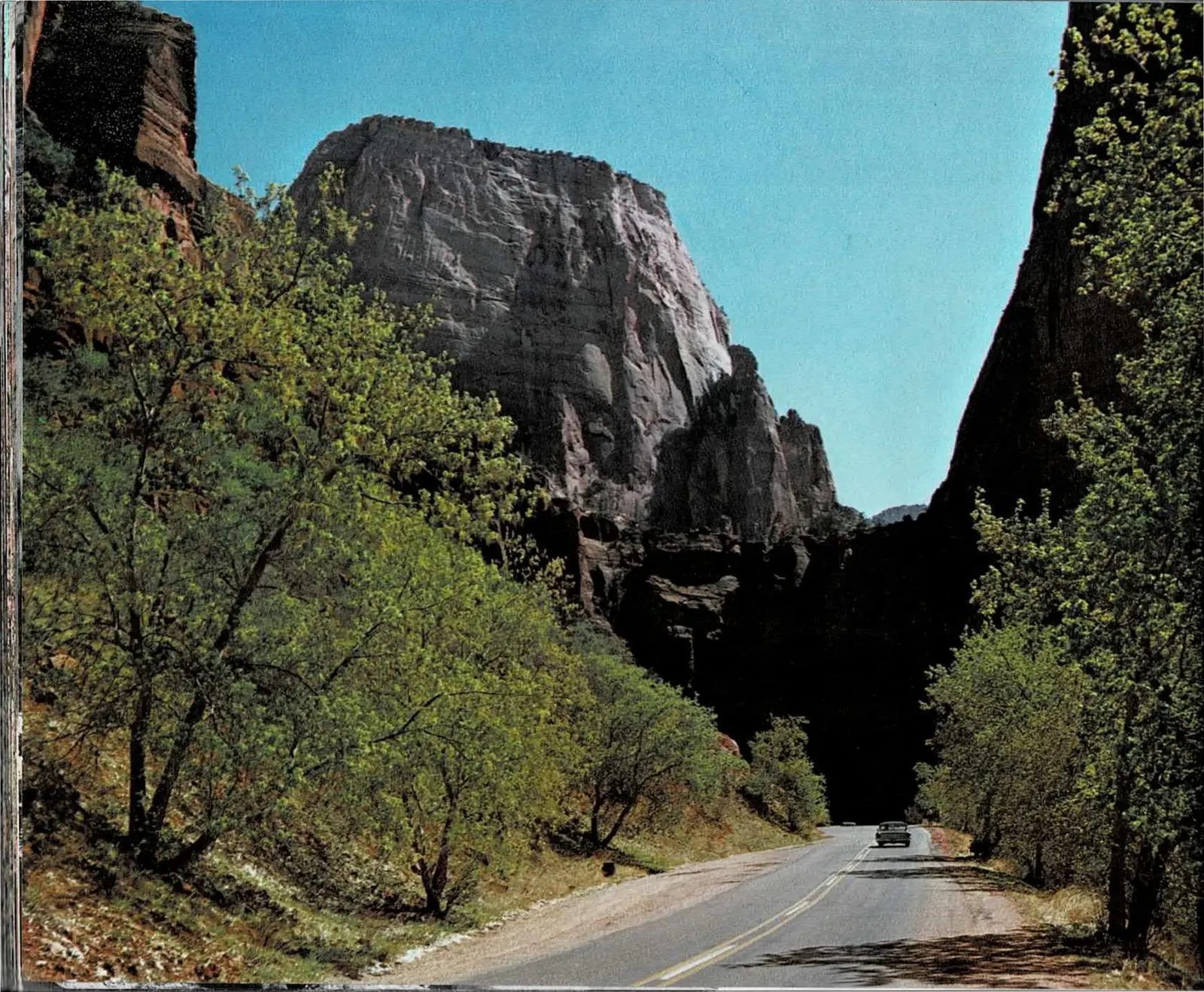
A Basin Long Before It Was a Mountain
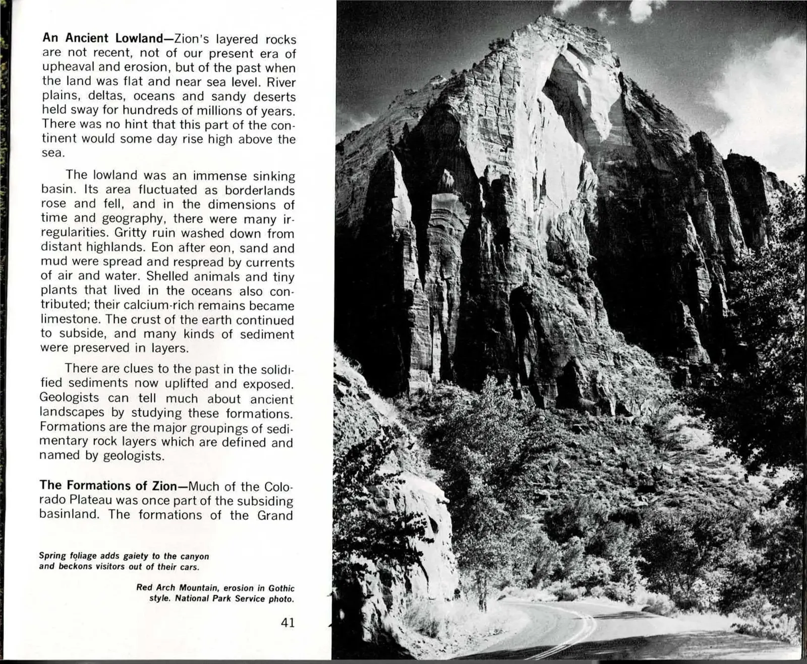
The canyon road pictured here, the one a modern visitor drives past cottonwoods and sandstone walls, sits on top of rock that has nothing to do with the mountains around it today. Long before Zion was lifted into plateau country, this ground was a low, subsiding basin near sea level, catching whatever sediment drifted or washed into it.
That basin filled slowly and by different means over an immense span of time: river sand and desert dunes in some eras, shallow seas in others, with shelled sea creatures leaving behind the calcium that eventually became limestone. None of it happened as a single event. It was accumulation, one thin layer at a time, for longer than is easy to picture.
Geologists now read those accumulated layers as formations, distinct groupings of rock that can be traced, named and compared across the wider Colorado Plateau, of which Zion's cliffs are only one exposed corner. Red Arch Mountain, pictured here, is one visible result of that ancient stacking, cut afterward into its present shape.
Read the original book text (pages 40 - 41)
An Ancient Lowland - Zion's layered rocks are not recent, not of our present era of upheaval and erosion, but of the past when the land was flat and near sea level. River plains, deltas, oceans and sandy deserts held sway for hundreds of millions of years. There was no hint that this part of the continent would some day rise high above the sea.
The lowland was an immense sinking basin. Its area fluctuated as borderlands rose and fell, and in the dimensions of time and geography, there were many irregularities. Gritty ruin washed down from distant highlands. Eon after eon, sand and mud were spread and respread by currents of air and water. Shelled animals and tiny plants that lived in the oceans also contributed; their calcium-rich remains became limestone. The crust of the earth continued to subside, and many kinds of sediment were preserved in layers.
There are clues to the past in the solidified sediments now uplifted and exposed. Geologists can tell much about ancient landscapes by studying these formations. Formations are the major groupings of sedimentary rock layers which are defined and named by geologists.
The Formations of Zion - Much of the Colorado Plateau was once part of the subsiding basinland. The formations of the Grand
Spring foliage adds gaiety to the canyon and beckons visitors out of their cars.
Red Arch Mountain, erosion in Gothic style. National Park Service photo.
Six Layers, Two Miles Deep
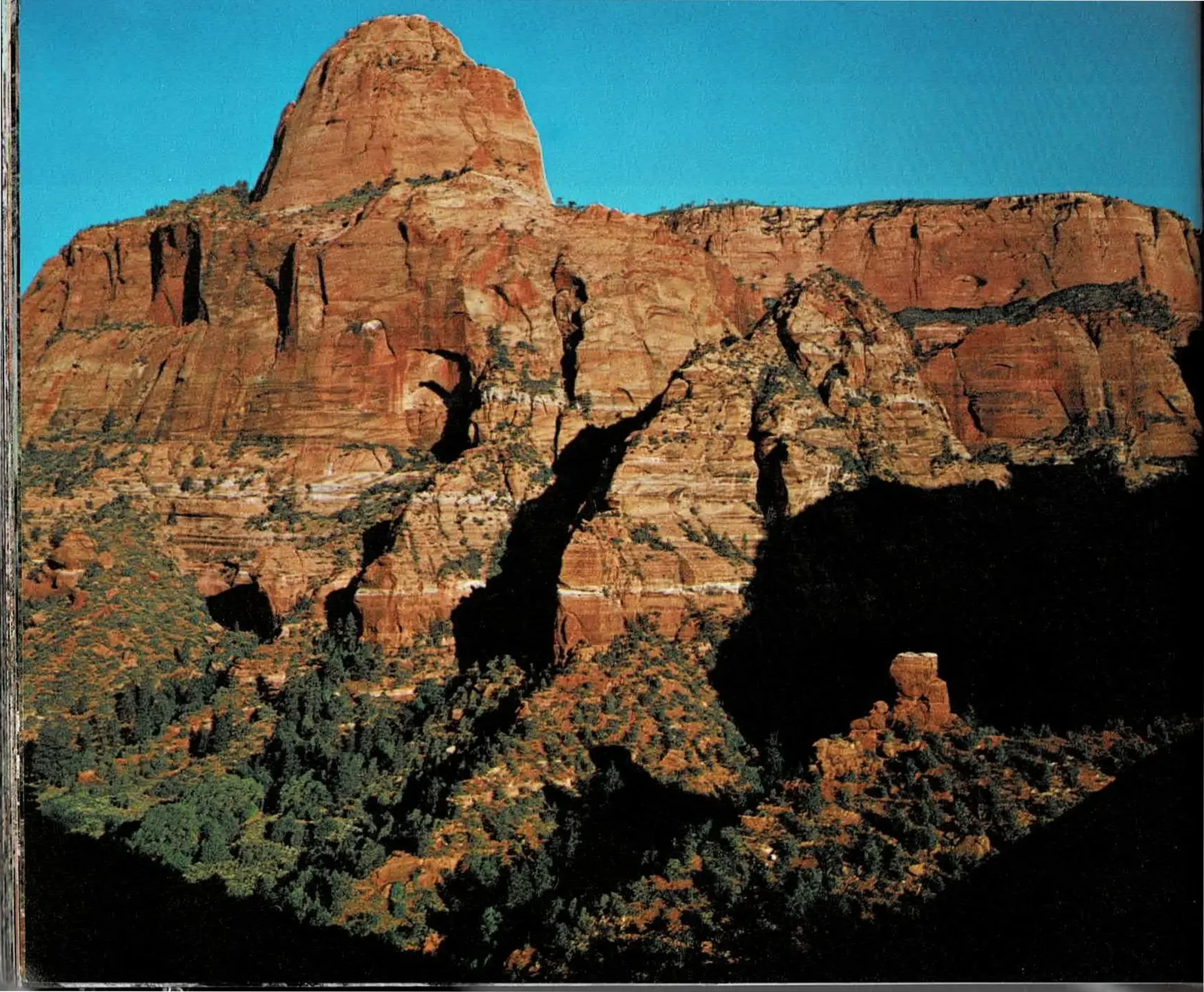
Gregory Butte, pictured here from the Hop Valley Trail, is one small piece of a much bigger stack. Hagood uses this spread to name that stack directly: six formations, from the reddish Moenkopi at the bottom to the pale Carmel at the top, adding up to nearly six thousand feet of rock in places near the park. The Navajo Sandstone that most visitors think of as "Zion" is only the uppermost, most visible slice of that pile, a two-thousand-foot cliff riding on top of the softer, tree-covered Kayenta Formation below it.
The comparison to the Grand Canyon is the chapter's real point. Those famous canyon walls expose an older, lower set of layers, rock that was already buried by the time Zion's own formations began accumulating on top of it. The same sedimentary blanket once stretched continuously across both places; erosion has simply stripped different parts of it bare at each location, so that reading Zion's cliffs and the Grand Canyon's together tells a longer, unbroken story than either place tells alone.
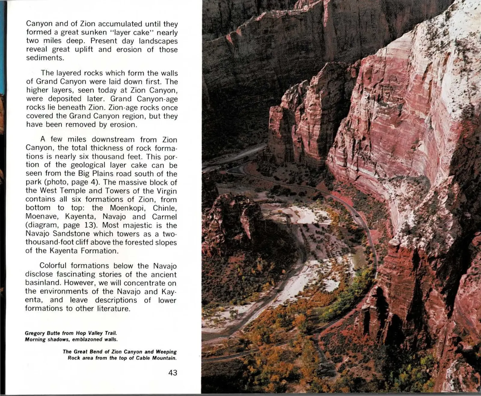
The aerial photograph opposite, looking down on the Great Bend of Zion Canyon from the top of Cable Mountain, shows why that thickness matters on the ground. The road below traces a route that millions of years of layered rock now force it to follow, threading a canyon cut down through formation after formation rather than around them.
Read the original book text (pages 42 - 43)
Canyon and of Zion accumulated until they formed a great sunken "layer cake" nearly two miles deep. Present day landscapes reveal great uplift and erosion of those sediments.
The layered rocks which form the walls of Grand Canyon were laid down first. The higher layers, seen today at Zion Canyon, were deposited later. Grand Canyon-age rocks lie beneath Zion. Zion-age rocks once covered the Grand Canyon region, but they have been removed by erosion.
A few miles downstream from Zion Canyon, the total thickness of rock formations is nearly six thousand feet. This portion of the geological layer cake can be seen from the Big Plains road south of the park (photo, page 4). The massive block of the West Temple and Towers of the Virgin contains all six formations of Zion, from bottom to top: the Moenkopi, Chinle, Moenave, Kayenta, Navajo and Carmel (diagram, page 13). Most majestic is the Navajo Sandstone which towers as a two-thousand-foot cliff above the forested slopes of the Kayenta Formation.
Colorful formations below the Navajo disclose fascinating stories of the ancient basinland. However, we will concentrate on the environments of the Navajo and Kayenta, and leave descriptions of lower formations to other literature.
Gregory Butte from Hop Valley Trail. Morning shadows, emblazoned walls.
The Great Bend of Zion Canyon and Weeping Rock area from the top of Cable Mountain.
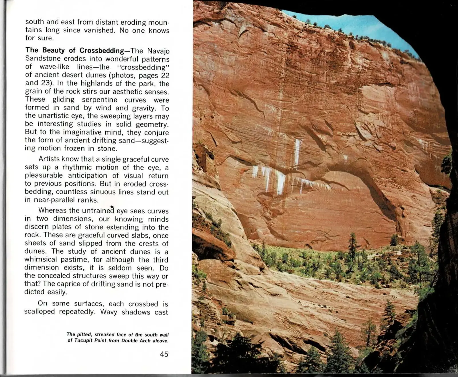
When the Desert Buried the Rivers
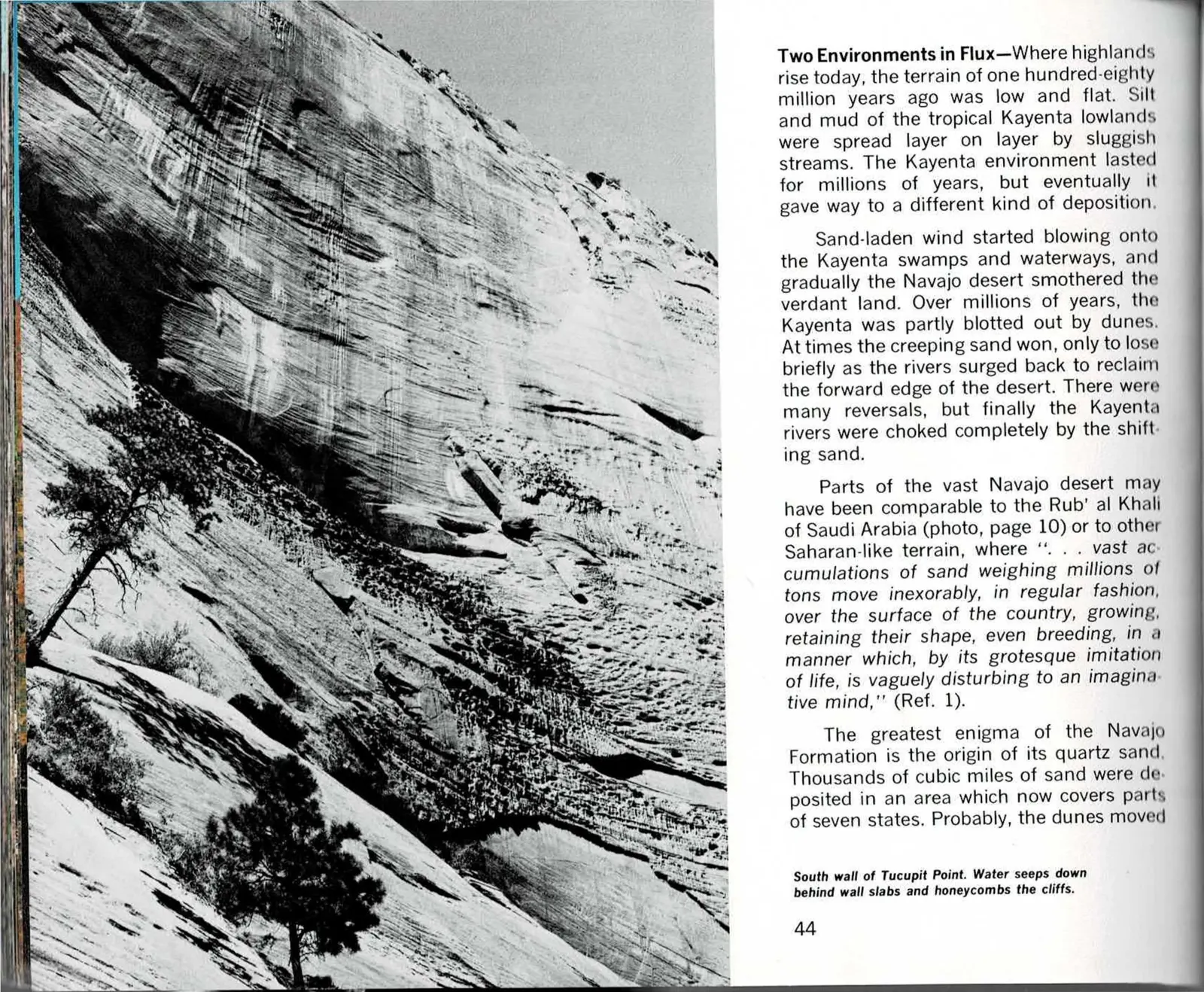
This spread covers one of the more vivid transitions in Zion's rock record: a wet, river-crossed lowland slowly losing ground to a spreading desert. The streaked sandstone wall pictured here, part of Tucupit Point, is Navajo Sandstone eroding along the same wave-like bedding planes that were once the faces of ancient dunes, a texture geologists call crossbedding.
Hagood's account is a battle, not a single event. Sand crept over the Kayenta Formation's rivers and swamps for millions of years, and more than once the rivers reasserted themselves and drove the sand back, before the desert finally won for good and the Kayenta rivers went silent under it. The comparison invoked to describe that desert, to Arabia's Rub' al Khali, is meant to unsettle a modern reader used to thinking of Zion's canyon as forested and watered.
What fascinated Hagood, though, was a mystery rather than a settled fact: nobody has ever fully explained where all that sand came from. Thousands of cubic miles of it, spread across parts of seven states, likely blew in from mountains that eroded away so completely they left no other trace behind them. The alcove wall pictured on the facing page, seen from below at Double Arch, is what those vanished mountains' sand looks like now, curve after fossilized curve.
Read the original book text (pages 44 - 45)
Two Environments in Flux - Where highlands rise today, the terrain of one hundred-eighty million years ago was low and flat. Silt and mud of the tropical Kayenta lowlands were spread layer on layer by sluggish streams. The Kayenta environment lasted for millions of years, but eventually it gave way to a different kind of deposition.
Sand-laden wind started blowing onto the Kayenta swamps and waterways, and gradually the Navajo desert smothered the verdant land. Over millions of years, the Kayenta was partly blotted out by dunes. At times the creeping sand won, only to lose briefly as the rivers surged back to reclaim the forward edge of the desert. There were many reversals, but finally the Kayenta rivers were choked completely by the shifting sand.
Parts of the vast Navajo desert may have been comparable to the Rub' al Khali of Saudi Arabia (photo, page 10) or to other Saharan-like terrain, where ". . . vast accumulations of sand weighing millions of tons move inexorably, in regular fashion, over the surface of the country, growing, retaining their shape, even breeding, in a manner which, by its grotesque imitation of life, is vaguely disturbing to an imaginative mind," (Ref. 1).
The greatest enigma of the Navajo Formation is the origin of its quartz sand. Thousands of cubic miles of sand were deposited in an area which now covers parts of seven states. Probably, the dunes moved
South wall of Tucupit Point. Water seeps down behind wall slabs and honeycombs the cliffs.
south and east from distant eroding mountains long since vanished. No one knows for sure.
The Beauty of Crossbedding - The Navajo Sandstone erodes into wonderful patterns of wave-like lines - the "crossbedding" of ancient desert dunes (photos, pages 22 and 23). In the highlands of the park, the grain of the rock stirs our aesthetic senses. These gliding serpentine curves were formed in sand by wind and gravity. To the unartistic eye, the sweeping layers may be interesting studies in solid geometry. But to the imaginative mind, they conjure the form of ancient drifting sand - suggesting motion frozen in stone.
Artists know that a single graceful curve sets up a rhythmic motion of the eye, a pleasurable anticipation of visual return to previous positions. But in eroded crossbedding, countless sinuous lines stand out in near-parallel ranks.
Whereas the untrained eye sees curves in two dimensions, our knowing minds discern plates of stone extending into the rock. These are graceful curved slabs, once sheets of sand slipped from the crests of dunes. The study of ancient dunes is a whimsical pastime, for although the third dimension exists, it is seldom seen. Do the concealed structures sweep this way or that? The caprice of drifting sand is not predicted easily.
On some surfaces, each crossbed is scalloped repeatedly. Wavy shadows cast
The pitted, streaked face of the south wall of Tucupit Point from Double Arch alcove.
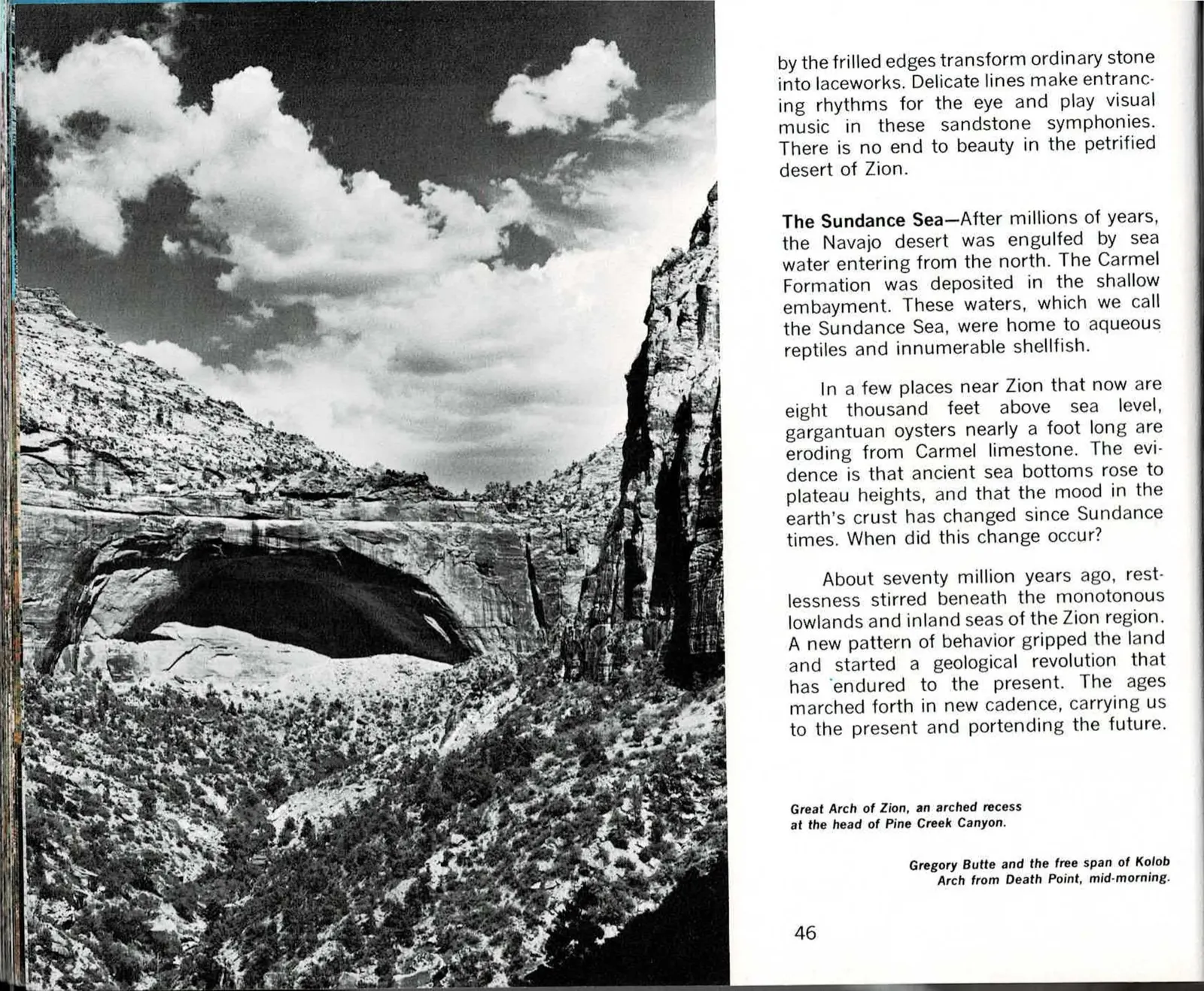
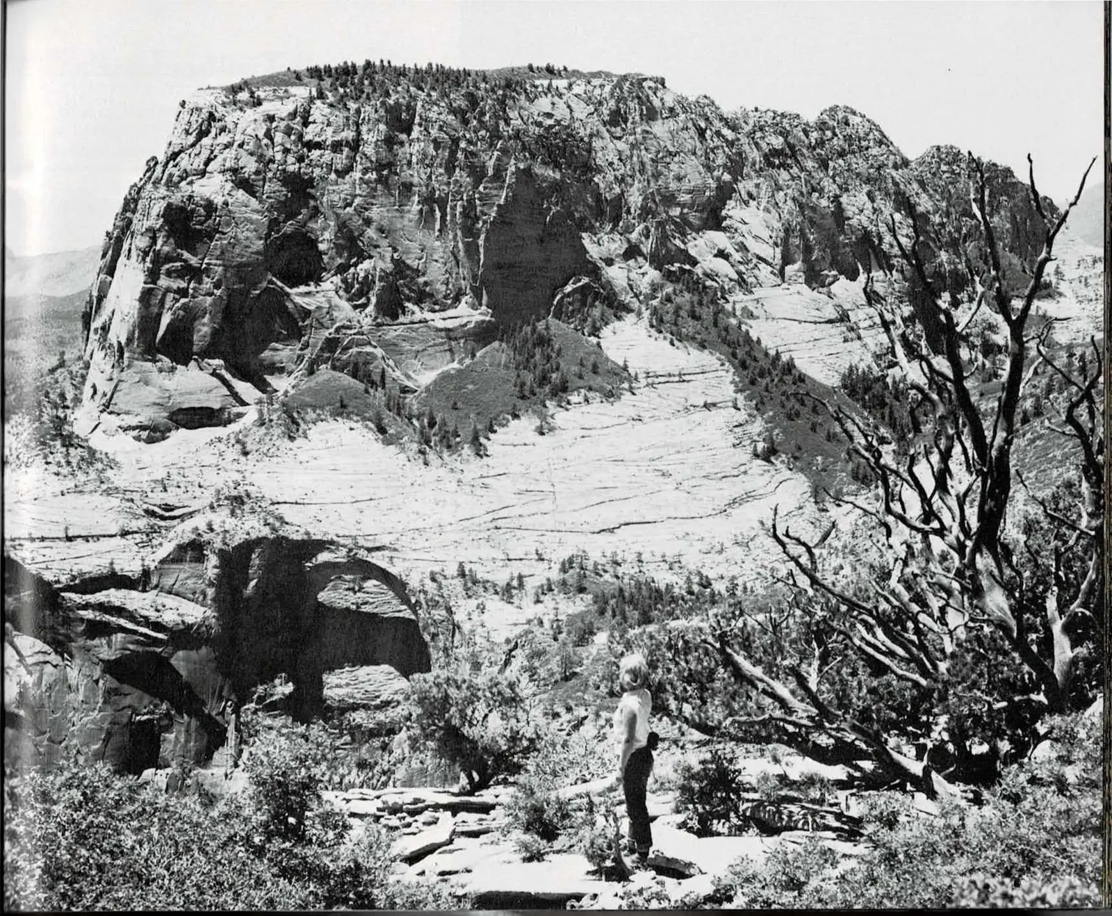
A Sea That Drowned the Dunes
The chapter's final movement reverses everything that came before it: after the Navajo desert had buried the land in sand for millions of years, seawater arrived from the north and buried the desert in turn. The Carmel Formation is what settled out of that shallow inland sea, and Hagood gives it a name of its own, the Sundance Sea, along with the reptiles and shellfish that lived in it.
The evidence he points to is almost startling out of context: oyster shells nearly a foot long, eroding out of limestone at elevations of eight thousand feet, nowhere near any ocean today. That single fact carries the chapter's whole argument. Ground that once sat at sea level now stands high above it, which means the land itself has been lifted, not just carved, since the Sundance Sea receded roughly seventy million years ago.
That lift is where this chapter of This is Zion ends and its second begins. The photographs here, the Great Arch of Zion at the head of Pine Creek Canyon and the free span of Kolob Arch seen from Death Point, are both later, erosional features carved into rock this chapter has just finished explaining. The next chapter turns to the folding and faulting that got that rock moving in the first place.
Read the original book text (pages 46 - 47)
by the frilled edges transform ordinary stone into laceworks. Delicate lines make entrancing rhythms for the eye and play visual music in these sandstone symphonies. There is no end to beauty in the petrified desert of Zion.
The Sundance Sea - After millions of years, the Navajo desert was engulfed by sea water entering from the north. The Carmel Formation was deposited in the shallow embayment. These waters, which we call the Sundance Sea, were home to aqueous reptiles and innumerable shellfish.
In a few places near Zion that now are eight thousand feet above sea level, gargantuan oysters nearly a foot long are eroding from Carmel limestone. The evidence is that ancient sea bottoms rose to plateau heights, and that the mood in the earth's crust has changed since Sundance times. When did this change occur?
About seventy million years ago, restlessness stirred beneath the monotonous lowlands and inland seas of the Zion region. A new pattern of behavior gripped the land and started a geological revolution that has endured to the present. The ages marched forth in new cadence, carrying us to the present and portending the future.
Great Arch of Zion, an arched recess at the head of Pine Creek Canyon.
Gregory Butte and the free span of Kolob Arch from Death Point, mid-morning.
Part Two, Chapter Two - Pages 48 to 53
Zion, A Restless Land
Having named the layers, Hagood sets them moving. This chapter is about deformation: the folding and faulting that tilted and broke the rock blocks, and the joint systems that decide where the canyons will eventually be cut.
Markers in the form (Ref. 5) inside the original-text panels are Hagood's own citations to a numbered reference list. That list is not reproduced anywhere in this scanned edition, so the marker is preserved here for fidelity rather than as a working reference.
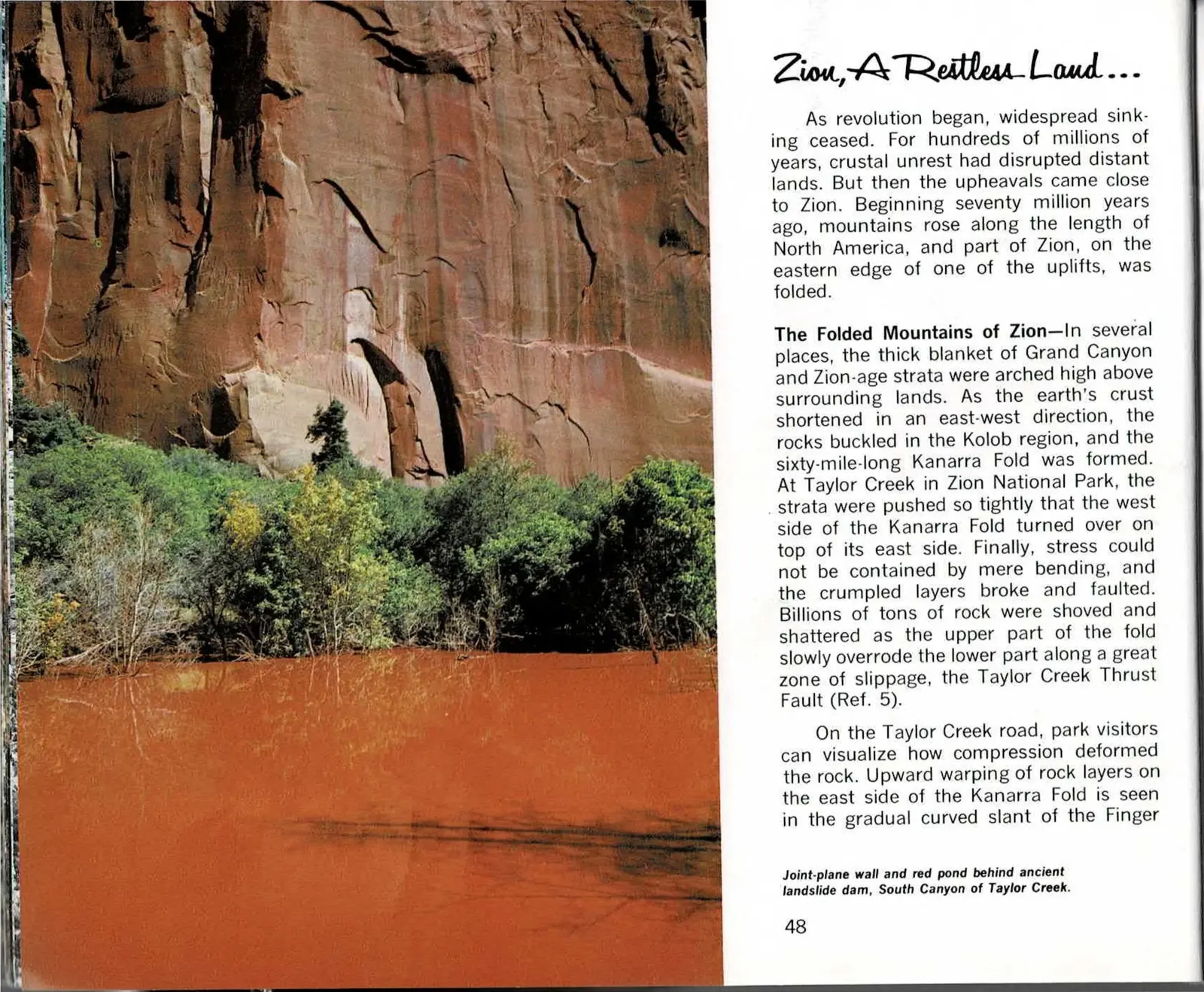
The Mountains That Bent Before They Broke
For most of Zion's deep history the ground simply sank, layer after layer settling into shallow seas and river plains for hundreds of millions of years. That pattern broke about seventy million years ago, when mountain-building finally reached the region and the rock along Zion's eastern edge began to buckle instead of settle. The result, arcing roughly sixty miles through the Kolob country, is what geologists call the Kanarra Fold - a slow, massive crease pressed into stone that had spent ages lying flat.
At Taylor Creek the compression went past a simple bend. The layers were pushed together so forcefully that one side of the fold rode up and over the other along the Taylor Creek Thrust Fault, a slippage zone where billions of tons of rock were shoved and shattered. The warped, tilted layers exposed along that canyon are the visible record of stress the ground could no longer absorb by bending alone.
Folding did not touch all of Zion evenly. Most of the park's rock never moved from where it was laid down; the buckling concentrated in this one uplifted band, and the folded rock has since been worn down by the same erosion at work everywhere else in the park. Read together, the layers that stayed flat and the ones that bent sketch just how restless this stretch of land turned out to be.
Read the original book text (pages 48 - 49)
Zion, A Restless Land . . .
As revolution began, widespread sinking ceased. For hundreds of millions of years, crustal unrest had disrupted distant lands. But then the upheavals came close to Zion. Beginning seventy million years ago, mountains rose along the length of North America, and part of Zion, on the eastern edge of one of the uplifts, was folded.
The Folded Mountains of Zion - In several places, the thick blanket of Grand Canyon and Zion-age strata were arched high above surrounding lands. As the earth's crust shortened in an east-west direction, the rocks buckled in the Kolob region, and the sixty-mile-long Kanarra Fold was formed. At Taylor Creek in Zion National Park, the strata were pushed so tightly that the west side of the Kanarra Fold turned over on top of its east side. Finally, stress could not be contained by mere bending, and the crumpled layers broke and faulted. Billions of tons of rock were shoved and shattered as the upper part of the fold slowly overrode the lower part along a great zone of slippage, the Taylor Creek Thrust Fault (Ref. 5).
On the Taylor Creek road, park visitors can visualize how compression deformed the rock. Upward warping of rock layers on the east side of the Kanarra Fold is seen in the gradual curved slant of the Finger
Joint-plane wall and red pond behind ancient landslide dam, South Canyon of Taylor Creek.
Canyon buttes (photo, page 12). Of course, these rocky points were not cut by erosion until relatively recent geologic times, but they do owe part of their bold prominence to the folding.
In most of Zion, the sedimentary layers were not disturbed, and they remained flat-lying. However, compression in the earth's crust did effect the rock layer cake in regions beyond Zion to the east where several isolated mountain ranges were up-folded.
In a broad sense, geological revolution had come to Zion. The vast lowlands had been broken by folding, and the region became less submissive to the slow, widespread sinking of earlier eras.
Erosion of the Folded Mountains - As deformation slackened, the rate of erosion exceeded the rate of mountain building, and the highlands were worn down. Gravel and sand washed into valleys and onto the remaining lowlands. Because clear paths to the ocean were blocked, fresh water lakes and streams occupied the low areas, and the basins filled with layers of ooze and rocky fragments. Again, Zion became a land of lakes and streams. It was an irregular basinland compared to the vast sinking areas that earlier had been filled with Grand Canyon and Zion layers, but nevertheless the regime of deposition had returned.
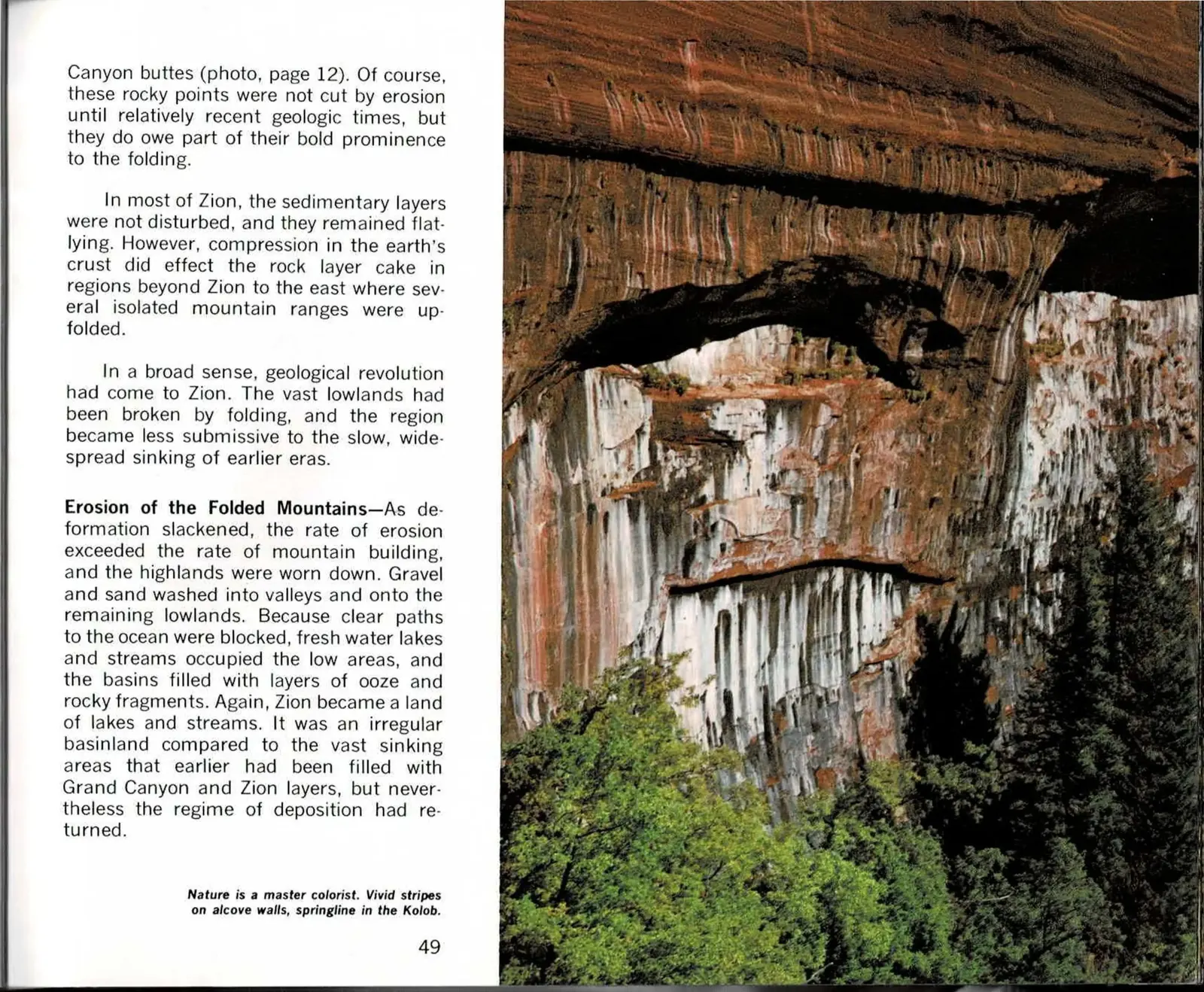
Nature is a master colorist. Vivid stripes on alcove walls, springline in the Kolob.
A Pink Frosting, Then the Land Cracked
The layer cake of rock beneath Zion wasn't finished with the folding described on the facing page. Not long after those mountains buckled, volcanic activity added one more layer on top: gas-charged magma rose from deep in the crust and erupted in searing, fast-moving clouds of ash and pumice that swept across the land, eventually cooling into the pink-hued rock now exposed at Cedar Breaks and Bryce Canyon. Later eruptions in the Zion area itself were calmer, leaving behind cinder cones and dark lava flows rather than the earlier violent ash flows.
Around the same time, in geologic terms, the whole region began to rise. The Colorado Plateau lifted broadly and gently, keeping most of its rock layers flat, but Zion's own ground broke instead into large blocks along a handful of north-south faults - the Sevier Fault along the plateau's east side, the Hurricane Fault along its west. Zion Canyon itself is carved into just one of these blocks, the roughly thirty-by-hundred-mile Markagunt Plateau.
That block-faulted uplift is the coarse-grained fracturing. On a finer scale, the same stress left the rock crossed with joints - the thin, closely spaced cracks pictured on the facing page, where the two sides of the fracture never actually slid past each other. Those joints, more than the region's larger faults, are what later gave water an easy path into the stone.
Read the original book text (pages 50 - 51)
Today, the hardened ooze and the debris eroded from the folded mountains are seen in the colorful walls of Cedar Breaks and Bryce Canyon. The gritty rocks are called the "Pink Cliffs formation". They form the top sedimentary rock layers in southwestern Utah.
Grand Canyon, Zion and Cedar Breaks-age formations have been broadly compared to a three-layer cake. The analogy could be narrowed by saying that the baker was careless and distorted his cake before setting the pink layer on top. The Grand Canyon and Zion-age layers were broken by widespread folding before the Pink Cliffs layers were plastered unevenly across the top.
But the Pink Cliffs formation was not the final touch on the geological layer cake...
Fire Frosts the Cake - Like other cakes, the "plateau pastry" has frosting. On top of the Cedar Breaks layer is a glaze spread in part by hot gas. Even before the Pink Cliffs lakes had dried up, volcanic fires spewed out, heralding a new crescendo of the underground restlessness that started with the folding of the Grand Canyon and Zion-age layers.
Gas-rich magma rose from great depths and spilled onto the land. As molten rock frothed out, water in the magma, suddenly relieved of subterranean pressure, became explosive steam. This vapor shattered the foaming lava and carried white-hot splinters over hundreds of square miles. Burning clouds of ash swept along the ground at velocities of perhaps a hundred miles an hour. All animals in the way must have perished in a twinkling with little more to note their passing than astonished squeals and flashes of flame. The hard, glassy rock on Brian Head Mountain, near Cedar Breaks, was formed by fiery compaction of the shattered volcanic foam.
Glowing clouds were erupted often through long ages, but with passing time, the volcanoes changed in character.
Later eruptions of the Zion region were less violent than the incandescent holocausts that poured over the Cedar Breaks area some thirty million years ago. The recent eruptions left cinder cones such as Crater Hill and Firepit Knoll as well as the black lavas near Navajo Lake. This younger generation of volcanic rock contained less explosive vapor than the older lava, and it is different chemically too.
These changes in the lavas have accompanied the newer types of movement in the earth's crust. Rocks in the Zion area broke into great plateau blocks. And in geologically recent times, there is uplifting of the region which is only part of the prodigious rearing of the backbone of the Americas.
Creation of Plateaus - Why were the rocks of Zion elevated? The causes of uplift are not well known because our tools of scientific inquiry into the nature of the deep crust are very limited. We have only theories.
Although the causes of uplift are speculative, the surface effects are quite evident. In recent epochs, the Colorado Plateau has risen widely and gently, and most of its rock layers have remained horizontal. The Zion region has uplifted with little more disturbance than fracturing into large blocks along a few north-south faults. Zion Canyon is carved in the Markagunt Plateau block which is about thirty miles across and a hundred miles long (map, page 3). The Sevier Fault parallels the east side of the plateau, and the west side of the plateau is formed by the Hurricane Fault.
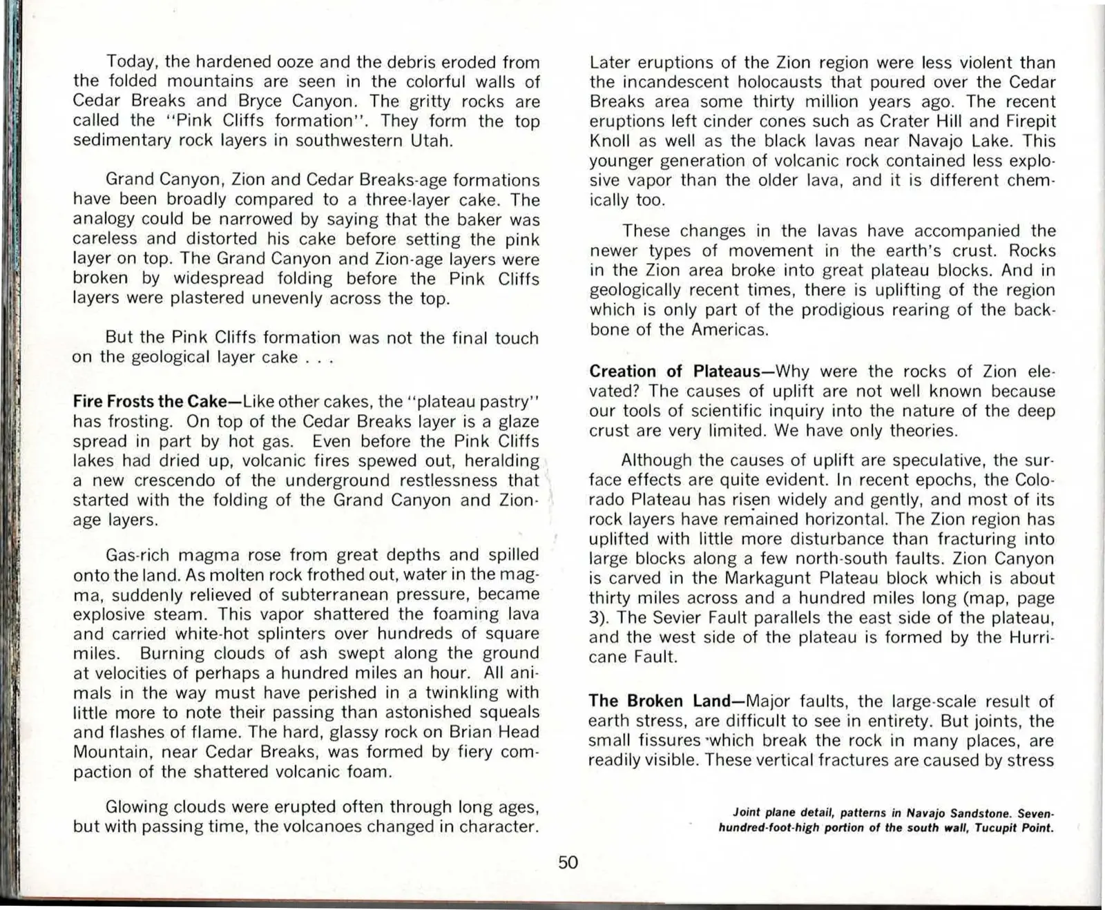
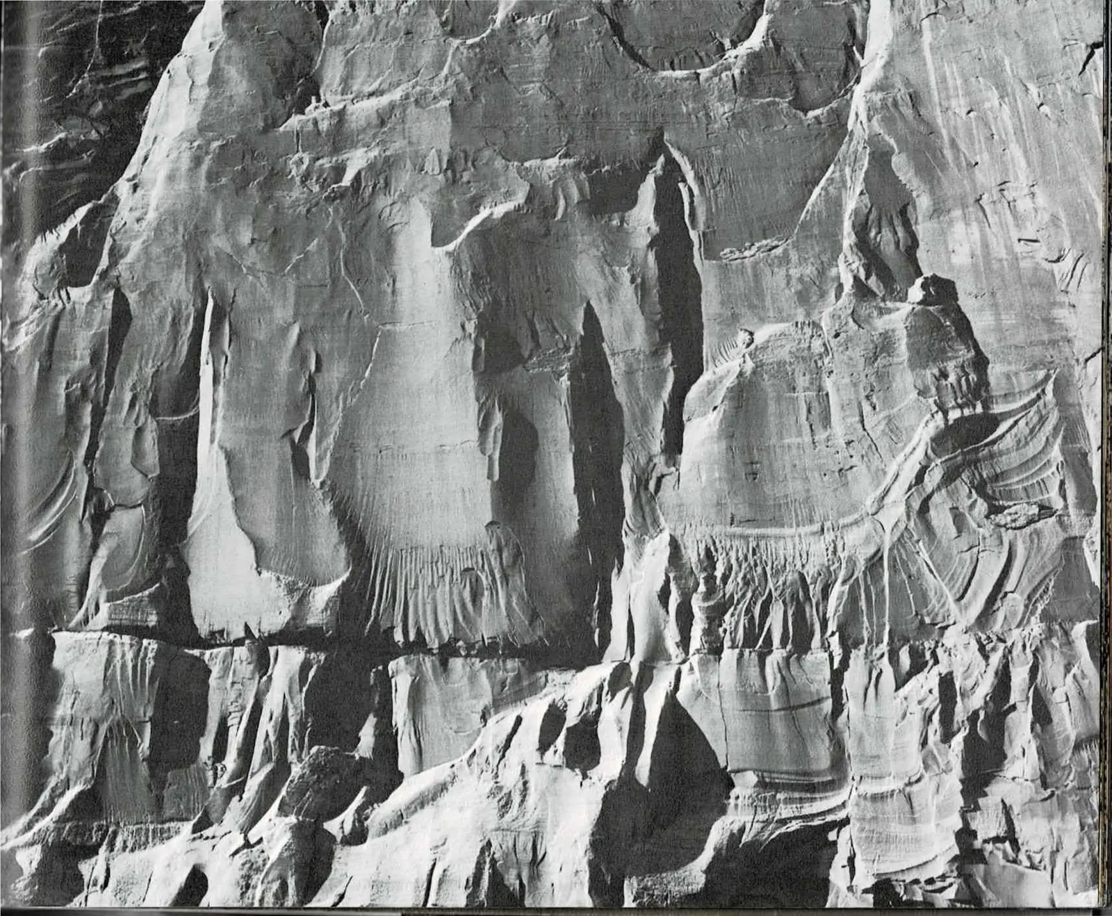
Joint plane detail, patterns in Navajo Sandstone. Seven-hundred-foot-high portion of the south wall, Tucupit Point.
The Broken Land - Major faults, the large-scale result of earth stress, are difficult to see in entirety. But joints, the small fissures which break the rock in many places, are readily visible. These vertical fractures are caused by stress
[No printed text on page 51 - a full-bleed photograph; its caption is the "Joint plane detail" line above, printed on page 50.]
The Cracks That Carve Zion's Canyons
Zion's cliffs aren't solid stone all the way through - they're crossed by joints, thin vertical cracks in the rock that formed long before any canyon existed. Where those joints run through Navajo Sandstone, water finds a shortcut. Rain and snowmelt follow the fractures down into the rock, dissolving the mineral cement that holds the grains together and loosening the land from the inside out. Given enough time, that quiet chemistry does as much shaping as the visible flow of any stream.
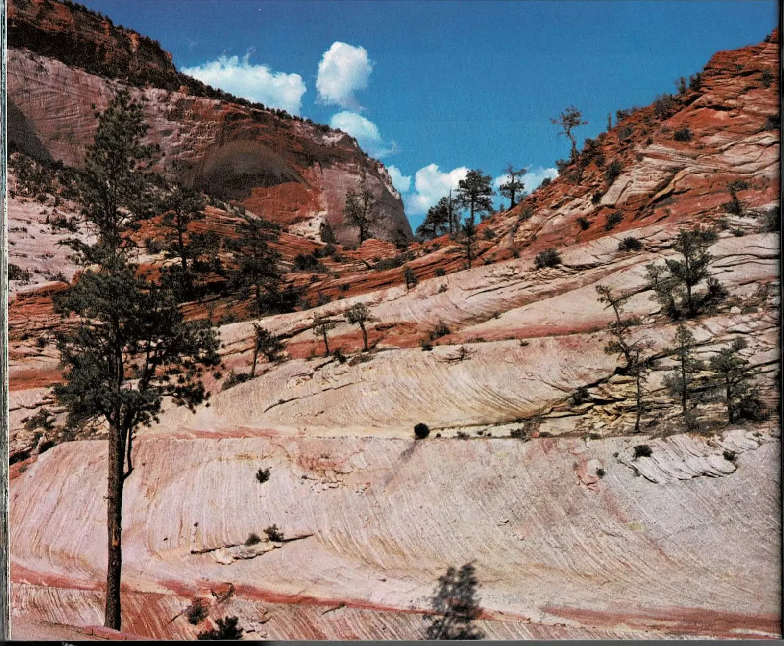
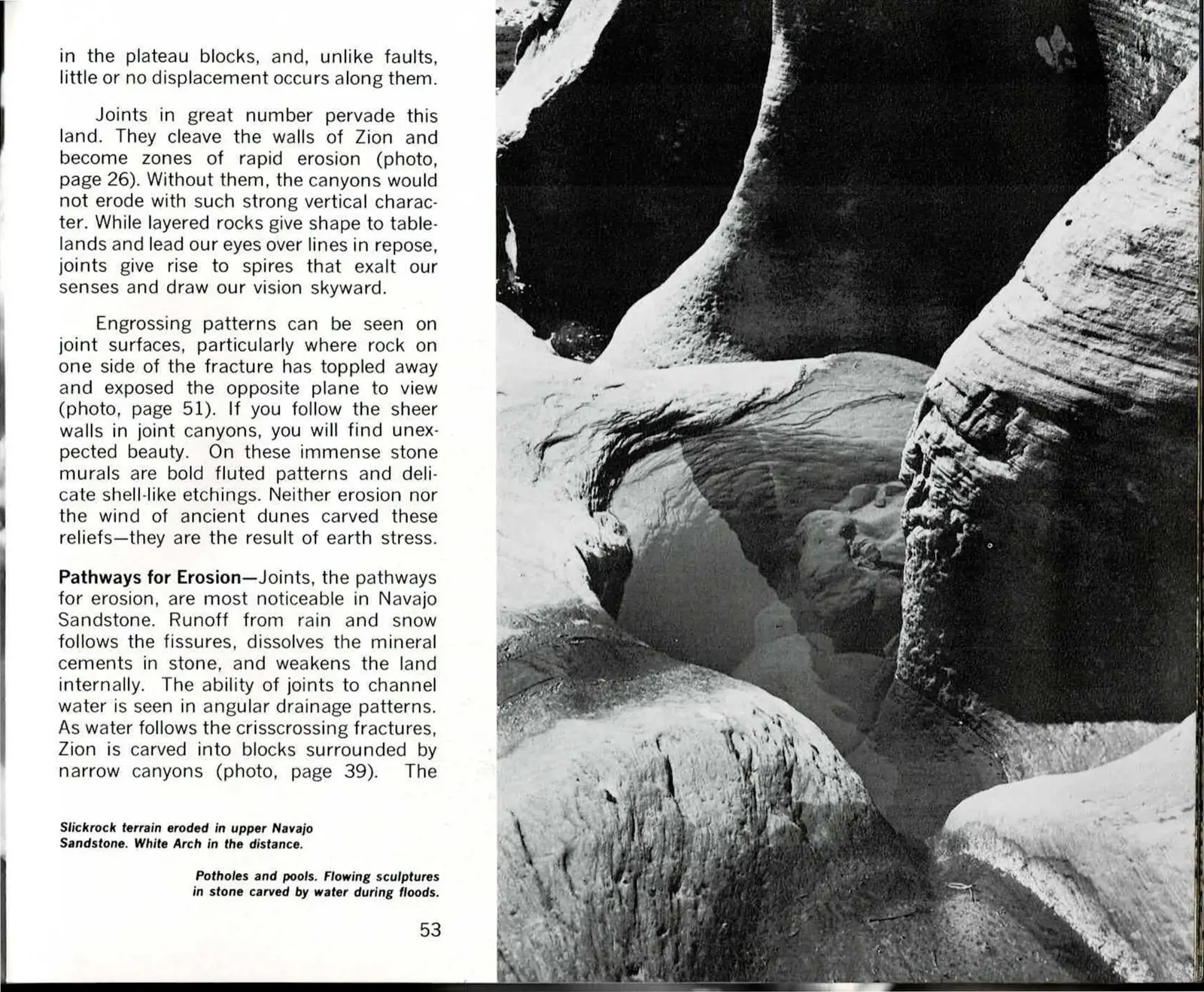
The slickrock terrain pictured here, sanded pale and swept into long curving lines, sits below White Arch and shows the pattern at a landscape scale: joints running in crisscrossing sets, carving Zion into blocks separated by narrow canyons rather than one continuous cliff. It's the same fracture pattern that governs where canyons form throughout the park, just visible here in the open instead of hidden underground.
Closer to the ground, the same water carves in miniature. Flash floods send sheets of runoff across bare rock, and wherever a joint or a soft spot slows the flow, it grinds out a pothole - a smooth stone basin that fills and empties with each storm. Chained together, these pools and hollows read like sculpture, though nothing carved them but water moving fast enough, often enough, over the fissured stone.
Read the original book text (pages 52 - 53)
Slickrock terrain eroded in upper Navajo Sandstone. White Arch in the distance.
in the plateau blocks, and, unlike faults, little or no displacement occurs along them.
Joints in great number pervade this land. They cleave the walls of Zion and become zones of rapid erosion (photo, page 26). Without them, the canyons would not erode with such strong vertical character. While layered rocks give shape to tablelands and lead our eyes over lines in repose, joints give rise to spires that exalt our senses and draw our vision skyward.
Engrossing patterns can be seen on joint surfaces, particularly where rock on one side of the fracture has toppled away and exposed the opposite plane to view (photo, page 51). If you follow the sheer walls in joint canyons, you will find unexpected beauty. On these immense stone murals are bold fluted patterns and delicate shell-like etchings. Neither erosion nor the wind of ancient dunes carved these reliefs - they are the result of earth stress.
Pathways for Erosion - Joints, the pathways for erosion, are most noticeable in Navajo Sandstone. Runoff from rain and snow follows the fissures, dissolves the mineral cements in stone, and weakens the land internally. The ability of joints to channel water is seen in angular drainage patterns. As water follows the crisscrossing fractures, Zion is carved into blocks surrounded by narrow canyons (photo, page 39). The
Potholes and pools. Flowing sculptures in stone carved by water during floods.
Part Two, Chapter Three - Pages 54 to 69
Erosion Destroys the Land
Chapters One and Two named the rock and set it moving. This chapter turns to the force that actually shapes what a visitor sees: erosion, working through the Virgin River, through joints and faults, through ice and gravity, wearing the uplifted block back down toward the sea.
The original text in this chapter's panels includes the book's own internal photo cross-references, in the form (photo, page 27), pointing to other pages of the printed book, as well as one marker in the form (Ref.3), which is Hagood's own citation to a numbered reference list. That list is not reproduced anywhere in this scanned edition, so the markers are reproduced here exactly as printed, for fidelity rather than as working references, and are not links within this edition.
A Movie Eight Minutes Long
Chapter Three opens with a thought experiment: speed up a million years of Zion into an eight-minute film, one frame for every century, and watch what happens. Hagood's answer is that the canyon we call permanent would prove anything but - streams and joints eating into the plateau like fungus through a rotting stump, storms slowly ushering the land toward the sea. The rock only reads as stable because a human lifetime is far too short to catch the motion.
That instability is the same joint-driven collapse the previous chapter traced in cross section, now shown at the scale of a whole canyon wall. Where earlier chapters found faults and joints and the pink volcanic frosting stacked one atop another, this chapter follows what happens next: water finds every crack, decomposing the sandstone from the surface in and working outward from within wherever it can circulate.
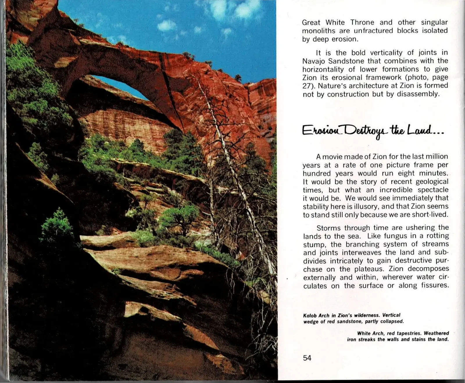
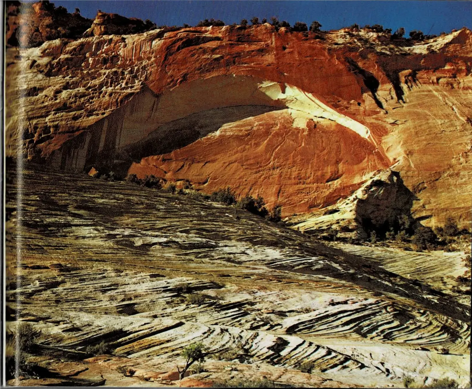
The two arches pictured here are erosion caught mid-collapse rather than finished landmarks. Kolob Arch, deep in Zion's back country, is a wedge of red sandstone that has already partly given way. White Arch, on the facing page, shows the same process closer to the surface - iron-rich water bleeding down through the rock and staining the wall in dark, rust-red streaks.
Read the original book text (pages 54 - 55)
Great White Throne and other singular monoliths are unfractured blocks isolated by deep erosion.
It is the bold verticality of joints in Navajo Sandstone that combines with the horizontality of lower formations to give Zion its erosional framework (photo, page 27). Nature's architecture at Zion is formed not by construction but by disassembly.
Erosion Destroys the Land . . .
A movie made of Zion for the last million years, at a rate of one picture frame per hundred years would run eight minutes. It would be the story of recent geological times, but what an incredible spectacle it would be. We would see immediately that stability here is illusory, and that Zion seems to stand still only because we are short-lived.
Storms through time are ushering the lands to the sea. Like fungus in a rotting stump, the branching system of streams and joints interweaves the land and subdivides intricately to gain destructive purchase on the plateaus. Zion decomposes externally and within, wherever water circulates on the surface or along fissures.
Kolob Arch in Zion's wilderness. Vertical wedge of red sandstone, partly collapsed.
White Arch, red tapestries. Weathered iron streaks the walls and stains the land.
[No printed text on page 55 - a full-bleed photograph; its caption, "White Arch, red tapestries. Weathered iron streaks the walls and stains the land," is printed on page 54.]
How the Virgin River Carved Its Canyon
Zion Canyon is the record of a single relationship: an ancestral Virgin River meandering across a nearly flat landscape, and then a slow uplift that gave the river somewhere to cut. As the Markagunt Plateau rose beneath it, roughly ten million years ago, the river turned erosive, stripping back the layered rock one bed at a time and exposing each formation according to its own hardness and character.
The result is a canyon that looks different depending on where you stand in it. Downstream, the wide lower canyon is stair-stepped, its softer beds worn back into long benches beneath cliffs of harder rock. Upstream, the canyon narrows sharply where the river runs entirely within Navajo Sandstone - there is no soft layer left to widen the valley, so the river can only cut straight down.
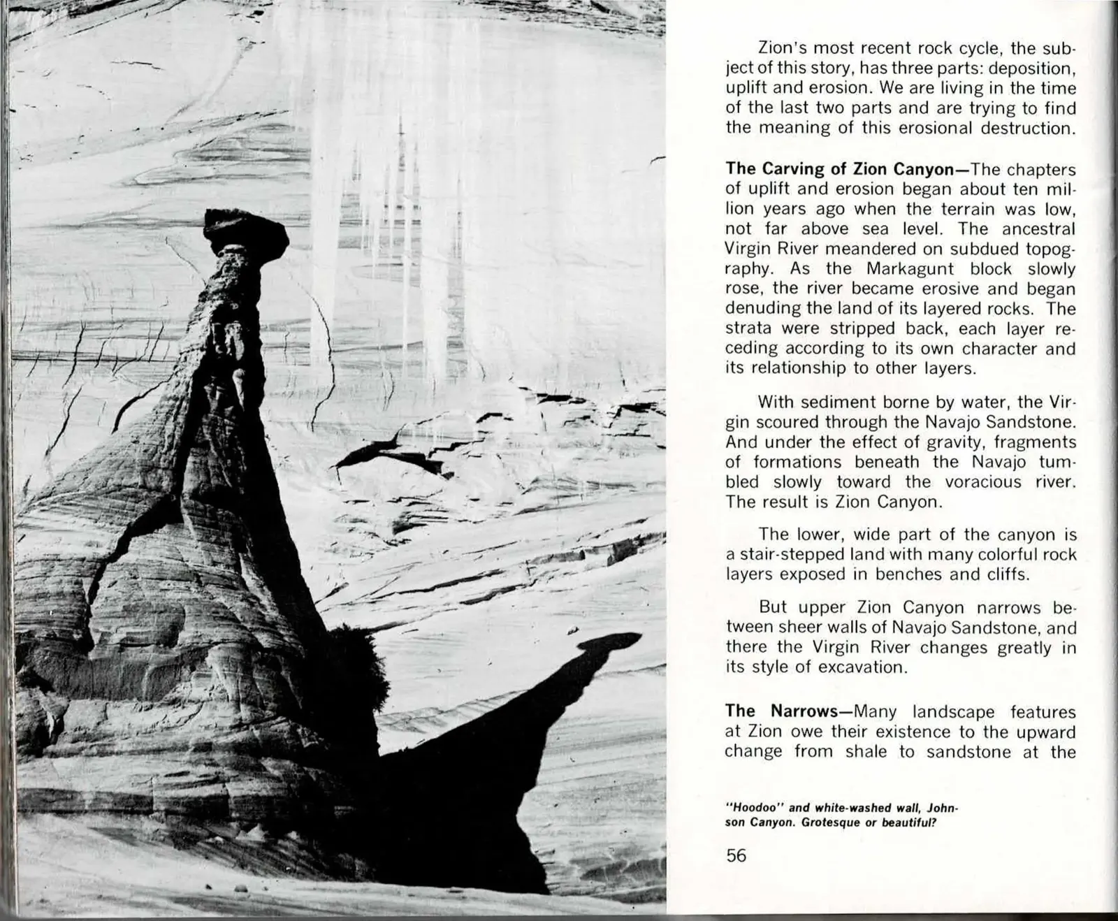
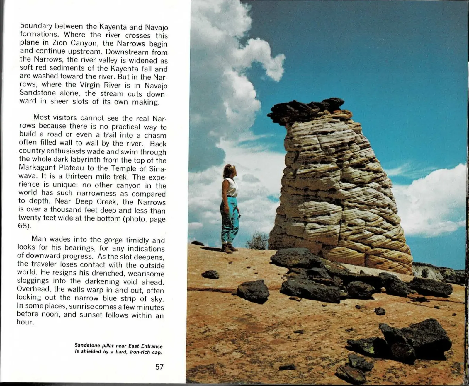
The hoodoo and the sandstone pillar pictured here are that same principle in miniature. Wherever a hard, iron-cemented cap protects the softer rock beneath it, the surrounding stone erodes away first, leaving an isolated column standing while everything around it disappears.
Read the original book text (pages 56 - 57)
Zion's most recent rock cycle, the subject of this story, has three parts: deposition, uplift and erosion. We are living in the time of the last two parts and are trying to find the meaning of this erosional destruction.
The Carving of Zion Canyon - The chapters of uplift and erosion began about ten million years ago when the terrain was low, not far above sea level. The ancestral Virgin River meandered on subdued topography. As the Markagunt block slowly rose, the river became erosive and began denuding the land of its layered rocks. The strata were stripped back, each layer receding according to its own character and its relationship to other layers.
With sediment borne by water, the Virgin scoured through the Navajo Sandstone. And under the effect of gravity, fragments of formations tumbled slowly toward the voracious river. The result is Zion Canyon.
The lower, wide part of the canyon is a stair-stepped land with many colorful rock layers exposed in benches and cliffs.
But upper Zion Canyon narrows between sheer walls of Navajo Sandstone, and there the Virgin River changes greatly in its style of excavation.
The Narrows - Many landscape features at Zion owe their existence to the upward change from shale to sandstone at the
"Hoodoo" and white-washed wall, Johnson Canyon. Grotesque or beautiful?
boundary between the Kayenta and Navajo formations. Where the river crosses this plane in Zion Canyon, the Narrows begin and continue upstream. Downstream from the Narrows, the river valley is widened as soft red sediments of the Kayenta fall and are washed toward the river. But in the Narrows, where the Virgin River is in Navajo Sandstone alone, the stream cuts downward in sheer slots of its own making.
Most visitors cannot see the real Narrows because there is no practical way to build a road or even a trail into a chasm often filled wall to wall by the river. Back country enthusiasts wade and swim through the whole dark labyrinth from the top of the Markagunt Plateau to the Temple of Sinawava. It is a thirteen mile trek. The experience is unique; no other canyon in the world has such narrowness as compared to depth. Near Deep Creek, the Narrows is over a thousand feet deep and less than twenty feet wide at the bottom (photo, page 68).
Man wades into the gorge timidly and looks for his bearings, for any indications of downward progress. As the slot deepens, the traveler loses contact with the outside world. He resigns his drenched, wearisome sloggings into the darkening void ahead. Overhead, the walls warp in and out, often locking out the narrow blue strip of sky. In some places, sunrise comes a few minutes before noon, and sunset follows within an hour.
Sandstone pillar near East Entrance is shielded by a hard, iron-rich cap.
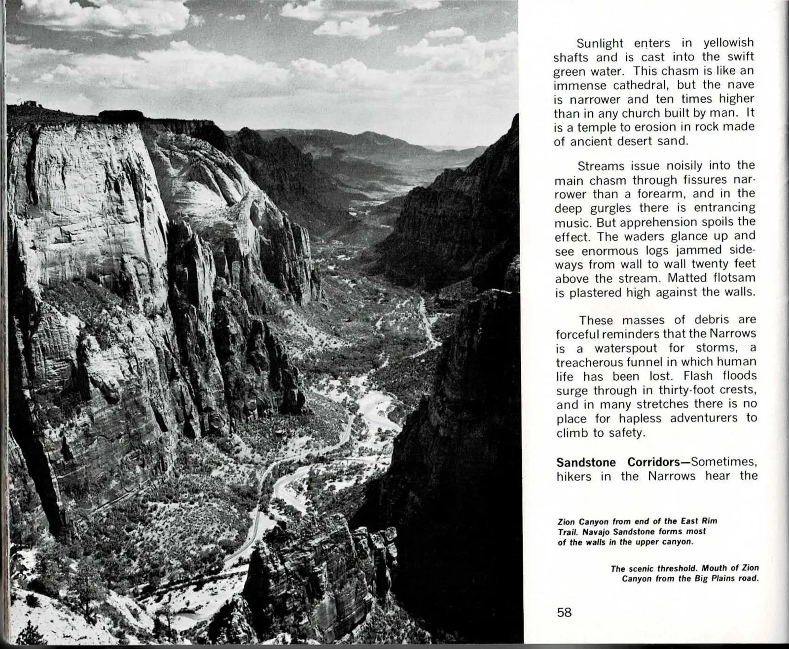
A Cathedral You Wade Into
Deep in the Narrows, sunlight falls in narrow yellow shafts onto swift green water, and the comparison Hagood reaches for is architectural: a cathedral nave, but narrower and ten times higher than anything built by hand - a space carved not from ambition but from ancient desert sand slowly giving way to a persistent river.
The same water that makes the Narrows beautiful also makes it dangerous. Storms send flash floods roaring through in crests thirty feet high, and the evidence lingers afterward: whole logs wedged sideways twenty feet above the normal waterline, debris plastered against walls that offer no ledge to climb to safety. The chasm that looks otherworldly on a calm day is, by design, a drain for the entire watershed above it.
From there the chapter turns from the vertical slot of the Narrows to a different kind of erosion entirely - the rounded, sculpted "corridors" where floodwater has spent centuries grinding smooth potholes and undulating crossbedded walls into the same Navajo Sandstone, a subject the next pages take up in the canyon's open stretches.
Read the original book text (pages 58 - 59)
Sunlight enters in yellowish shafts and is cast into the swift green water. This chasm is like an immense cathedral, but the nave is narrower and ten times higher than in any church built by man. It is a temple to erosion in rock made of ancient desert sand.
Streams issue noisily into the main chasm through fissures narrower than a forearm, and in the deep gurgles there is entrancing music. But apprehension spoils the effect. The waders glance up and see enormous logs jammed sideways from wall to wall twenty feet above the stream. Matted flotsam is plastered high against the walls.
These masses of debris are forceful reminders that the Narrows is a waterspout for storms, a treacherous funnel in which human life has been lost. Flash floods surge through in thirty-foot crests, and in many stretches there is no place for hapless adventurers to climb to safety.
Sandstone Corridors - Sometimes, hikers in the Narrows hear the
Zion Canyon from end of the East Rim Trail. Navajo Sandstone forms most of the walls in the upper canyon.
The scenic threshold. Mouth of Zion Canyon from the Big Plains road.
[No printed text on page 59 - a full-bleed photograph, uncaptioned.]
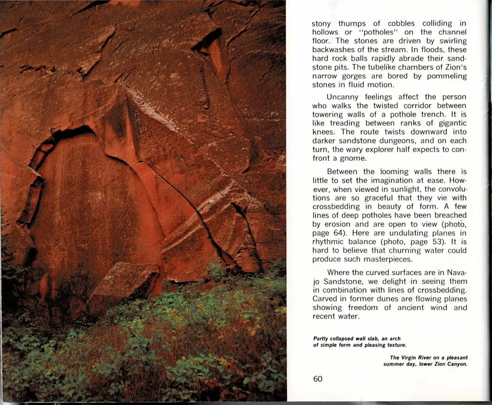
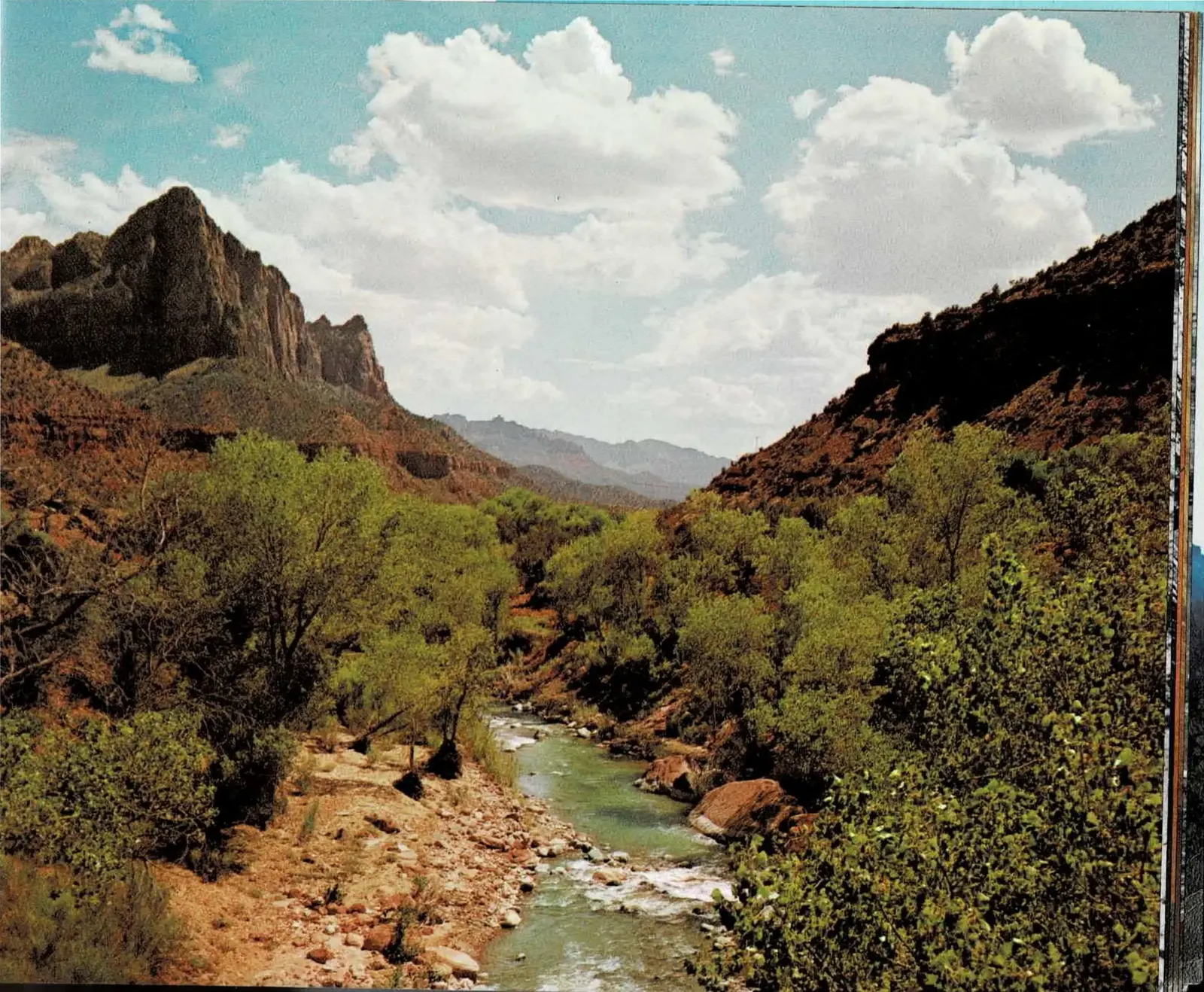
The Sound of Stones Grinding Stone
A pothole starts with a single trapped cobble. Floodwater spins the stone inside a hollow in the channel floor, and over years the stone grinds a smooth pit into the sandstone around it - then grinds it deeper, and wider, until chains of these pits bore tube-like chambers through the rock. It is a slow, mechanical process, but the results read as anything but mechanical.
Walking a pothole trench that has been fully carved feels less like hiking and more like descending into architecture built by something other than a person. The walls twist downward between towering, rounded forms that Hagood likened to a giant's knees, narrowing and darkening with every turn until the light from above is a memory.
Where erosion has breached the outer wall of a pothole chain, the interior opens to view, and what's inside is the same story told at a different scale: the undulating, crossbedded planes of ancient sand dunes, now fixed in stone and polished by the same churning water that shaped the Virgin River valley pictured on the facing page.
Read the original book text (pages 60 - 61)
stony thumps of cobbles colliding in hollows or "potholes" on the channel floor. In floods, these stones are driven by swirling backwashes of the stream. Hard rock balls rapidly abrade their sandstone pits. The tubelike chambers of Zion's narrow gorges are bored by pommeling stones in fluid motion.
Uncanny feelings affect the person who walks the twisted corridor between towering walls of a pothole trench. It is like treading between ranks of gigantic knees. The route twists downward into darker sandstone dungeons, and on each turn, the wary explorer half expects to confront a gnome.
Between the looming walls there is little to set the imagination at ease. However, when viewed in sunlight, the convolutions are so graceful that they vie with crossbedding in beauty of form. A few lines of deep potholes have been breached by erosion and are open to view (photo, page 64). Here are undulating planes in rhythmic balance (photo, page 53). It is hard to believe that churning water could produce such masterpieces.
Where the curved surfaces are in Navajo Sandstone, we delight in seeing them in combination with lines of crossbedding. Carved in former dunes are flowing planes showing freedom of ancient wind and recent water.
Partly collapsed wall slab, an arch of simple form and pleasing texture.
The Virgin River on a pleasant summer day, lower Zion Canyon.
[No printed text on page 61 - a full-bleed photograph, uncaptioned.]
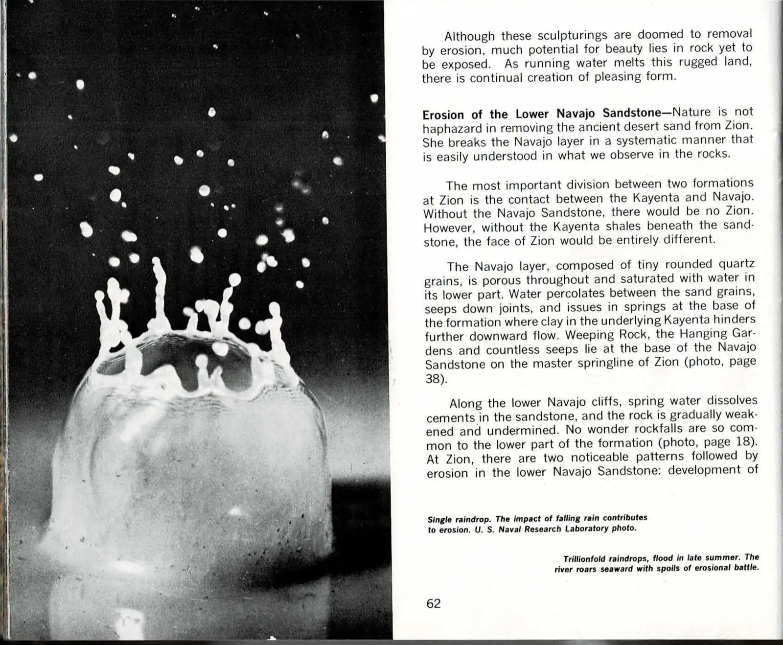
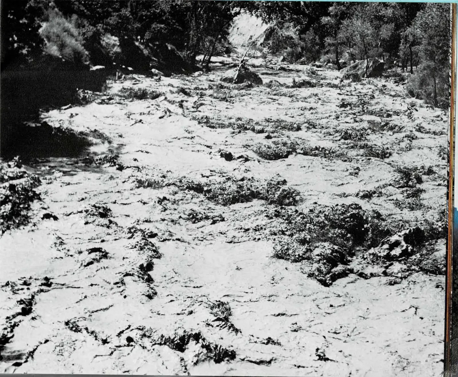
One Raindrop, Then a Flood
Hagood opens this section of the chapter with the smallest possible unit of erosion: a single drop of rain, caught mid-splash by a U.S. Naval Research Laboratory camera fast enough to freeze its crown of droplets. Paired against it, filling the facing page, is where that raindrop's work eventually arrives - a flash flood scouring through a wooded streambed, carrying rock, mud, and debris seaward. Between the two photographs is the entire argument of the chapter: erosion is not one dramatic event but an accumulation of trillions of impacts too small to notice individually.
The text turns next to the mechanics of that accumulation, and specifically to the boundary between the Kayenta and Navajo formations - the single most consequential contact line in the park's geology. The Navajo Sandstone's porous, rounded quartz grains hold water like a sponge until they meet the Kayenta shale beneath, which stops the water's downward path and forces it sideways, out through the rock face as springs. Weeping Rock and the Hanging Gardens are both products of that same springline, water finding the one place it can still go.
Where that spring water seeps out, it also dissolves the cement holding the sandstone together, gradually undermining the lower cliffs from within. Hagood's point is that rockfalls at Zion are not random accidents but a predictable consequence of this plumbing - wherever the springline runs, the rock above is quietly being weakened, one drop at a time.
Read the original book text (pages 62 - 63)
Although these sculpturings are doomed to removal by erosion, much potential for beauty lies in rock yet to be exposed. As running water melts this rugged land, there is continual creation of pleasing form.
Erosion of the Lower Navajo Sandstone - Nature is not haphazard in removing the ancient desert sand from Zion. She breaks the Navajo layer in a systematic manner that is easily understood in what we observe in the rocks.
The most important division between two formations at Zion is the contact between the Kayenta and Navajo. Without the Navajo Sandstone, there would be no Zion. However, without the Kayenta shales beneath the sandstone, the face of Zion would be entirely different.
The Navajo layer, composed of tiny rounded quartz grains, is porous throughout and saturated with water in its lower part. Water percolates between the sand grains, seeps down joints, and issues in springs at the base of the formation where clay in the underlying Kayenta hinders further downward flow. Weeping Rock, the Hanging Gardens and countless seeps lie at the base of the Navajo Sandstone on the master springline of Zion (photo, page 38).
Along the lower Navajo cliffs, spring water dissolves cements in the sandstone, and the rock is gradually weakened and undermined. No wonder rockfalls are so common to the lower part of the formation (photo, page 18). At Zion, there are two noticeable patterns followed by erosion in the lower Navajo Sandstone: development of
Single raindrop. The impact of falling rain contributes to erosion. U. S. Naval Research Laboratory photo.
Trillionfold raindrops, flood in late summer. The river roars seaward with spoils of erosional battle.
[No printed text on page 63 - a full-bleed photograph, uncaptioned.]
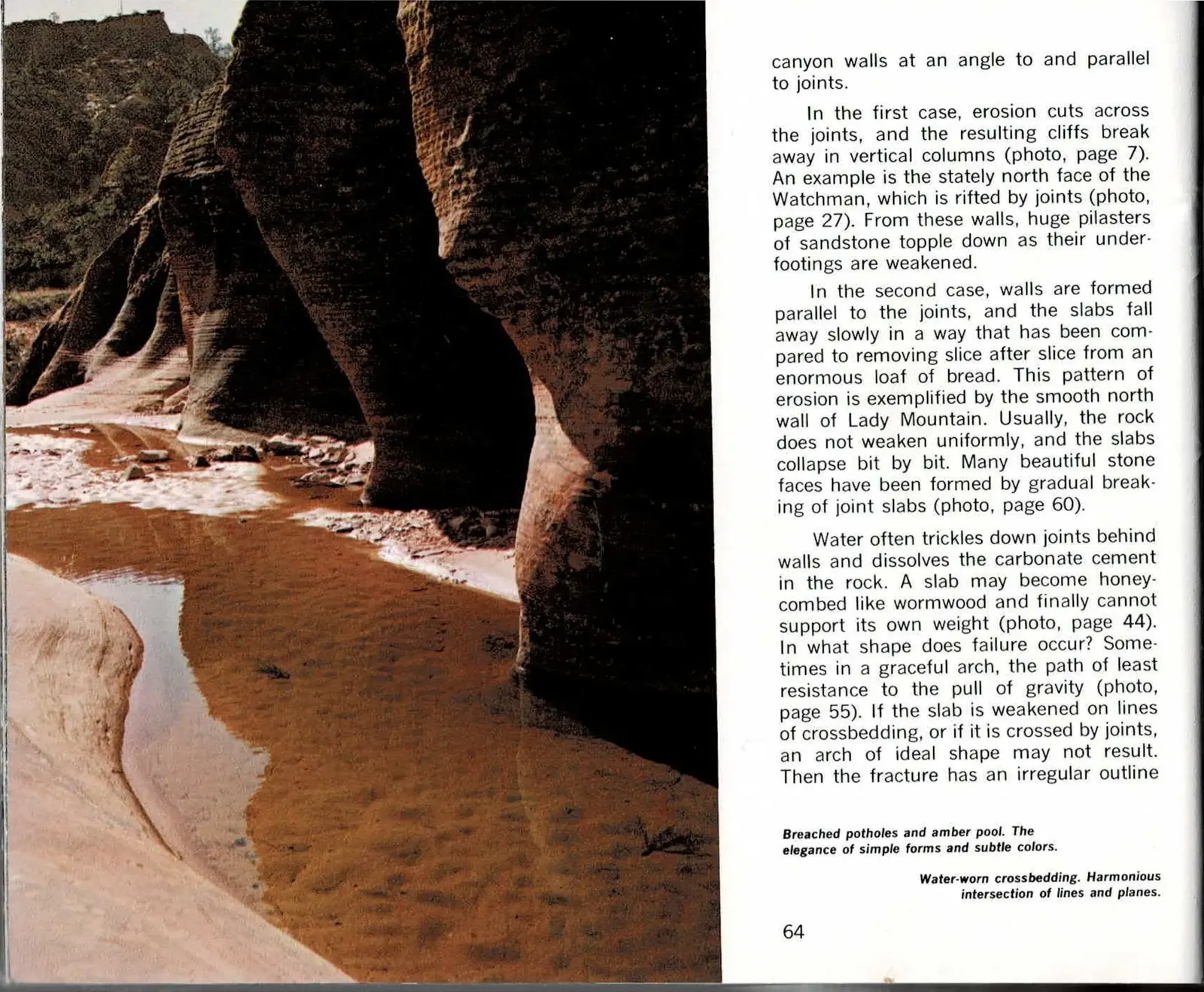
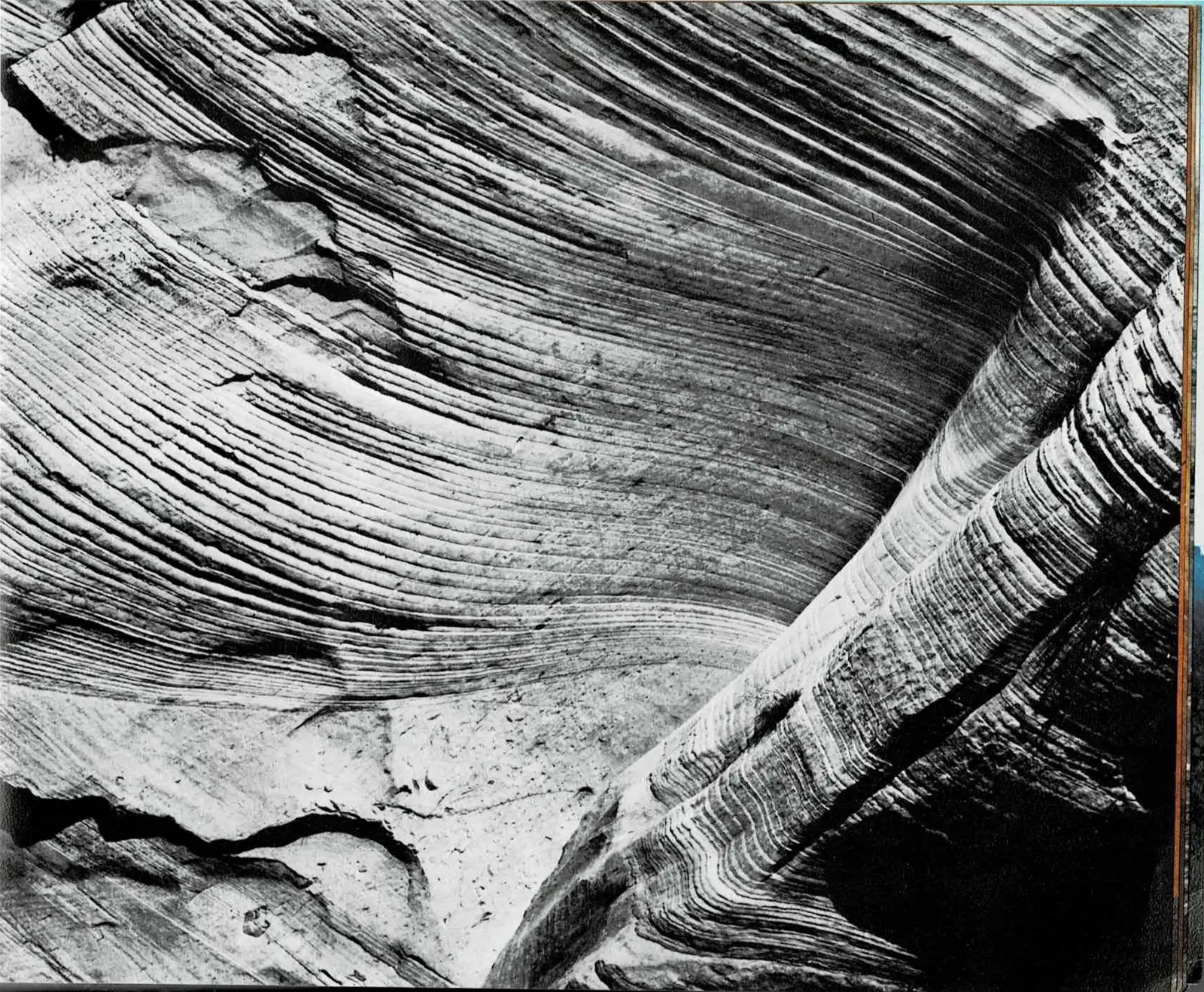
Two Ways a Wall Can Fail
Zion's cliffs break apart in exactly two patterns, and once you know to look for them, both are visible on every cliff face in the park. Where erosion cuts across the vertical joints in Navajo Sandstone, the rock breaks away in tall, freestanding columns and pilasters - the pattern behind the Watchman's rifted north face. Where the walls form parallel to the joints instead, whole slabs peel away slowly, layer after layer, in what Hagood compared to slicing an enormous loaf of bread.
Either way, the mechanism underneath is the same water chemistry described on the facing pages: moisture trickling down behind a wall dissolves the carbonate cement holding the sandstone's quartz grains together, until a slab honeycombs out and can no longer support its own weight. When that failure happens along a curve rather than a flat plane, the result is an arch - not by design, but because a curved fracture is the shape that offers gravity the least resistance.
The two facing photographs make the same point at a smaller scale: a breached pothole chain opening into an amber pool, and a sweep of crossbedded sandstone worn smooth by water. Both are the visible aftermath of joints and crossbedding lines acting as the rock's built-in fault lines, the places erosion always finds first.
Read the original book text (pages 64 - 65)
canyon walls at an angle to and parallel to joints.
In the first case, erosion cuts across the joints, and the resulting cliffs break away in vertical columns (photo, page 7). An example is the stately north face of the Watchman, which is rifted by joints (photo, page 27). From these walls, huge pilasters of sandstone topple down as their underfootings are weakened.
In the second case, walls are formed parallel to the joints, and the slabs fall away slowly in a way that has been compared to removing slice after slice from an enormous loaf of bread. This pattern of erosion is exemplified by the smooth north wall of Lady Mountain. Usually, the rock does not weaken uniformly, and the slabs collapse bit by bit. Many beautiful stone faces have been formed by gradual breaking of joint slabs (photo, page 60).
Water often trickles down joints behind walls and dissolves the carbonate cement in the rock. A slab may become honeycombed like wormwood and finally cannot support its own weight (photo, page 44). In what shape does failure occur? Sometimes in a graceful arch, the path of least resistance to the pull of gravity (photo, page 55). If the slab is weakened on lines of crossbedding, or if it is crossed by joints, an arch of ideal shape may not result. Then the fracture has an irregular outline
Breached potholes and amber pool. The elegance of simple forms and subtle colors.
Water-worn crossbedding. Harmonious intersection of lines and planes.
[No printed text on page 65 - a full-bleed photograph, uncaptioned.]
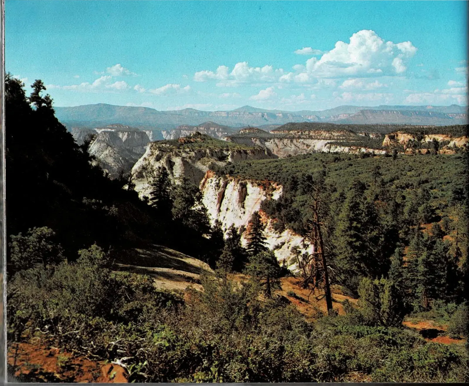
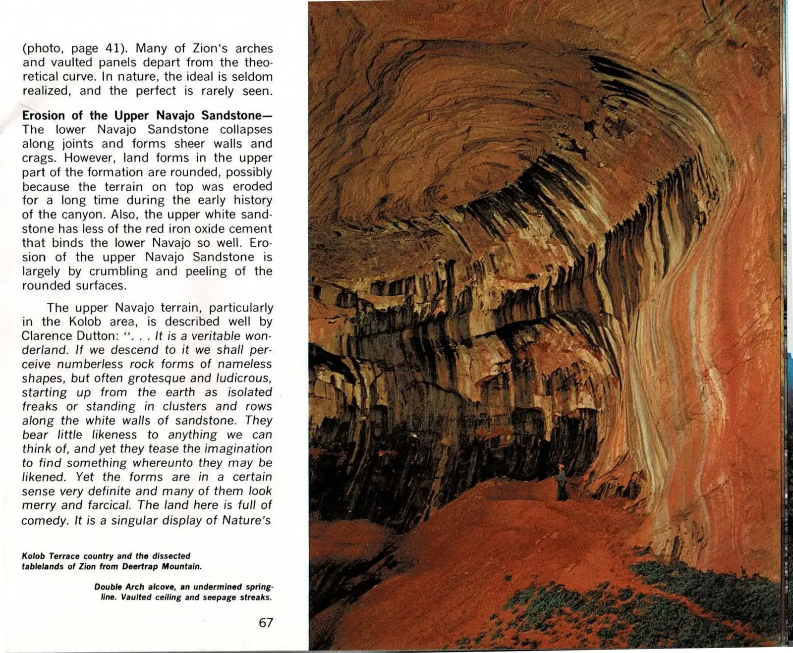
A Wonderland Named Kolob
Above the sheer, joint-broken cliffs of the lower Navajo Sandstone, the rock changes character entirely. Land forms in the upper formation are rounded rather than angular, worn smooth by a longer stretch of exposure and by upper-layer sandstone that holds less of the iron-oxide cement binding the redder rock below. Instead of the vertical columns and slabs seen lower down, erosion here works by slow crumbling and peeling - the same forces, producing a completely different landscape.
Nowhere is that landscape stranger than the Kolob Terrace, the forested, dissected tableland pictured full-bleed on the facing page. Hagood reaches for a nineteenth-century witness to describe it: the geologist Clarence Dutton, who toured this country in the 1870s and called it "a veritable wonderland" of rock forms so odd - domes, hoodoos, freestanding pinnacles - that he struggled to compare them to anything else he had seen.
The Double Arch alcove pictured here is one specific example of that upper-formation erosion at work: a vaulted ceiling undermined along its own springline, seepage streaking the rock the same way water shapes Weeping Rock lower in the canyon, just carried out on a larger, more theatrical scale.
Read the original book text (pages 66 - 67)
[No printed text on page 66 - a full-bleed photograph, uncaptioned.]
(photo, page 41). Many of Zion's arches and vaulted panels depart from the theoretical curve. In nature, the ideal is seldom realized, and the perfect is rarely seen.
Erosion of the Upper Navajo Sandstone - The lower Navajo Sandstone collapses along joints and forms sheer walls and crags. However, land forms in the upper part of the formation are rounded, possibly because the terrain on top was eroded for a long time during the early history of the canyon. Also, the upper white sandstone has less of the red iron oxide cement that binds the lower Navajo so well. Erosion of the upper Navajo Sandstone is largely by crumbling and peeling of the rounded surfaces.
The upper Navajo terrain, particularly in the Kolob area, is described well by Clarence Dutton: ". . . It is a veritable wonderland. If we descend to it we shall perceive numberless rock forms of nameless shapes, but often grotesque and ludicrous, starting up from the earth as isolated freaks or standing in clusters and rows along the white walls of sandstone. They bear little likeness to anything we can think of, and yet they tease the imagination to find something whereunto they may be likened. Yet the forms are in a certain sense very definite and many of them look merry and farcical. The land here is full of comedy. It is a singular display of Nature's
Kolob Terrace country and the dissected tablelands of Zion from Deertrap Mountain.
Double Arch alcove, an undermined springline. Vaulted ceiling and seepage streaks.

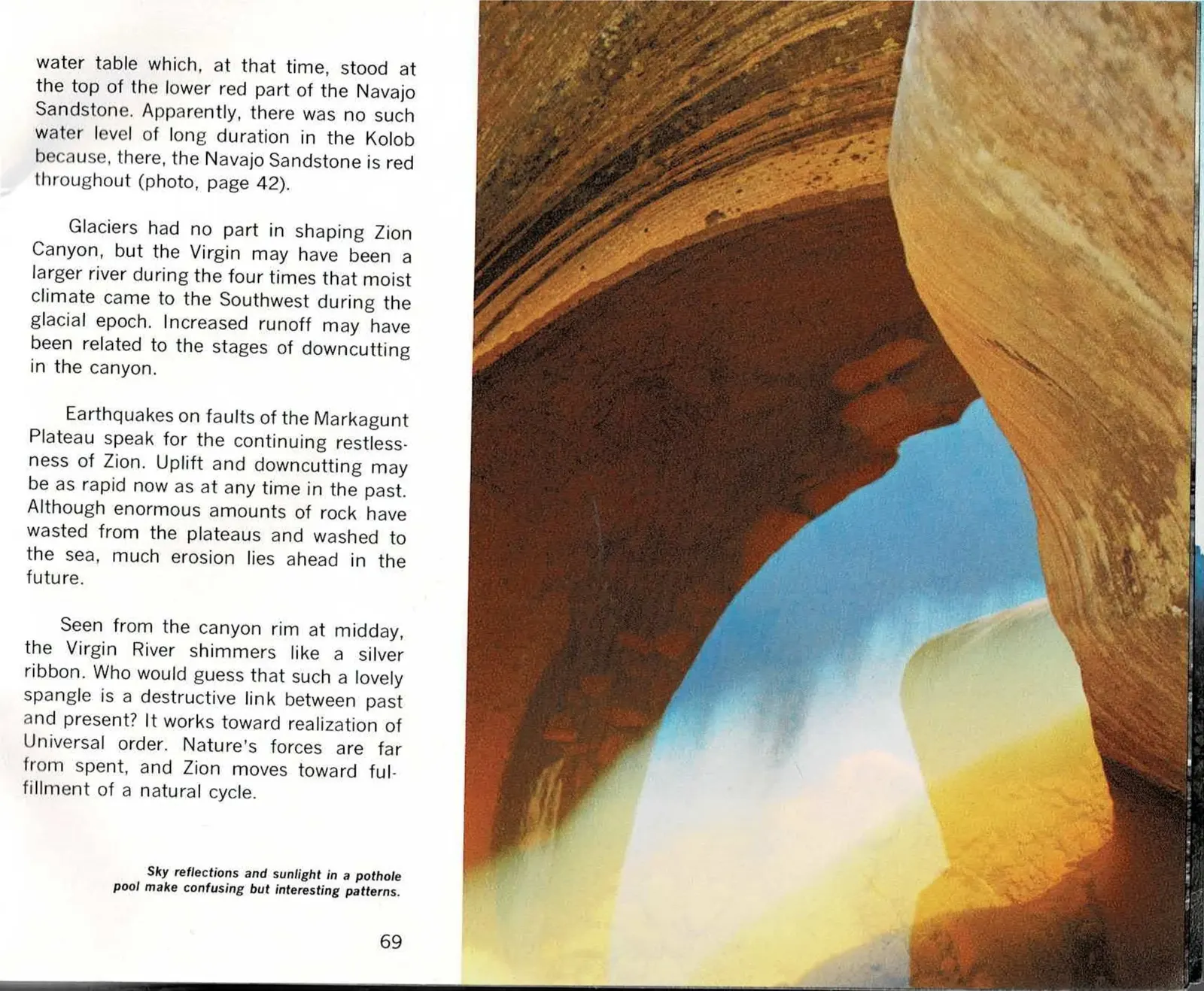
Why the Canyon Wears Two Colors
The Dutton quotation that opened the previous pages closes here, and the chapter pivots to a question every visitor eventually asks: why is the lower Navajo Sandstone deep red while the upper formation glows white? Hagood's answer traces an undulating line halfway up the canyon walls back to old water tables - ancient ground-water levels that once sat at that exact height and slowly leached the red iron minerals out of the rock above, carrying them down to be redeposited below.
That same section explains the faint terraces visible in a few spots along lower Zion Canyon - shelf-like remnants of old valley floors, evidence that the Markagunt Plateau rose in at least three distinct pulses rather than one smooth uplift. Each pulse sent the Virgin River cutting down hard, followed by a quieter stretch of widening before the next pulse started the cycle over. The hiker pictured here, dwarfed by walls fifty times deeper than the gorge is wide, stands inside the most recent chapter of that same cutting.
Hagood closes the chapter by returning to the river itself: seen from the rim at midday it looks like a harmless silver ribbon, but it is the working link between Zion's past and its future, still carrying rock toward the sea. Nature's forces, he writes, are far from spent - and with that, the chapter turns from erosion's destruction toward the fulfillment of a cycle.
Read the original book text (pages 68 - 69)
art mingled with nonsense. It is well named the Colob, for the word has no ascertainable meaning, and yet it sounds as if it ought to have one . . ." (Ref.3).
In sculpturing stone, nature may overstep our sense of beauty and stumble into absurdity. All sorts of whalebacks and baldheads, domes and beehives, and knobs and hobgoblins decorate the slickrock areas of upper Navajo (photo, page 57). The delicate lines in ancient sand dunes crisscross the rock and, in many places, this crossbedding is broken by cracks that produce odd biscuitworks and checkerboards (photo, page 34).
History of the Canyon - Visitors often ask why the lower Navajo is deep red and the upper part is glistening white. The division between the two colors is an undulating line halfway up the canyon walls. This color boundary and other land forms can be explained by the stages of downcutting of Zion Canyon by the Virgin River.
In a few places, there are three discontinuous terraces on the sides of lower Zion Canyon; they are remnants of valley floors cut long ago by the Virgin River. These features suggest that the Markagunt Plateau was uplifted in at least three distinct pulses, and that the river reacted vigorously each time with renewed downcutting, followed by gradual widening and the establishment of a new valley floor at a level lower than the preceding one. The red-white color boundary in the Navajo probably marks the ground water level beneath one of these old valleys. The red iron minerals may have been dissolved in the upper part of the formation and carried down to the
Hiker in Narrows where the gorge is fifty times deeper than wide. Roland Wauer photo.
water table which, at that time, stood at the top of the lower red part of the Navajo Sandstone. Apparently, there was no such water level of long duration in the Kolob because, there, the Navajo Sandstone is red throughout (photo, page 42).
Glaciers had no part in shaping Zion Canyon, but the Virgin may have been a larger river during the four times that moist climate came to the Southwest during the glacial epoch. Increased runoff may have been related to the stages of downcutting in the canyon.
Earthquakes on faults of the Markagunt Plateau speak for the continuing restlessness of Zion. Uplift and downcutting may be as rapid now as at any time in the past. Although enormous amounts of rock have wasted from the plateaus and washed to the sea, much erosion lies ahead in the future.
Seen from the canyon rim at midday, the Virgin River shimmers like a silver ribbon. Who would guess that such a lovely spangle is a destructive link between past and present? It works toward realization of Universal order. Nature's forces are far from spent, and Zion moves toward fulfillment of a natural cycle.
Sky reflections and sunlight in a pothole pool make confusing but interesting patterns.
Part Two, Chapter Four - Pages 70 to 73
Fulfillment of a Cycle
The book's closing argument. Having built the land up and worn it back down, Hagood follows the eroded material all the way to the Colorado River delta, closing the geological story where every uplifted landscape eventually ends.
The original text in this chapter's panels includes the book's own internal photo cross-references, in the form (photo, page 71), pointing to other pages of the printed book. They are reproduced here exactly as printed and are not links within this edition.
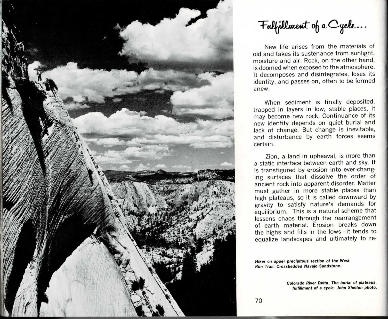
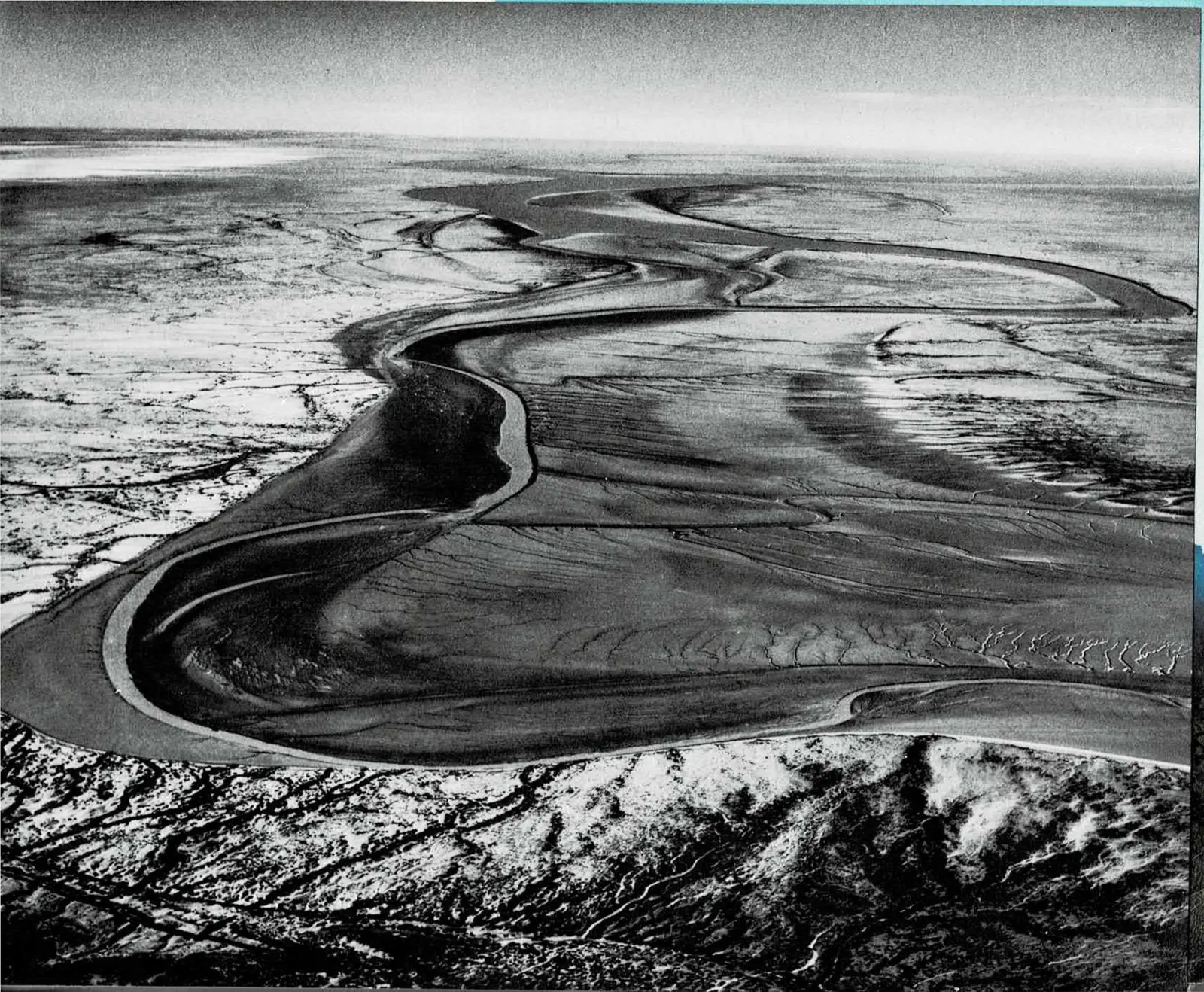
Where Zion's Sand Finally Settles
Chapter Four opens with the book's most reflective passage yet: a shift from cataloguing individual erosional processes to naming the larger pattern behind all of them. Rock exposed to sun and rain is, in Hagood's phrase, doomed - but the sediment it sheds does not simply disappear. Gravity carries it downward until it settles somewhere stable enough to become new rock in its turn, and the chapter's title names that migration directly.
The hiker pictured on page 70, working up a wind-scoured, crossbedded slope of Navajo Sandstone on the West Rim Trail, stands on the very material the chapter is describing - rock still years from its own turn to erode, caught mid-cycle rather than at either end of it.
Page 71 skips ahead to where that cycle actually finishes: a full-bleed aerial photograph of the Colorado River Delta, its channels braided and silt-heavy as they spread across the flat plain. Hagood's own caption calls it plainly the "burial of plateaus, fulfillment of a cycle" - the same grains of sand that once formed Zion's cliffs, carried downstream by the Virgin and the Colorado, finally coming to rest.
Read the original book text (pages 70 - 71)
Fulfillment of a Cycle . . .
New life arises from the materials of old and takes its sustenance from sunlight, moisture and air. Rock, on the other hand, is doomed when exposed to the atmosphere. It decomposes and disintegrates, loses its identity, and passes on, often to be formed anew.
When sediment is finally deposited, trapped in layers in low, stable places, it may become new rock. Continuance of its new identity depends on quiet burial and lack of change. But change is inevitable, and disturbance by earth forces seems certain.
Zion, a land in upheaval, is more than a static interface between earth and sky. It is transfigured by erosion into ever-changing surfaces that dissolve the order of ancient rock into apparent disorder. Matter must gather in more stable places than high plateaus, so it is called downward by gravity to satisfy nature's demands for equilibrium. This is a natural scheme that lessens chaos through the rearrangement of earth material. Erosion breaks down the highs and fills in the lows - it tends to equalize landscapes and ultimately to re-
Hiker on upper precipitous section of the West Rim Trail. Crossbedded Navajo Sandstone.
Colorado River Delta. The burial of plateaus, fulfillment of a cycle. John Shelton photo.
[No printed text on page 71 - a full-bleed photograph; its caption, "Colorado River Delta. The burial of plateaus, fulfillment of a cycle. John Shelton photo," is printed on page 70.]
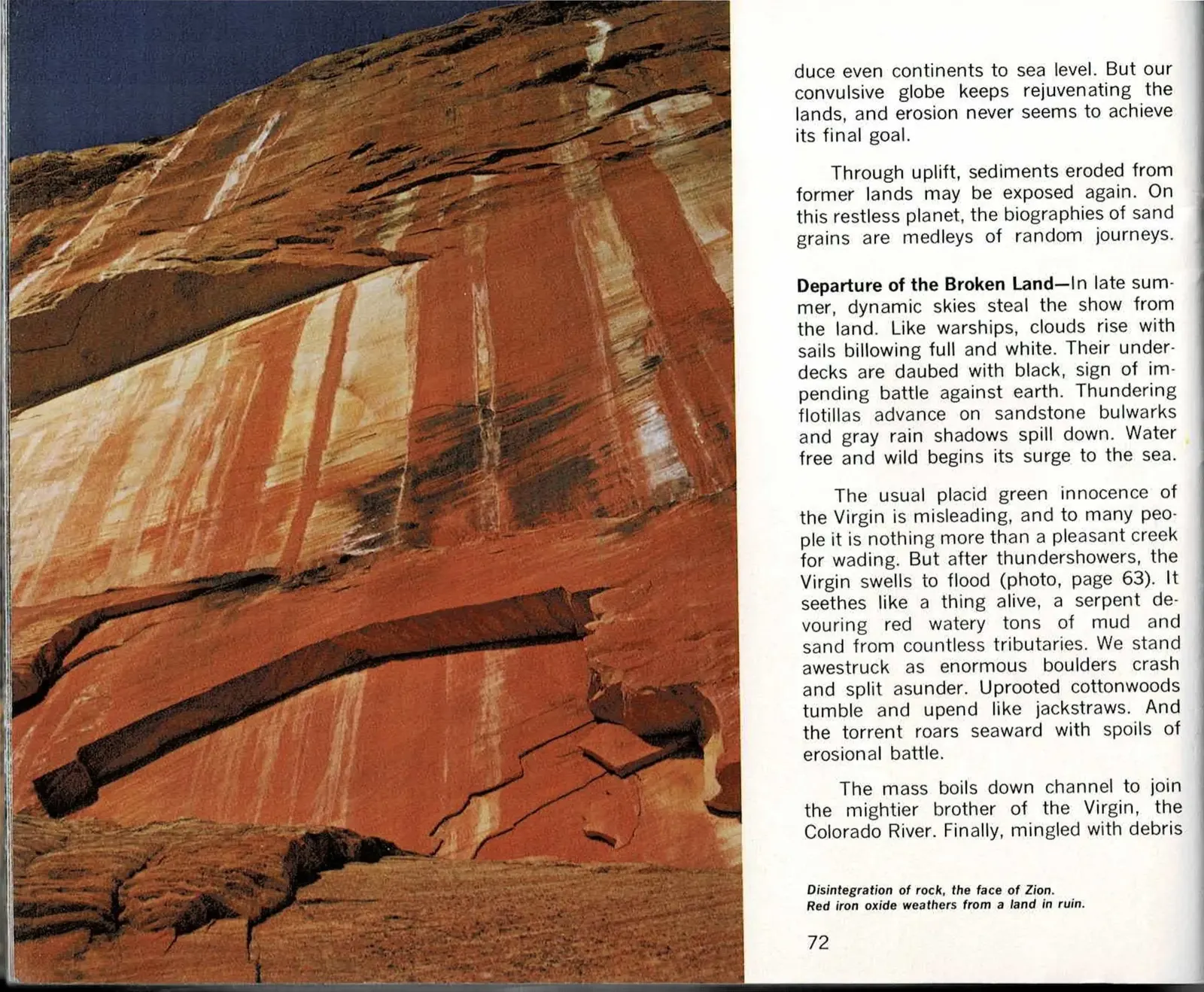
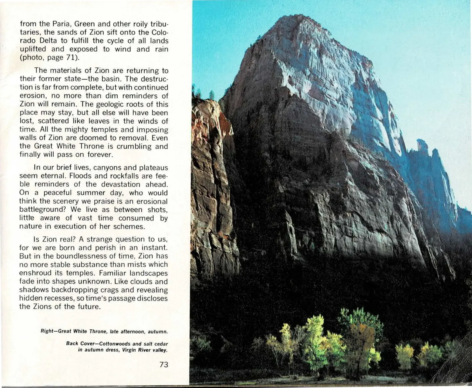
The Book's Last Two Pages
Page 72 opens with the chapter's meteorological interlude, "Departure of the Broken Land": late-summer storm clouds building like distant fleets before breaking over sandstone, until, in Hagood's words, water free and wild begins its surge to the sea. What follows is the same erosional story the whole book has been telling, but told at flood pace rather than geologic pace - the Virgin River swollen and churning, boulders splitting apart, cottonwoods uprooted and carried toward the Colorado. The streaked, weathering cliff face photographed alongside that text carries its own blunt caption: disintegration of rock, the face of Zion.
Page 73 carries the book's final paragraphs, closing both the chapter and This is Zion itself. Hagood widens the lens one last time, naming Zion's great walls - the Great White Throne included - as doomed to removal like everything the book has already described, then asks his closing question outright: is Zion real? His answer is less a denial than a reframing. Measured against the boundlessness of geologic time, the canyon has no more permanence than the mist that sometimes wraps its temples, and the erosion carrying this Zion away is also, somewhere else, building the Zions still to come.
The photograph paired with that closing text is the Great White Throne at late-afternoon light in autumn, cottonwoods glowing gold at its base - the same monolith the text has just named as doomed, caught here at a moment that looks, for now, like nothing so much as permanence.
Read the original book text (pages 72 - 73)
duce even continents to sea level. But our convulsive globe keeps rejuvenating the lands, and erosion never seems to achieve its final goal.
Through uplift, sediments eroded from former lands may be exposed again. On this restless planet, the biographies of sand grains are medleys of random journeys.
Departure of the Broken Land - In late summer, dynamic skies steal the show from the land. Like warships, clouds rise with sails billowing full and white. Their underdecks are daubed with black, sign of impending battle against earth. Thundering flotillas advance on sandstone bulwarks and gray rain shadows spill down. Water free and wild begins its surge to the sea.
The usual placid green innocence of the Virgin is misleading, and to many people it is nothing more than a pleasant creek for wading. But after thundershowers, the Virgin swells to flood (photo, page 63). It seethes like a thing alive, a serpent devouring red watery tons of mud and sand from countless tributaries. We stand awestruck as enormous boulders crash and split asunder. Uprooted cottonwoods tumble and upend like jackstraws. And the torrent roars seaward with spoils of erosional battle.
The mass boils down channel to join the mightier brother of the Virgin, the Colorado River. Finally, mingled with debris
Disintegration of rock, the face of Zion. Red iron oxide weathers from a land in ruin.
from the Paria, Green and other roily tributaries, the sands of Zion sift onto the Colorado Delta to fulfill the cycle of all lands uplifted and exposed to wind and rain (photo, page 71).
The materials of Zion are returning to their former state - the basin. The destruction is far from complete, but with continued erosion, no more than dim reminders of Zion will remain. The geologic roots of this place may stay, but all else will have been lost, scattered like leaves in the winds of time. All the mighty temples and imposing walls of Zion are doomed to removal. Even the Great White Throne is crumbling and finally will pass on forever.
In our brief lives, canyons and plateaus seem eternal. Floods and rockfalls are feeble reminders of the devastation ahead. On a peaceful summer day, who would think the scenery we praise is an erosional battleground? We live as between shots, little aware of vast time consumed by nature in execution of her schemes.
Is Zion real? A strange question to us, for we are born and perish in an instant. But in the boundlessness of time, Zion has no more stable substance than mists which enshroud its temples. Familiar landscapes fade into shapes unknown. Like clouds and shadows backdropping crags and revealing hidden recesses, so time's passage discloses the Zions of the future.
Right - Great White Throne, late afternoon, autumn.
Back Cover - Cottonwoods and salt cedar in autumn dress, Virgin River valley.
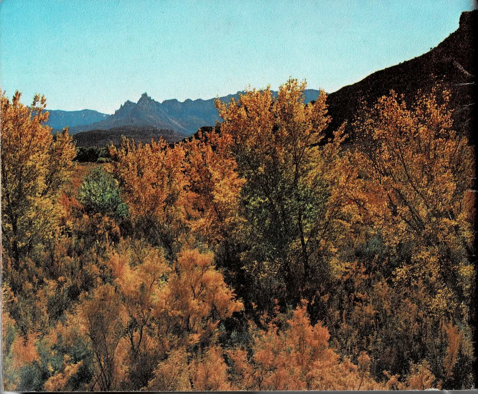
Back cover - printed page 74
Cottonwoods and Salt Cedar
in Autumn Dress
The book ends the way it began: with a photograph and nothing else. No summary, no index, no closing essay - just the Virgin River valley in autumn color, credited on page 73 as "Cottonwoods and salt cedar in autumn dress, Virgin River valley."
It is a quiet way to close an argument about erosion. The cottonwoods on this page will be gone in a season; the canyon they stand in will be gone, on Hagood's own timescale, eventually too.
About the Source
About This Book
This is Zion was written by Allen Hagood and published by the Zion Natural History Association. This edition is digitized from a physical copy of the second edition, printed in 1974, scanned spread by spread.
The book runs 74 pages across 37 two-page spreads and is organized in two parts. Part One, "The Beauty of Zion," is a continuous photographic passage through the park. Part Two, "The Geological Story," is divided into four chapters - "The Layered Rocks of Zion," "Zion, A Restless Land," "Erosion Destroys the Land," and "Fulfillment of a Cycle" - each citing Hagood's own numbered references in the running text, reproduced in the original-text panels exactly as printed (the reference list itself was not part of the scanned pages).
Practical details in a book from 1974 are historical, not current. Roads, trails, facilities, fees, and regulations have all changed. For anything you intend to act on, check nps.gov/zion first.
This isn't the only historic document in Best of Zion's archive - see also the digitized 1920s Union Pacific Railroad brochure for Zion, Bryce Canyon, and Cedar Breaks, a promotional guide from the earliest years of organized tourism to the region.