Historic Archive
Zion National Park, Bryce Canyon & Cedar Breaks
A hybrid digital edition of a historic travel brochure: a short modern overview for general readers, with expandable original brochure text placed directly beneath the related sections.
A Hybrid Reading Experience
This page is designed to work two ways. The main section text offers a smoother modern reading experience, helping visitors quickly understand the scenic themes and travel appeal of the brochure.
Under each major section, you can open a toggle to read the original brochure wording for that part of the booklet. That preserves the archival source while keeping the page approachable for casual readers.
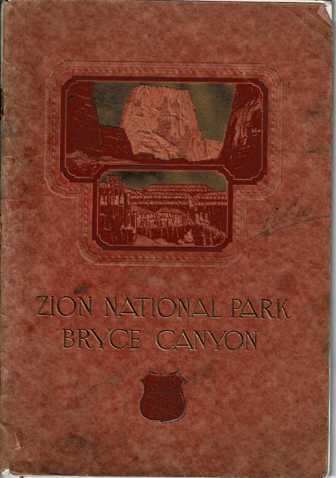
Railway Travel Brochure (c. 1920s)
Zion National Park
Bryce Canyon
The cover immediately frames the brochure as scenic invitation and travel promise. It presents Zion, Bryce Canyon, and Cedar Breaks as a unified canyon-country journey and signals that the pages ahead are meant to inspire wonder as much as convey information.
In its original printed form, the cover had to attract attention, establish mood, and suggest the scale and beauty of the western parks. It still performs that role beautifully in digital form.
Interpretive Highlight
The Land of Flaming Canyons and Jeweled Amphitheatres
Touched by a light that hath no name,
A glory never sung,
Aloft on sky and mountain wall,
Are God's great pictures hung.
- Whittier
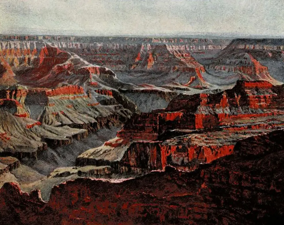
Before the brochure settles into individual destinations, it opens by defining the whole region as a place of overwhelming scale, color, and geologic drama. Southern Utah is introduced not simply as scenery, but as a sequence of gigantic terraces, cliff systems, canyon worlds, and high plateaus unlike anything else in America.
This opening matters because it teaches the reader how to understand everything that follows. Zion, Cedar Breaks, Bryce Canyon, and even the North Rim are presented as related expressions of one greater landscape: a vast country shaped by uplift, faulting, volcanic force, and above all erosion.
The tone is both promotional and reverential. The brochure wants the traveler to feel that entering this country is not ordinary tourism, but arrival in a scenic province of rare beauty, frontier mystery, and almost unimaginable natural architecture.
Step Inside the Original Travel Brochure (Pages 4-7)
The Land of Flaming Canyons and Jeweled Amphitheatres
Touched by a light that hath no name,
A glory never sung,
Aloft on sky and mountain wall,
Are God's great pictures hung.
- Whittier
Southward from the thirty-eighth parallel of latitude the surface of western Utah descends in magnificent cyclopean steps from the flattened summits of the Wasatch Mountains, then falls to the Rio Virgin, and rises again toward the colossal arch of the Kaibab Plateau overlooking the Grand Canyon.
These titanic terraces and palisaded plateaus - more particularly the flaming canyons and jeweled amphitheatres cut from their color-saturated rock layers - form scenic spectacles without peer or rival on the globe.
Nothing else is comparable to these wonderlands. To see them is both a thrilling adventure and an artistic delight.
Measured by civilization's yardstick, the unknown land in which they lie is a frontier, still in the pioneer stage of existence. It is not so long since the forts along the way actually repelled Indian attacks; it is not so far to fastnesses where cougars come forth to prey on deer, or to desert valleys where wild mustangs range.
On the edge of the plains are ruins of primitive dwellings of which the modern Indian knows nothing; in many a secluded canyon are the more inscrutable habitations of the cliff dwellers.
The indomitable rancher has built quaint, poplar-shaded villages with homes of adobe, and their farms are often fenced with stone.
It is a mysterious land of purple sage and incomparable distances, of incredible color, of sun-magic and the wizardry of wind and water. It is a place to drink in beauty, to form new conceptions of the divine.
Geologists recognize three subdivisions of the region from north to south: the High Plateaus, the Terraced Plateaus, and the Grand Canyon Platform. The country reveals fascinating chapters of geologic history. It is a region that has undergone great transitions - alternately sea bottom and mountain top - broken and tilted by tremendous displacements, scorched by volcanic action, but above all sculptured by the beauty-creating genius of erosion.
From Cedar Breaks, cut into mountains 11,000 feet high, the vision has a sweep of 100 miles, and vast terraces may be seen thrust out to the south like promontories into the sea. More than 10,000 feet of strata are exposed, a library of the ages in vivid bindings containing the fossil remains of creatures from the morning of life on earth.
The highest of the Terraced Plateaus, the Markagunt and Paunsaugunt, in which Cedar Breaks and Bryce Canyon lie, break down in spired palisades of the Pink Cliffs, endless in sculptured variety. Beneath them, the southern scarp of the Kolob Plateau, into which flaming Zion Canyon is sunk, forms noble cliffs of fire. Lower still appear the Vermilion Cliffs and the brilliantly banded Shinarump country.
Such is the strange, magnificent, and colorful structure of the land.
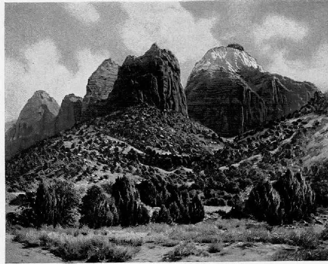
Zion Canyon is a profound gorge with the colors of blood, fire and snow - a matchless carving by the greatest of all sculptors, erosion. Several of its mighty rock temples rank with the most majestic masses in the land.
The variety of its endless etchings, the exquisite harmonics of its painted precipices, the sustained grandeur of its stupendous buttes and walls, and its glorious cycle of color from dawn to sunset are sources of undimmed delight.
From its green-garbed floor it has one aspect of beauty; from its dizzy rim of white, another. From the dusky depths of the Narrows the dominant sensation is soul-gripping awe.
Cedar Breaks, the highest of Utah's jeweled amphitheatres, is a place of sublime and lofty beauty, a series of vast sculptured basins sunk into the summits of the mountains.
Bryce Canyon also is an amphitheatre - a richer, more compact bit of resplendence. You hardly believe that Bryce Canyon exists until you have gazed many times; so amazing is its beauty that it seems like the flashing vision of a dream.
The way is now prepared for you to see these miracle places of America in comfort.
SCENIC APPROACH TO ZION
The Road from Cedar City to Zion National Park
This section shifts from broad regional wonder to the lived experience of arrival. The brochure traces the highway south from Cedar City through fault country, lava fields, orchard settlements, and red-rock mesas, turning the drive itself into part of the destination. Zion is not presented as a sudden stop on a map, but as a landscape gradually revealed through contrast and anticipation.
The language moves between geology and promotion. Hurricane Ledge, volcanic flows, the Virgin River valley, and the agricultural villages of southern Utah all help frame Zion as a place where harsh structure and human settlement meet. The road passes from basin country into a warmer and more cultivated "Dixie," then onward toward scenery that becomes progressively more vertical, more sculpted, and more improbable.
By the time the brochure reaches the gates of Zion, it abandons ordinary travel description and gives itself over to awe. Captain Clarence Dutton's famous account of the West Temple and the surrounding canyon walls is used to elevate the scene beyond sightseeing into something almost architectural and sacred. The effect is deliberate: before the traveler even enters the canyon fully, Zion has already been introduced as one of the supreme scenic spectacles of the American West.
Follow the Original Cedar City to Zion Route (Pages 8-13)
Cedar City to Zion National Park
The highway southward from Cedar City (the Zion Park Highway) is on the floor of an arm of prehistoric Lake Bonneville. This is the Great Basin region, a sort of prison for running water because none of its streams ever reach the sea. In the east are the steep scarps of the Markagunt and Kolob Plateaus limited by a tremendous fault plane, the Hurricane Ledge; in the west are the Iron Mountains, veritable masses of iron ore; in the south are the lofty, majestic Pine Valley Mountains, extinct volcanoes whose dark, wrinkled summits exceed 10,000 feet in elevation.
Hamilton's Fort, a few miles from Cedar City, was once a frontier outpost, the scene of several battles with Indians. Near the village of Kanarra the route passes over the rim of the Great Basin and enters the Colorado River watershed. Here Hurricane Ledge lifts more sharply into prominence, a precipitous rampart of gray and red rock mottled by pinons and junipers. The surface on which the road lies is the same as that on top of the ledge; the land in the valley either dropped hundreds of feet or the plateau was upthrust an equal distance. Hurricane Fault, as geologists call it, is the most striking displacement in the West. It extends from the volcanic Tushar Mountains, north of Cedar City, along the base of the Markagunt Plateau and southward across the Grand Canyon, a total distance of more than 200 miles.
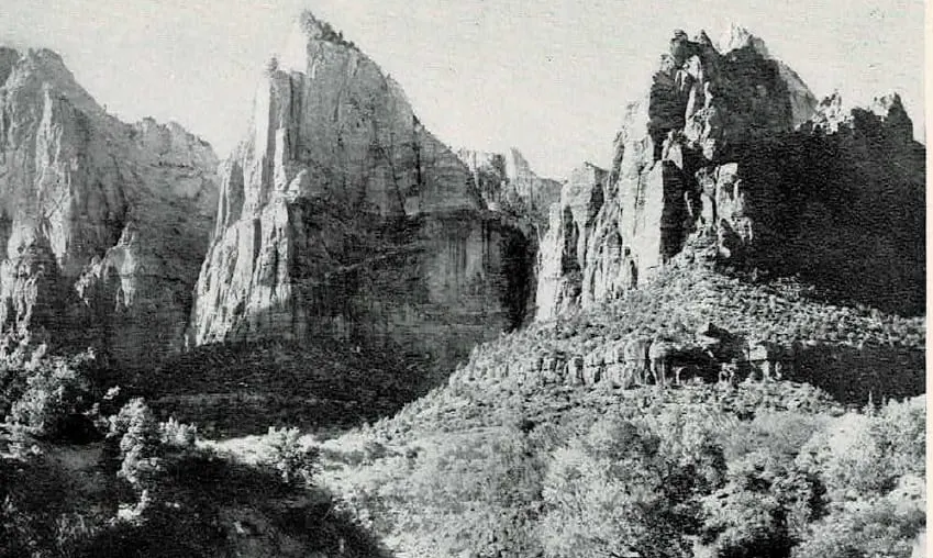
The road now follows Ash Creek, a tributary of the Virgin, over lava flows where prickly pears, pin-cushion cacti, yucca, torchweed and miner's candlesticks grow among the sage brush. Thereabouts the first view is had of the Valley of the Virgin, Utah's "Dixie," a tumbled region of low mesas, black volcanic cones, lava fields and dunes of cherry-red sand, settled by Mormon colonists in 1858. This "Dixie" section of Utah, about 3,000 feet in elevation, is sub-tropical in climate, grows a large variety of agricultural products including cotton and tobacco, and its poplar-shaded villages have a quaintness suggestive of foreign lands.
One of the most picturesque communities is Toquerville, named after an Indian chief, and where the automobiles stop so that the traveler may purchase for small sums an amazing variety of delicious fruit: figs, pomegranates, grapes, melons, almonds, peaches, pears, plums and apricots. Along the village street, with its double row of poplars planted as windbreaks, are odd houses of adobe fenced with stone, seemingly asleep beneath their luxuriant fig trees; irrigation streams gurgle and sing with the cool seduction of flowing water in an arid land. The scene has a pastoral air of Biblical peace and plenty. Three miles south, the Harding Highway crosses La Verkin Creek, turns eastward, and begins to climb.
In an instant the scene changes completely. Long, buttressed and fretted mesa promontories parade solemnly into view, an endless array of marching mountains banded with buff, red, pink and gray, mountains that seem to have come from nowhere. Soon arises across the gray-green sage the huge rock cathedral called Smithsonian Butte, spired with silver and gray; and then, instantaneously dominating the entire landscape, there appears, at the gates of Zion, the West Temple of the Virgin.
The transcendent beauty of this tremendous tinted temple of stone is best realized when irradiated by the morning or afternoon sun. The southern facade of the structure forms a sundial for the villages near by.
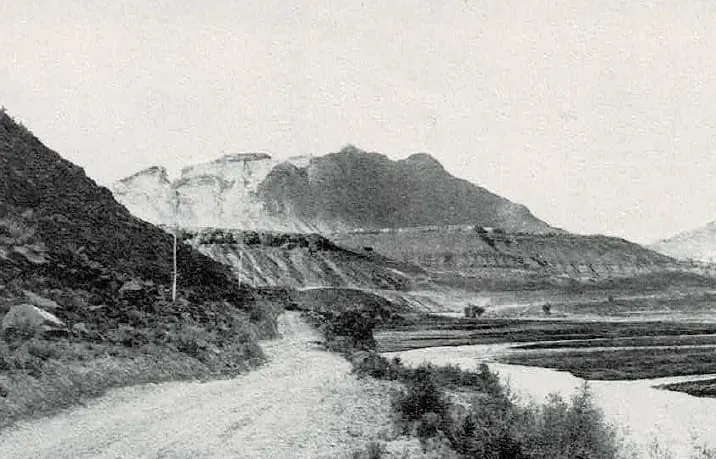
"In an hour's time, we reached the crest of the isthmus, and in an instant there flashed before us a scene never to be forgotten. In coming time it will, I believe, take rank with a very small number of spectacles each of which will, in its own way, be regarded as the most exquisite of its kind which the world discloses.
"Across the canyon stands the central and commanding object of the picture, the Western Temple, rising 4,000 feet above the river. Its glorious summit was the object we had seen an hour before, and now the matchless beauty and majesty of its vast mass is all before us. Yet it is only the central object of a mighty throng of structures wrought up to the same exalted style and filling up the entire panorama.
"Right opposite us are the two principal forks of the Virgin, the Parunuweap coming from the east, and the Mukuntuweap, or Little Zion Valley, descending from the north. The Parunuweap is seen emerging through a stupendous gateway and chasm nearly 3,000 feet in depth. The further wall of this canyon swings northward and becomes the eastern wall of Little Zion Valley. As it sweeps down the Parunuweap, it breaks into great pediments covered all over with the richest carving.
"The flank of the wall receding up the Mukuntuweap is for a mile or two similarly decorated, but soon breaks into new forms much more impressive and wonderful. A row of towers half a mile high is quarried out of the palisade and stands well advanced from its face. There is an eloquence to their forms which stirs the imagination with singular power and kindles in the mind of the dullest observer a glowing response.
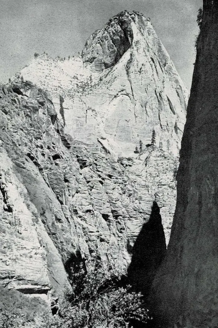
"Directly in front of us a complex group of white towers, springing from a central pile, mounts upward to the clouds. Out of their midst, and high over all, rises a dome-like mass which dominates the entire landscape. It is almost pure white, with brilliant streaks of carmine descending its vertical walls. At the summit it is truncated and a flat tablet is laid upon the top, showing its edge of deep red.
"The towers which surround it are of inferior mass and altitude, but each is a study of fine form and architectural effect. They are white above and change to rich red below. Dome and towers are planted upon a substructure no less admirable. A curtain wall 1,400 feet high descends vertically from the eaves of the temples and is succeeded by a steep slope of ever-widening base-courses leading down to the esplanade below."
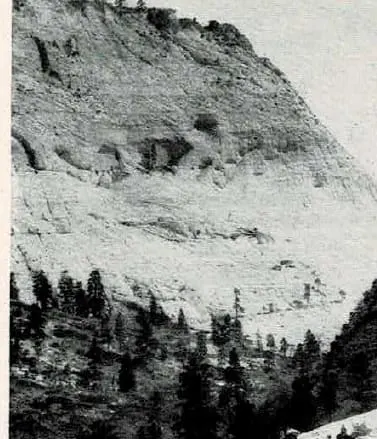
But the traveler has not yet reached the gates of Zion, although distant views continue to appear and disappear. The Virgin River is now near at hand on the right, a swift, moody, meandering stream whose red waters are the creators of the fertile farms along its banks and sometimes their destroyers.
Near Virgin City there is a view northeastward of sensational Guardian Angel Pass. Across Great West Canyon, apparently, stands an immense dam of rock cleft by a rectangular aperture as regular as if cut by engineers; surmounting the barrier are two towering white cones, the ghostly guardians of the gap. Another fascinating feature of the panorama is the complex convergence of the battlemented mesa promontories from all directions except the south; these carved and tinted headlands actually seem to advance upon the beholder.
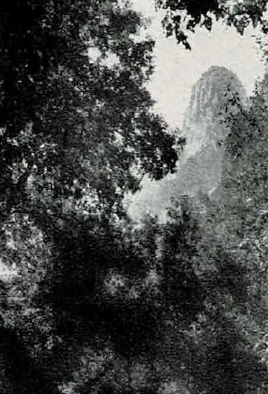
Rockville, another village beside the Virgin, was founded by Mormon pioneers in 1861, and was long an important telegraph station. There is a petrified forest in the vicinity.
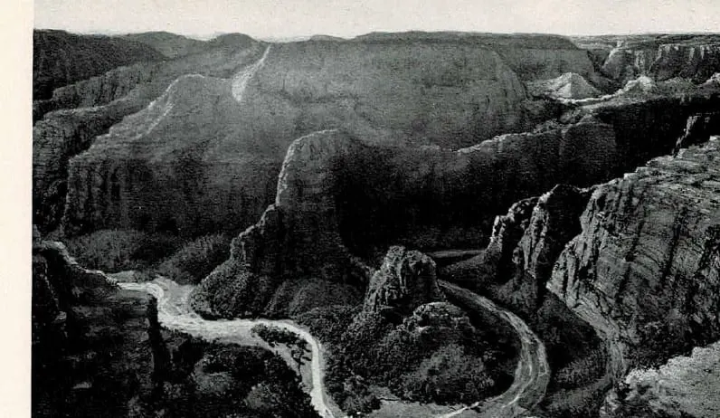
About five miles beyond, the two profound chasms, the Mukuntuweap (Zion) and the Parunuweap, converge; and the two sublime domes, the East and West Temples, with their incredible crests of crimson bleeding down their pale precipices, soar above the rushing waters. Springdale, the last Mormon hamlet, is passed; then the Ranger Station at the southern boundary of Zion National Park.
ZION NATIONAL PARK
The Cathedral Canyon of the Virgin River
Having traced the approach from Cedar City, the brochure now turns fully to Zion itself. The canyon of the Virgin River is introduced not merely as a scenic valley, but as a colossal natural architecture - a corridor of sandstone walls rising thousands of feet above the narrow canyon floor.
Early explorers and geologists struggled to describe the scale of Zion's formations. Towers, domes, temples, and buttresses appear throughout the canyon, their names reflecting the sense that these monumental cliffs resemble the architecture of ancient civilizations. The Virgin River winds through this vast stone sanctuary, carving the canyon that reveals the park's most extraordinary scenery.
The brochure emphasizes Zion as one of the great natural spectacles of the American West. Sheer canyon walls glow in shifting colors of cream, rose, crimson, and gold, while narrow side canyons lead into hidden chambers of rock. Visitors arriving in the early decades of automobile travel found themselves in a landscape unlike any other in North America - a place where geology, light, and scale combine to produce an overwhelming sense of grandeur.
Explore Zion National Park in the Original Brochure (Pages 14-18)
Legend and History
Zion National Park is a roughly quadrangular area of approximately 120 square miles, sixty-four miles by highway from Cedar City, and sixty miles on an air line north of the rim of Grand Canyon. It was set apart as a National Monument under its Indian name, Mukuntuweap, in 1909. In 1919 its area was enlarged, its name was changed to that given it by the Mormon pioneers, and it was made a National Park.
There are cliff dwelling ruins in Zion Canyon, more in Parunuweap Canyon, and the modern Indians had a reverent acquaintance with its solemn amphitheatres. Several interpretations are given of its Indian name, Mukuntuweap. Major Powell translated it "straight canyon;" another interpretation is "place of many waters;" still another is "place of the gods." One legend declares that the Paru-sha-pats Indians once saw a light upon the West Temple and supposed it to be a signal fire to warn them of a Navajo raid. But they found that the West Temple is unscalable and decided that friendly rock spirits had produced a supernatural incandescence; and so, to them, it was "Rock-rover's Land."
It is certain that the Indians regarded Zion Canyon as a place sacred to spiritual beings; they laid their propitiatory offerings of flesh and fruit at the foot of the crimson crags of Sinawava and none would spend a night in their shadows.
Mormon colonists entered the region about 1858, began its patient reclamation by irrigation, and named the marvelous canyon Little Zion. Major Powell, the famous explorer-geologist, reconnoitered the country in 1870. A few years later Captain Dutton studied it and in "The Tertiary History of the Grand Canyon District," now out of print, presented a picture that is "a classic of inspired description." From that time until 1909, except for the visits of a few artists and travelers of the adventurous type, Zion was practically unknown. It may now be visited in perfect comfort. Several colleges have sent classes there for summer study.
Description
The outstanding feature of Zion National Park is Zion Canyon, the stupendous red and white gorge cut by the Mukuntuweap River from the Kolob Plateau through more than 3,000 feet of the Jurassic sandstones of the White and Vermilion cliffs and down into lower beds of mauve sandstone and shales of purple and red. The floor of Zion is 4,100 feet above sea level; the dome of the West Temple rises to 7,650 feet. The canyon is about fourteen miles long and varies in width from about a mile at Springdale to scarcely more than the reach of a man's outstretched hands in the upper Narrows where the river has cut a channel under the towering cliffs. Imagine, if you can, the overwhelming effect of these painted precipices, nearly 2,000 feet high and both close enough to be touched without moving.
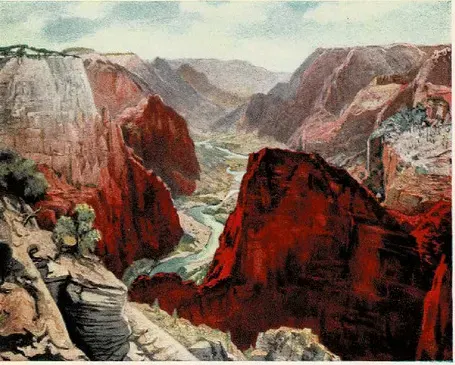
In places the canyon widens into courts and shrines of bewitching beauty, such as the Court of the Patriarchs and the Temple of Sinawava. From the vermilion walls have been chiseled individual buttes and peaks of monstrous greatness and surpassing majesty, among them Angels Landing, the Great White Throne and the Mountain of Mystery. And these soaring scarps and summits present such varied tints and hues of red that the expert in pigments is bewildered; from the delicate pink of a baby's cheek to deepest carmine, and beyond - from bittersweet and orient pink through orange chrome, flame-scarlet, vermilion, jasper, Pompeiian red and Indian lake to mahogany, ox-blood, maroon and a red that is almost black. In places the walls are topped with creamy white and the green of pines. Everywhere they exhibit a wizardry of massive sculpture. The deep-set river is bordered with the verdure of cottonwoods, box-elders, pines, ferns and flowering shrubs; in mossy caves curtained by little waterfalls, deer cradle their fawns. The radiance of the morning and evening sun upon the tinted towers of Zion is among the finest of its spectacles.
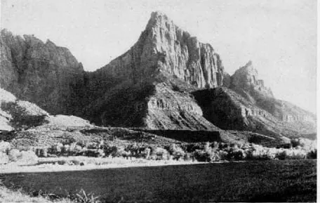
Standing upon the edge of the Park near Springdale is The Watchman, a stately cathedral-like pile of red sandstone. About a mile beyond is Bridge Mountain upon whose upper slope may be discerned a great bow of stone, a natural bridge with a span of 100 feet. Among the Towers of the Virgin stands the Altar of Sacrifice, a buttressed white fane whose summit and wall are stained deep with flowing crimson, suggesting the bloody sacrificial place of some insatiable pagan god. The East Temple, on the right, is a splendid structure of pink and white surmounted by a carmine capstone.
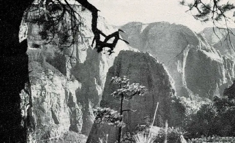
On the left is the Streaked Wall bearing strange white cones, and beyond it is Sentinel Peak. The west wall then recedes to form the fine Court of the Patriarchs whence rise the three stately Patriarchs themselves, jagged pink and white pyramids. Above the east wall stand the Twin Brothers and the Mountain-of-the-Sun, the latter the first to glow in the light of dawn, the last to hold the evening rays. Lady Mountain, Mt. Majestic and Red Arch Mountain next appear, and Angels Landing, a sharp-shorn, pyramidal wedge of Pompeiian red that projects boldly into the canyon and throws off from its foot a fluted ox-blood mass called the Great Organ. Round this the river winds in a serpentine semicircle.
The Great White Throne
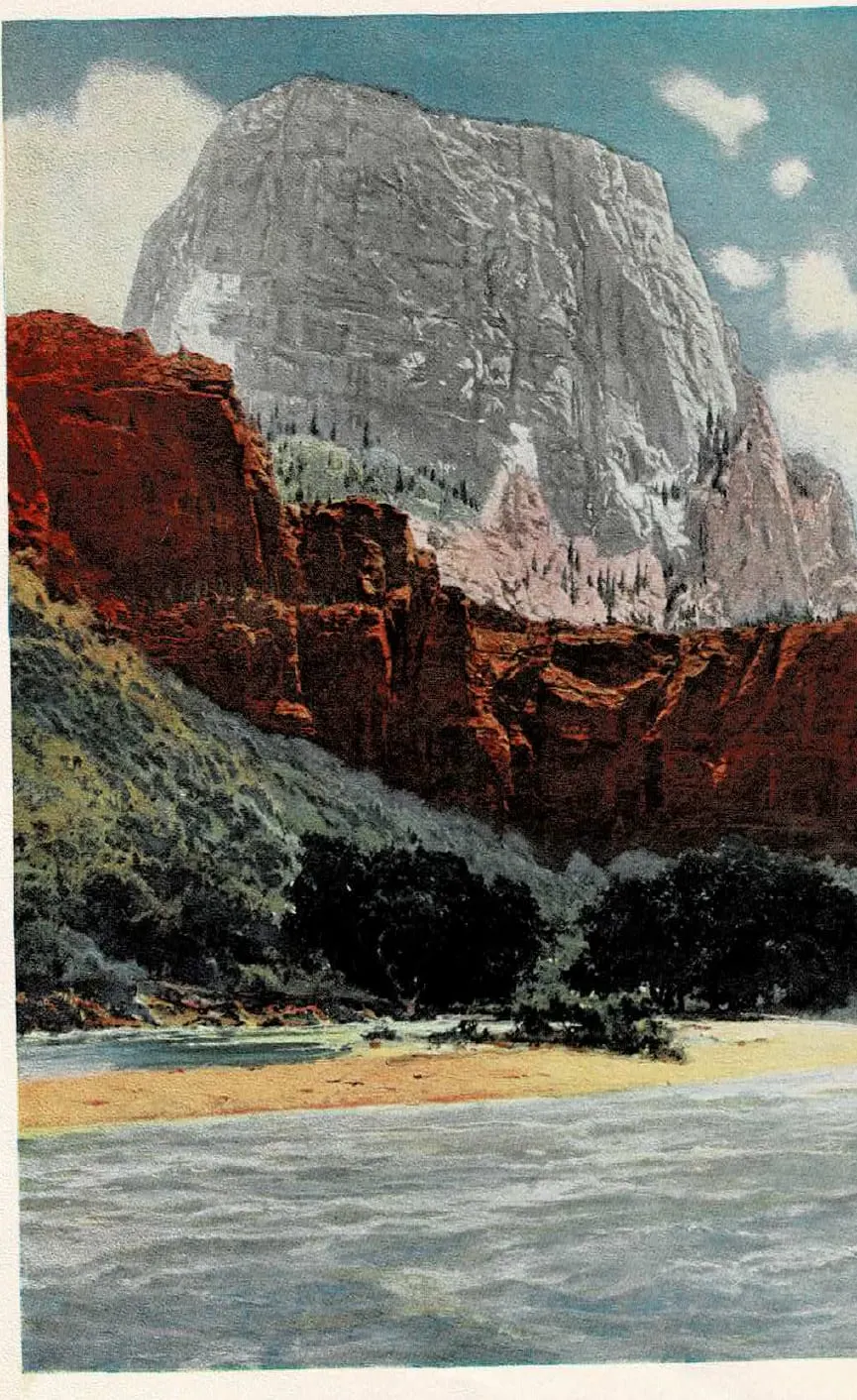
Just below the great bend in the Mukuntuweap River looms an isolated rock temple of prodigious bulk and imperial majesty, a truncated pyramid or mayhap a flattened dome, its lower half red, its upper half tinting from rosy buff to white, a forest of tall pines, acres in extent, upon its untrodden summit. This colossal butte, "one of the world's great rocks," is seen most effectively from the Temple of Sinawava, through the inverted maroon arch between the Great Organ and Angels Landing. It appears completely detached from the east wall, aloof and unscalable. While it has not been officially measured, its crest is probably more than 3,000 feet above the river.
To the north is Cable Mountain, whence a rope of steel wire conveys lumber to the valley from the forested plateau. Between it and the next peak is Raining Cave and the site of a cliff dwelling.
The Temple of Sinawava
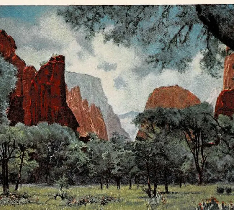
Beyond the bend the precipices of jasper red confine a flower-dotted meadow shaded by trees, where sphinx-like figures, colossi, and shattered pylons of warm and sombre reds suggest the Egyptian ruins at Karnak and Thebes. Several obelisks rise isolated from the gardens of the shrine. This is the beautiful Temple of Sinawava, the last of the courts as one ascends the Canyon. It was here that President Harding paid his tribute to Zion in 1923.
The Narrows
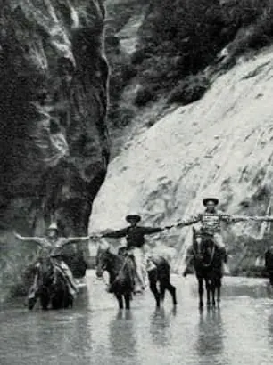
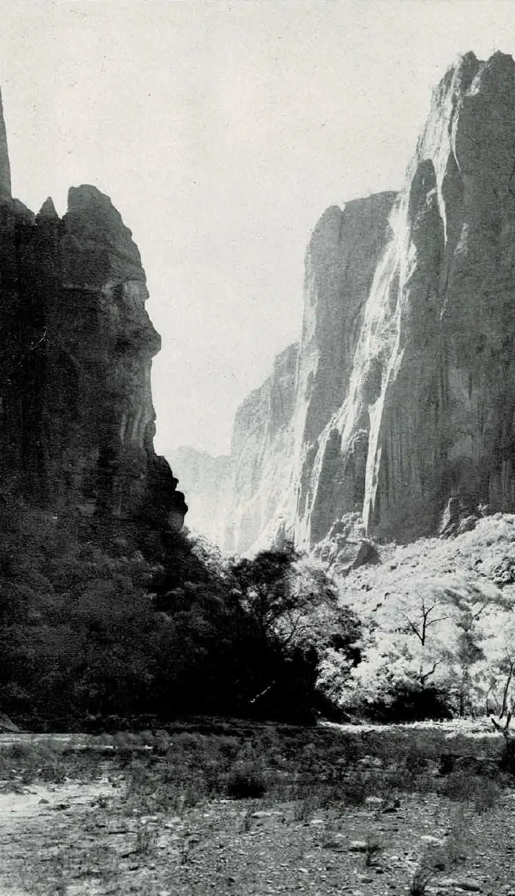
Half a mile beyond, the dragon's-blood precipices become more perpendicular and close in toward each other until the gorge seems blocked, but a turn opens new vistas. Now, it is no more than seventy-five feet from cliff to cliff and the stream stretches from wall to wall. But there is one last glorious picture for those who must turn back. A short distance farther up the gorge soars a slender, ethereal cone of pink and white, a peak of such appealing symmetry and delicate tints, so lofty and aspiring, that it evokes a cry of admiration. It is the Mountain of Mystery.
The Wet Trail
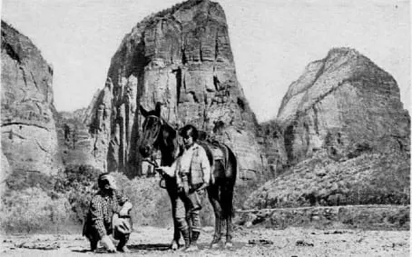
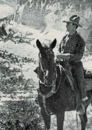
The Canyon continues some eight miles farther, but its exploration is only for the adventurous few. There is no trail but the winding river which reaches from wall to wall; sudden rainstorms send between the scarred and splintered cliffs a resistless torrent of water. With a competent guide those in search of unusual thrills may ride horseback several miles into the deep sunless cleft where great pendants of rock overhang and shut out the sky; where the churning stream in flood has left intricate cameos and arabesques upon the sandstone; where little waterfalls leap from green ledges; where one may almost touch both sombre walls with outstretched hands; where the stars may be seen by day. Many a time the canyon seems to end with prison-like finality and the sky seems lost forever. It is a travel adventure that may not be had elsewhere and one never forgotten.
Zion from the Rims
Seen from above, the aspect of Zion is wholly different. Instead of a relatively straight and orderly canyon dominantly red in color, it becomes a fantastic maze of white and variegated buttes and cones. Mr. Hal G. Evarts thus described in The Saturday Evening Post his impressions from the West Rim:
"It seemed that we gazed out across some vast oriental city that stretched away for a dozen miles. Scores of gaudy mosques and tinted towers, striped citadels topped by flat-roof gardens rose in countless tiers from this congested, painted metropolis.
And the coloring! Imagine a tremendous city of spires and turrets . . . its buildings catching every dazzling reflection of the sunset. There were soft apricot and salmon tints, vague pinks and creams; lemon blending into deepest orange . . . with here and there a haunting suggestion of pale mauve. Brilliant red spires stood beside domes of ivory white. In many of these fairy structures the stratifications pitched so abruptly as to lend a spiralling, barber-pole effect. . . ."
And Zion Canyon is but a part of Zion National Park.
CEDAR BREAKS
From Cedar City to Cedar Breaks
In the brochure's sequence, Cedar Breaks is not just another destination. It is approached as a scenic ascent from Cedar City into cooler air, higher forests, and a dramatically different landscape than Zion. The road climbs toward the summit of the Markagunt Plateau, where the traveler leaves canyon country behind and arrives at a broad mountain rim cut into painted cliffs.
That shift in setting matters. Instead of a narrow gorge, Cedar Breaks opens as a vast natural amphitheater eroded into the plateau edge. From the overlooks, the land spreads outward in great scalloped recesses, ridges, pinnacles, and terraces colored in white, rose, orange, red, and lavender. The sense is not enclosure but elevation, breadth, and distance.
The historic brochure treats this high country as both scenic and transitional: a lofty climax in its own right, and also part of the larger journey onward toward Bryce Canyon. Read that way, the approach from Cedar City, the arrival at the rim, and the monument itself all belong together in a single experience - one continuous rise into the painted plateaus of southern Utah.
Explore Cedar Breaks in the Original Brochure (Pages 19-22)
Cedar City to Cedar Breaks
Cedar Breaks is twenty-three miles by highway east of Cedar City and four-fifths of a mile nearer the sky. Immediately east of the town the road enters the rugged gorge of Coal Creek, its slopes covered with fine forests of conifers and aspens. The walls assume impressive castellated forms that are especially striking at the mouth of Ashdown Gorge, eight miles distant.
Ashdown Gorge is an extremely narrow, tortuous and precipitous rift in the plateau, down which rushes a sparkling stream from the vast furrows of Cedar Breaks. About one mile from the mouth and high up the precipice is a natural bridge with an arch of about sixty feet and a span of about seventy feet.
Following Coal Creek, ever upward, the road presently occupies a shelf upon the shoulder of the Markagunt Plateau whence are revealed glorious and almost illimitable panoramas. The whole sweep of the Terraced Plateau country to the south is visible.
Cedar Breaks
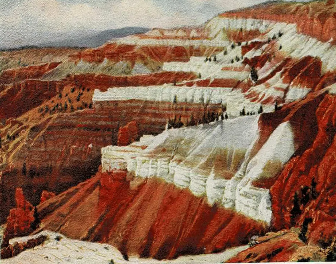
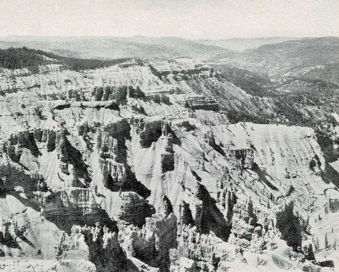
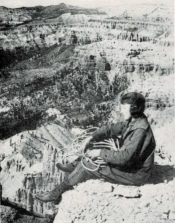
Cedar Breaks is a series of vast amphitheatres eroded to a depth of 2,000 feet into the Pink Cliff formation at the summit of the Markagunt Plateau and covering an area of approximately sixty square miles in the Sevier National Forest. Its forested rim, 10,300 feet in elevation, has been etched back into Blowhard Mountain and adjacent eminences; and a short distance to the north the blunted volcanic crest of Brian Head rises 900 feet higher, affording a panorama of practically all of southern Utah, Nevada and northern Arizona.
Within its limitless labyrinths countless millions of grotesque and magnificent architectural forms, anointed with all the colors of the spectrum, flash into the eyes of the beholder. The erosional structures are blends of Egyptian and massive medieval Gothic walls, modified in a thousand surprising and original details, and rising generally from far-flung, wedge-shaped base courses of white and orange.
The colors change marvelously in response to the sun; pink is dominant, though, at times, orange tones seem to prevail. In broad aspect the color scheme is pink, red, orange, yellow, white, lavender and purple, with intermediate tints and hues that would form a dictionary of pigments; and on the countless scalloped slopes appears the green of spruces, firs and pines. An artist has counted more than sixty tints in Cedar Breaks.
There are six or seven great amphitheatres, semicircular or three-quarter circles in shape, with sharp ridges radiating from rim to center; the few trails into the abysmal serrate basins are faint and obscure, yet the descent with a guide offers unsuspected marvels; then only does one comprehend the immensity and the variety of Cedar Breaks.
Along the rims are several easily reached viewpoints, among them Point Supreme and Point Perfection. Conspicuous in the welter of forms below are innumerable red, castellated bastions in parallel rows; long, writhing dragon-like forms of pure white; and huge sprawling dinosaurs covered with blood. For all its beauty, the place might appropriately have been the habitat of prehistoric monsters. The panoramas westward across the deserts of the Great Basin are notably fine.
In vastness, in variety of color, in wild grandeur, Cedar Breaks is the greatest of Utah's painted amphitheatres.
Cedar Breaks to Bryce Canyon
It is seventy miles from Cedar Breaks to Bryce Canyon. Crossing the broad summit of the Markagunt Plateau the highway traverses fine coniferous forests that frequently open into charming "parks," and passes great areas covered with lava from Hancock Peak and the adjacent extinct volcanoes. Navajo Lake, a beautiful mountain tarn encircled by pines and a noted fishing water, is about eight miles beyond Midway.
Soon pretty Duck Creek, rising in full power from a fine spring and filled with trout, parallels the highway for several miles, then disappears under the volcanic rock. At the crossing of Strawberry Gulch a little used trail extends southward to Strawberry Point, a famous observation place on the Pink Cliffs. The main highway is alternately surfaced with white, pink and red rock, a painted road in a land of color.
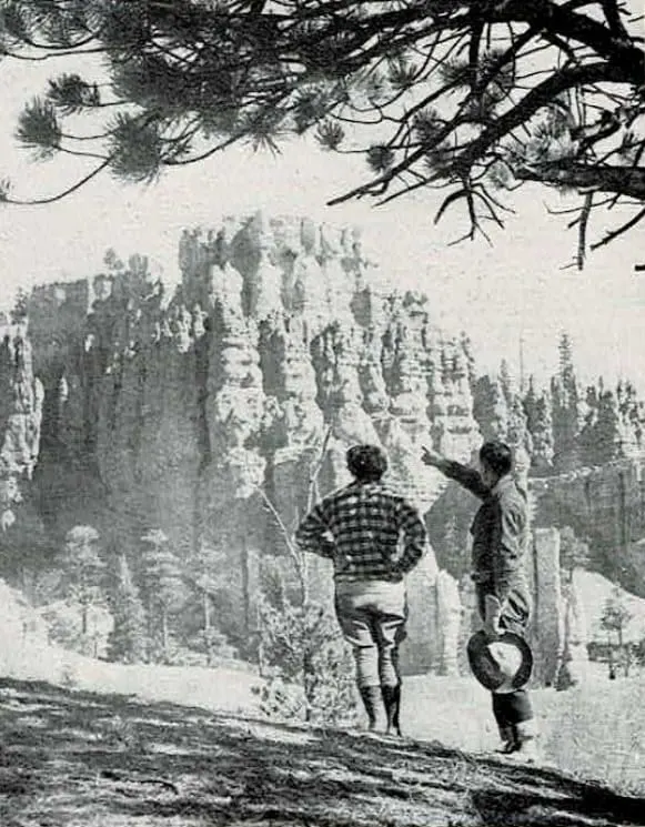
At Cedar Breaks Junction, the route turns north, following the head waters of the Sevier River, one of the most important streams of the Great Basin; to the eastward, in the vicinity of Hatch, vistas of the Pink Cliffs appear. Then the road crosses the Sevier and enters Red Canyon.
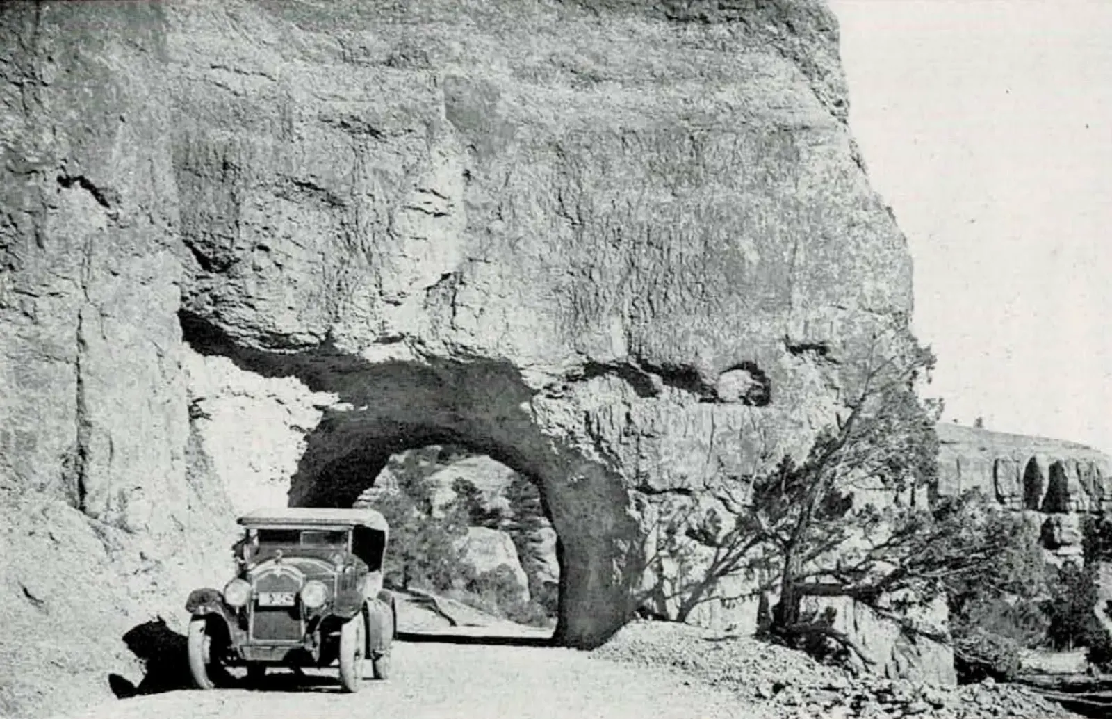
The rich red turrets and towers at this canyon gateway are harmonious introductions to the greater glories of Bryce. Once within its narrow defile, the superb portal broadens into a little pine-dotted valley and its walls display hundreds of spires, windowed walls, bridges, columns and statue-like shapes of pink and ruby. The road, often running through arches in the red cliffs, is as smooth as a boulevard. Next, the route leads out upon the level, treeless surface of the Paunsaugunt Plateau, and comes with startling unexpectedness to one of the splendid amphitheatres of the Pahreah Basin.
BRYCE CANYON
Bryce Canyon National Monument
In the brochure, Bryce Canyon is introduced as something beyond ordinary scenery: not simply a canyon, but a vast amphitheater of luminous stone, crowded with forms so intricate and fantastic that architecture becomes the natural metaphor. Where Zion is massive and cathedral-like, Bryce is delicate, crowded, and almost ornamental - a place of pinnacles, walls, towers, and carved figures rising from a great sunken basin.
The language of the original text emphasizes both beauty and strangeness. Bryce is described as intimate despite its scale, a landscape whose countless forms invite comparison to ruined cities, temples, and elaborate decorative stonework. Color is central to the experience: pink, red, orange, purple, yellow, and white shift constantly with the sun, making the amphitheater appear almost alive.
The brochure also stresses how Bryce should be seen: from the rim at different times of day, and from within. Dawn and dusk transform the formations, but the visitor is also urged to descend into the canyon itself, where the delicate designs seen from above become towering walls, grottoes, corridors, and sculptured chambers. Bryce is presented not just as a view, but as a place to enter.
Explore Bryce Canyon National Monument in the Original Brochure (Pages 23-24)
Bryce Canyon National Monument
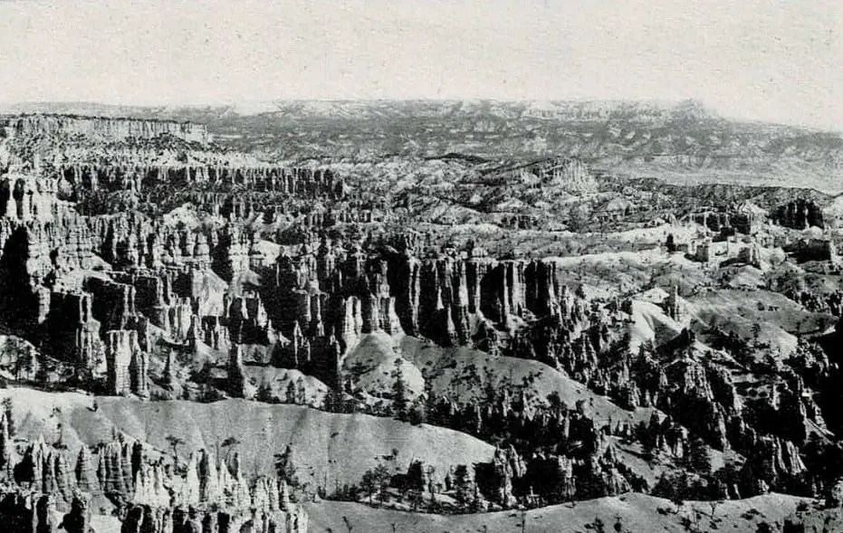
Probably Bryce Canyon is the most astonishing blend of exquisite beauty and grotesque grandeur that the forces of erosion have ever produced. In one aspect it is a gorgeous lacework design of frost and fire, the playground of sylphs and fairies; in another it is a smoldering inferno habited by goblins and demons; again, it seems as if some cataclysmic force had shuffled together a dozen oriental cities into one spectacular municipality. The joyous prevailing colors of this immense bowl of luminous, flickering filigree heaped with jewels, are pink, red, orange, purple, yellow and white; to these may be added as many other tints and tones as one has patience to distinguish. Though Bryce is immense, yet it is intimate, presenting to the eye a scintillating coral intaglio of bizarre but definite plan, overspread with a halo of lavender mist.
It is not a canyon, but an amphitheatre of horseshoe shape, graven 1,000 feet deep into the sandstones on the eastern edge of the Paunsaugunt Plateau, at the headwaters of the Pahreah River; it is approximately two miles wide and three miles long and its rim is 8,000 feet in elevation. The area of Bryce Canyon National Monument, which was created in 1923 and is administered by the U. S. Department of Agriculture, is 7,440 acres.
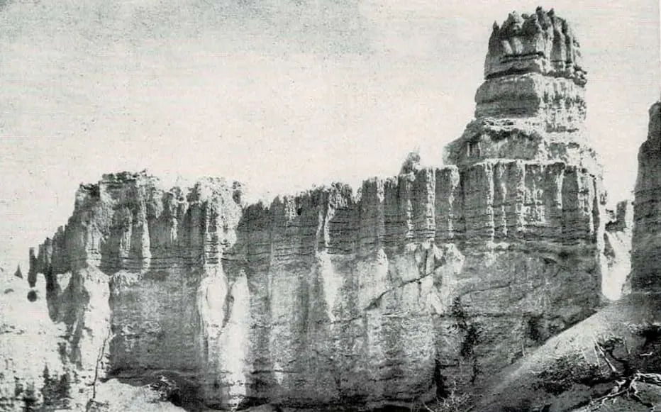
In the maze of architecture uprising from Bryce's sunken gardens, where pine, spruce and manzanita spread their greens, there are the styles of China and Egypt, of the Toltecs, Incas, Greeks and Goths; but stronger, perhaps, is the resemblance to those decaying Dravidian temples, bursting with decoration, in the jungles of Burmah and Java: pagodas, mosques, minarets, kiosks, fairy castles, cathedrals, theatres, flying buttresses and stairways, suspension bridges, niched and fenestrated walls, peristyles, colonnades, lotus columns, leaning towers, slim spires, massive pylons, pyramids, obelisks, pilasters capped by tilted disks, cones supporting cones, organs, shrines and altars. All of the architects of antiquity might have drawn their inspiration from the silent cities of Bryce.
And these dream-tissue cities in the realm of muted mystery have weird inhabitants statued in variegated stone: giants and gnomes, popes and queens, kneeling penitents, companies of matching soldiers, gargoyles, fauns, satyrs, nymphs, witches, horses, dogs, lizards, frogs and turtles - figures that seem to move, sway and posture in the flashing play of light and shadow. The least vivid imagination needs a checkrein.
In the east, on a headland of the Table Cliffs, an outlier of the vast Aquarius Plateau, the mesa rises by ramps and colonnades of pink and buff to a level esplanade where stand a dozen glorified Acropolises, facades, friezes, pillars and porticoes, in ruins of rosy marble. There, as everywhere, the marionettes of the sun continually perform their evanescent dances. And this is but a vista chosen at random from a hundred glorious panoramas.
Farther in the east, the amphitheatre opens out to make way for the headstreams of the Pahreah River; the green fields surrounding the village of Tropic may be seen and the ramparts of the Kaiparowitz Plateau.
Bryce should be seen from the west rim in the morning, from the east rim in the afternoon. The exquisite pageant of shimmering tints begins when dawn thrusts the first spears of light into the abysses. The best effects are obtained when the formations are between the beholder and the sun; it is then that the mysterious, lambent flames flicker in the distant temples and play upon altars and columns, warming them into living, glowing color. Trails extend in both directions along the rim of the Canyon from Bryce Lodge and the vistas change with almost every step taken.
Sunset upon Bryce Canyon is another breath-taking manifestation of Nature's magic, followed by a solemn twilight of the innumerable gods that dwell there in pomp and splendor. The visitor should see both dawn and dusk transform the great amphitheatre, and should see it sleeping in the noonday light.
Every visitor should take the trail into the depths of Bryce Canyon, either on foot or horseback. Lacy designs and dainty figures, seen from the rim, assume huge proportions when one is amongst them; there are sunless grottoes and shadowed crypts, wafer walls pierced by many windows, artists' studios filled with half-finished models and figurines, innumerable fantastic forms in bronze, jasper, ruby amethyst, topaz and alabaster. Each turn in every innumerable aisle, alley and corridor on Bryce's intricate floor has its charming revelations of unimagined contour and color.
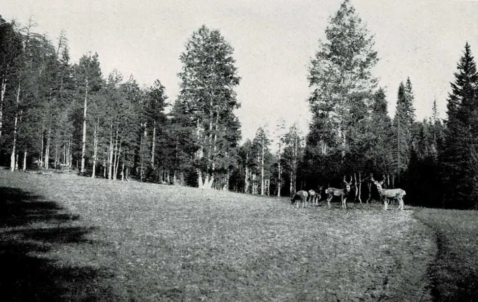
HISTORIC TRAVEL CONTEXT
Now Easy to Get There
In the final part of the brochure, the focus shifts from scenery to access. This is where the document becomes unmistakably a piece of railroad-era travel promotion, explaining how visitors could reach Zion, Bryce Canyon, Cedar Breaks, the Kaibab, and the North Rim through the Union Pacific system and its connecting motor tours.
The tone is revealing. What today feels like a remote circuit of parks and monuments was presented here as a coordinated and increasingly comfortable travel experience: mainline rail to Lund, branch service to Cedar City, scheduled automobile connections into the parks, and lodge accommodations arranged in advance through Union Pacific representatives.
These pages are valuable not only for logistics, but for what they show about the era itself. Cedar City is cast as the gateway community, El Escalante Hotel as a modern base of operations, and the entire southern Utah-northern Arizona route as a managed scenic itinerary - one designed to make even the most dramatic landscapes of the Colorado Plateau newly accessible to organized tourism.
Explore Historic Access and Gateway Travel in the Original Brochure (Pages 31-34)
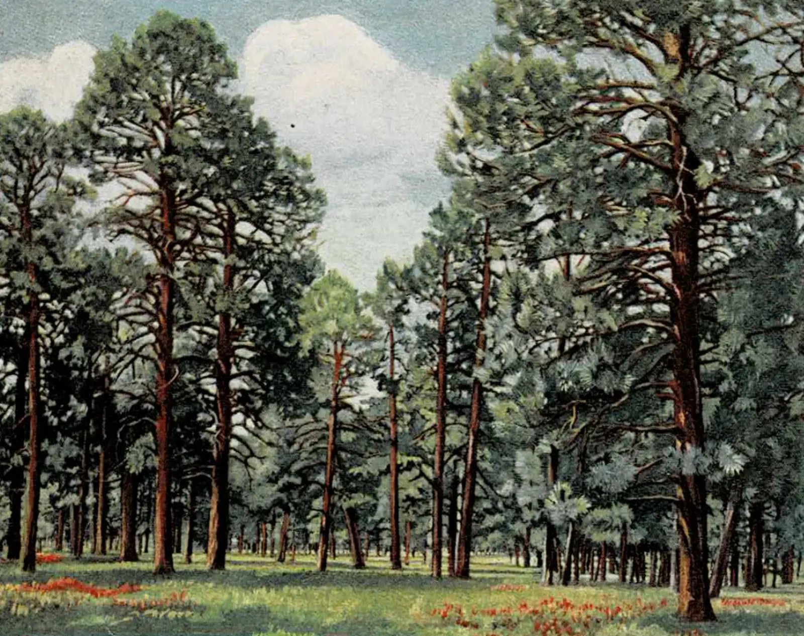
From the North Rim of Grand Canyon to Bryce Canyon
The route between Fredonia and the North Rim has been described on the foregoing pages. North of Fredonia the way leads to Kanab, Utah, a thriving village at the foot of the Vermilion Cliffs and 120 miles from the nearest railroad. Thence it continues through the Vermilion Cliffs by way of picturesque Three Lakes Canyon, across dunes of pink sand, and down to the canyon of the Parunuweap, cut through the majestic White Cliffs. Splendid panoramas of the temples and towers of Zion are disclosed.
The highway follows Parunuweap River through Long Valley to its source, passing the Mormon villages, Mt. Carmel, Orderville and Glendale. The regions traversed are of unusual and unflagging scenic interest; many of the rugged and tortuous side canyons, which contain cliff dwellings, give glimpses of impressive formations.
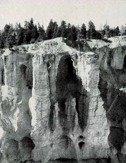
The traveler ascends the Terraced Plateaus from the Shinarump and the Vermilion to the Pink Cliffs, vivid exposures of which, capped by lava, may be seen on distant eminences. Chamberlain's Lake, north of Glendale, is a deep, cold tarn fed by a great spring. At Cedar Breaks Junction the road crosses from the Colorado drainage system into the Great Basin. The remainder of the route to Bryce Canyon has been described on page 22.
Now Easy To Get There
Zion National Park, Bryce Canyon National Monument, Cedar Breaks, Kaibab National Forest and the North Rim of Grand Canyon are reached via the through service of the Union Pacific System by way of Lund, Utah, to Cedar City, Utah, the railroad terminus. Lund is on the main line of the Union Pacific to Southern California, 243 miles southwest of Salt Lake City, 541 miles northeast of Los Angeles. From Lund a branch line of the Union Pacific extends thirty-three miles southeastward to Cedar City. During the season through sleeping cars are operated from Salt Lake City to Cedar City and all through trains will stop at Lund, whence there is direct connecting service to Cedar City.
Very low round-trip Summer Excursion Fares, with liberal limits and stop-over privileges, are in effect during the season to Cedar City and the scenic regions of Southern Utah. Likewise, low side-trip excursion fares to Cedar City and return are available for Pacific Coast passengers traveling via the Union Pacific System; $2.10 from Lund for those en route to or from Southern California, and $13.75 from Salt Lake City for those en route to San Francisco, the Pacific Northwest or Yellowstone Park, during the season.
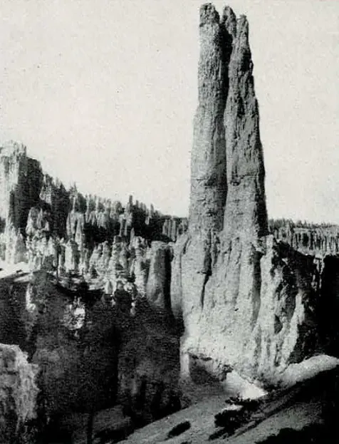
From Cedar City the Utah Parks Company, a subsidiary of the Union Pacific System, operates on regular schedules during the season a fleet of powerful eleven-passenger automobiles of the latest and most comfortable design to Zion National Park, Cedar Breaks and Bryce Canyon National Monument. Automobiles of the Utah & Grand Canyon Transportation Company (operated independently), also maintaining regular schedules, connect at Zion Park and at Bryce Canyon for the Kaibab Forest and the North Rim of Grand Canyon. There are good roads, constantly being improved, between Cedar City and Zion National Park, Cedar Breaks and Bryce Canyon National Monument; the roads between Zion Canyon and Bryce Canyon and the North Rim of Grand Canyon are fair, safe to travel, and are also undergoing improvement. Excellent lodges and camps are maintained at places where stop-overs are desirable.
The schedules of the automobiles, fares, accommodation at lodges, etc., are shown in detail on pages 39 to 43. Advance reservations made through any Union Pacific representative listed on page 47 will insure accommodations in automobiles, as well as at the lodges and camps. Inasmuch as the trip to Zion, Bryce and the North Rim of Grand Canyon is one of unusual character, unlike, in fact, any other in the United States, the traveler is urged to use the services of a Union Pacific representative in planning his itinerary. This may be done by letter, telephone or personal call; there is no charge for the service.
Season and Climate
The season in Zion National Park is from May 15 to October 15; at Bryce Canyon and the North Rim of Grand Canyon from June 1 to October 15. Dates of operation and conditions are shown in connection with all tours on pages 39-40-41.
The climate in Zion National Park is mild throughout the season. At Bryce Canyon and Cedar Breaks, farther north and at higher elevations, cool weather may be expected at night both early and late in the season. In the Kaibab Forest and at the North Rim of Grand Canyon, cool nights are to be expected.
Southern Utah and Northern Arizona are regions of clear, dry, sunny days, delightfully exhilarating and followed by refreshing nights. There are occasional showers throughout the country during the summer season.
Cedar City
All automobile tours start at Cedar City, Utah, a prosperous and picturesque Mormon city of 3,000 inhabitants, on the edge of the Escalante Plain, at the foot of the Markagunt Plateau, at an elevation of 5,750 feet. Coming from Lund, one may glimpse in the distant east and nearly 5,000 feet above him, some of the rosy palisades of Cedar Breaks.
Cedar City has a good hotel, water system, electric lights, a bank, photoplay theatre, well stocked stores, hospital, Carnegie Library, Mormon Tabernacle, a branch of the State Agricultural College, and a new and handsome railway station. On the edge of the town is a band of Piute Indians, the original inhabitants of the country, who sell buckskin gloves, moccasins and other articles. The prosperity of Cedar City is derived from sheep, wool, cattle, agriculture and the recent development of vast deposits of iron in the Iron Mountains, twelve miles away. The community, founded by Mormon leaders in 1851, was named from the abundance of cedar trees in the vicinity.
El Escalante Hotel
This handsome new Union Pacific hotel at Cedar City would be an outstanding establishment in a metropolis. It is a three-story structure of cream brick with sweeping wings and a broad verandah; seventy-five guest rooms with tub and shower baths; a spacious dining room; a banquet room, ballroom, billiard room, barber shop, and a luxurious lobby.
The dining-room service is of the highest metropolitan standard and many delicacies from the local markets are included in the menus. El Escalante Hotel, named after Padre Sylvestre de Escalante, the Spanish explorer-priest who was the first white man to visit the region (1776), is adjacent to the Union Pacific Station. Reservations and arrangements for any automobile tours may be made in the lobby.
Accommodations in Zion National Park
The Utah Parks Company maintains in Zion National Park, in a beautiful court beside the Mukuntuweap River at the foot of Red Arch Mountain and near the Great White Throne, one of the finest viewpoints in the Canyon, a handsome rustic Lodge Center and forty-six double guest lodges accommodating 184 persons.
The Lodge Center is a two-story structure of native pine, with foundations and columns of rubble masonry. There is a broad verandah, a spacious lobby and lounging room, with a huge fireplace of rough stone, Navajo rugs, a radio set, retiring rooms and shower baths for men and women on the main floor. The attractive and commodious dining room, accommodating 100 guests, also with a fireplace, is on the second floor.
Each room in the cozy double lodges is attractive and is separate and private, although two may be used en suite by family parties. The rooms contain two single beds or one double bed, a stove, dressing table, chairs, rugs, and are lighted by two double windows. All of the furnishings are new and thoroughly comfortable and the service is thoughtful and courteous. The evening camp fire is a pleasing feature. Zion Lodge is a delightful place to linger.
What To Do in Zion - the Trails
The visitor who merely rides in an automobile to Zion Lodge and goes no farther will obtain an entirely inadequate impression of its beauty.
There are two trips that none should miss. One is to the Narrows. An automobile road extends to the Temple of Sinawava, whence it is a walk of about two miles, or horses may be ridden all the way from the Lodge, a distance of about six miles. The other trip is up the spectacular West Rim Trail either to the West Rim, with a nine-mile loop on the crest (an all-day trip) or to Angels Landing (a half-day trip). The West Rim Trail is perhaps one of the most scenic in the entire National Park System. There is also a trail up Cable Mountain to the East Rim, where splendid panoramas are unfolded. The trail up Lady Mountain, two miles in length, has 1,400 steps chiseled from the rock, two ladders and 2,000 feet of hand cable. A short walk east of the Lodge leads to a pretty waterfall and a rock-bound pool. Other interesting little excursions may be made and the guides will gladly give suggestions.
Accommodations at Bryce Canyon
The Utah Parks Company maintains near the rim of Bryce Canyon an attractive rustic Lodge Center with a portico supported by massive logs. Bryce Lodge Center contains a hospitable lobby and lounge carpeted with Navajo rugs, and with a fireplace; a spacious dining room accommodating 100 guests, radio set, and retiring rooms and shower baths for men and women on the main floor.
In the pines adjacent to the Lodge Center are forty-six double guest lodges of native pine, accommodating 184 persons; each chamber is separate and private although they may be used en suite if desired. Each room contains two single beds or one double bed, stove, dressing table, chairs, rugs and two double windows, all new, comfortable and kept in spotless condition. Bryce Lodge is about distances from the rim of the Canyon at one of its most enchanting viewpoints. There is a camp fire gathering each night.
Accommodations at the North Rim of Grand Canyon and in the Kaibab Forest
On the North Rim of Grand Canyon, adjacent to Bright Angel Point, is "Wylie" Bright Angel Camp consisting of a central dining tent and social room and comfortable tent cottages accommodating forty persons. Wholesome food is served and all of the camp accessories are supplied under the capable management of Mrs. Elizabeth Wylie McKee.
V. T. Park Tourist Ranch, in DeMotte Park about eighteen miles north of Bright Angel Point, consists of a central dining pavilion seating sixty persons, and a recreation hall, ten log cabins and a dormitory accommodating seventy-five persons. Wholesome food and clean quarters may be had at V. T. Park Ranch, which is under the management of W. S. Russell.
*These accommodations are not operated by the Utah Parks Company and the information given is subject to change.
All-Expense Escorted Tours
Two weeks special vacation tours of Zion National Park, Cedar Breaks, Bryce Canyon National Monument and the North Rim of Grand Canyon leave Chicago every Saturday commencing June 20th and continuing through the season. These tours are at moderate cost, are escorted by courteous, well-informed travel representatives who relieve you of all the details by arranging for tickets, sleeping car and hotel reservations, automobile transportation, baggage transfers, sightseeing guides, side trips, etc., leaving you free to see the parks and enjoy every minute of your vacation.
Similar tours are conducted to Yellowstone National Park and to California. Schedules permit each tour to be combined with any other; travelers may select the combination that appeals to individual inclination.
These tours are inaugurated by the Chicago & North Western Railway and the Union Pacific System.
For complete information apply to
C. J. Collins, Manager
Department of Tours
148 South Clark St.
Chicago, Ill.
HISTORICAL CONTEXT
About This Historic Travel Brochure
This brochure was produced during the early decades of organized tourism in the American West, when railroads played a central role in opening remote landscapes to visitors. The Union Pacific Railroad and its subsidiary, the Utah Parks Company, developed a coordinated system of rail routes, motor tours, lodges, and guide services designed to bring travelers comfortably into the canyon country of southern Utah and northern Arizona.
Cedar City served as the gateway community for these journeys. Visitors arrived by rail from Salt Lake City, Los Angeles, or other Union Pacific destinations, then continued by automobile into Zion National Park, Cedar Breaks, Bryce Canyon, and the North Rim of the Grand Canyon. Lodges such as Zion Lodge and Bryce Lodge, along with hotels like Cedar City's El Escalante Hotel, were constructed specifically to support this growing form of scenic tourism.
The language of the brochure reflects both the promotional tone of the era and the genuine wonder early travelers felt when encountering these landscapes. Descriptions of temples, castles, and cathedrals carved in stone were common metaphors used to convey the scale and color of the canyon country long before color photography was widely available.
Today the parks described here are connected by modern highways and visited by millions each year. Yet this brochure captures a moment when the region was still emerging as a destination and when the journey itself - by train, motor tour, and horseback trail - was an essential part of the adventure.
For a different kind of historic document from the same archive, see This is Zion, a 1974 book by Allen Hagood - a hybrid digital edition that reproduces the original book's photographs and text spread by spread.